Show interactive timeline
The Lower Old Red Sandstone of New Aberdour
N.H. Trewin, S.D. Andrews and B.C. Kneller
An illustrated PDF download is available from the Aberdeen Geological Society website
Purpose
This excursion covers sections in the Crovie Group of the Lower Old Red Sandstone at the eastern side of the Turriff Basin and demonstrates the irregular nature of the sub-
Access
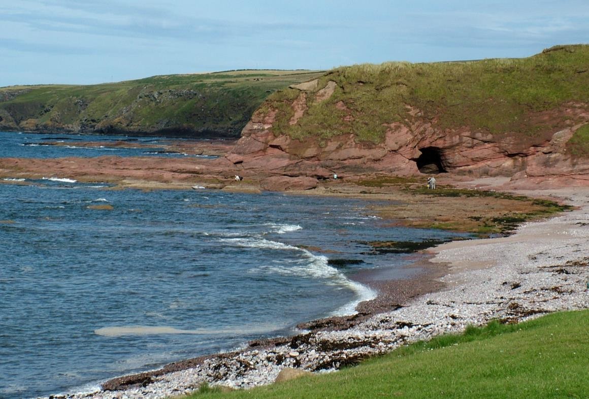
New Aberdour is situated on the B9031 coastal road 12 km (7 miles) west of Fraserburgh and 10 km (6 miles) east of Gardenstown. Take the minor road to New Aberdour beach
Introduction
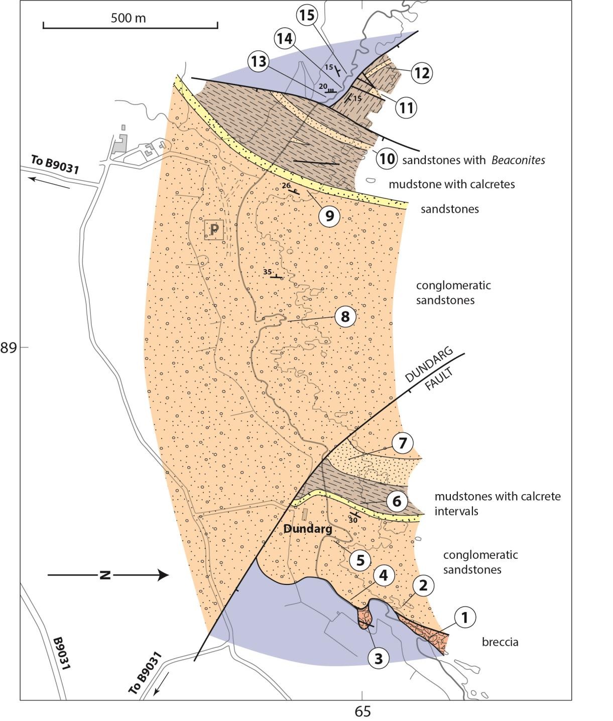
The Old Red Sandstone of the Turriff Basin is slightly more than 1 km thick (Ashcroft and Wilson 1976) mainly comprising conglomerates and red sandstones. The Lower ORS Crovie Group, which is seen on this excursion comprises sandstones, marls and conglomerates which are faulted against, or rest unconformably on the Dalradian. Conglomerates of the Middle ORS
The succession is generally well exposed, but is divided by the Dundarg Fault into two major blocks, and thicknesses are difficult to measure. The Localities described
For further details on Dalradian metamorphic and structural features (Localities. 13–15) refer to the Macduff to Whitehills Excursion (Hudson 1987,also Hudson and Johnson on AGS website) and the Geological History section (Kneller 1987) of the Aberdeen geological excursions guidebook.
Itinerary
Locality 1 [NJ 898 652]
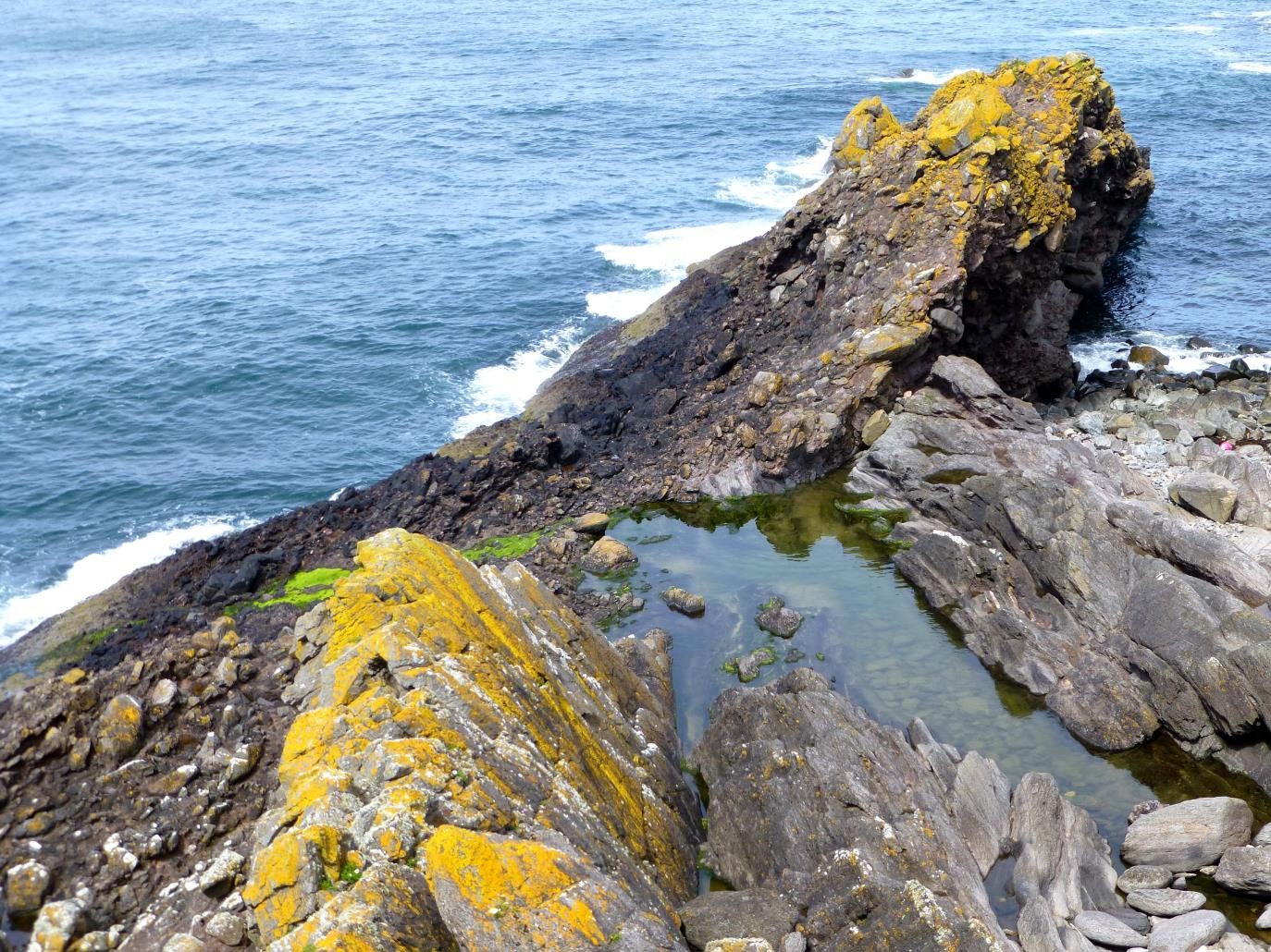
Proceed by the shore or cliff top from the parking area to Locality 1. This magnificent exposure shows the basal unconformity with the eroded surface of the Dalradian andalusite schists and psammites overlain by coarse ORS breccias
The basement consists of andalusite schists of the Rosehearty-Fyvie 'Group' in which relict andalusite crystals up to 1 cm long are largely altered to micaceous aggregates and deformed by a later foliation which is axial planar to folds in this area. The folds have axes generally trending north to NE and may plunge gently either north or south. At Locality 1 the original bedding in the schist group is clearly seen, the rocks are inverted and occur on the overturned limb of an anticline trending NE. The original sediments of the Rosehearty-Fyvie 'Group' (part of the
The unconformity surface dips at angles from 45° to close to vertical and shows weathering alteration and reddening as well as downturning of the schists at the contact. The less resistant schists are frequent as clasts only for a short distance from the unconformity surface. Most blocks in the breccias are psammitic lithologies of the local Dalradian together with occasional vein quartz and pink felsite. Granitic debris is absent and all clasts are of local origin. Close to the unconformity blocks up to 8 m long are found with their long axes parallel to the strike of the ORS. The large blocks acted as a framework which was filled with red sand and gravel by water flowing through the deposit. It appears that this very coarse breccia mantles an irregular topography on which resistant greywacke beds stood up as ridges as can be seen along the present day coastline. The very coarse breccia is about 10 m thick at this point.
Locality 2 [NJ 897 651]
Tracing the unconformity to the SW, towards Locality 2, the basal breccias can be seen to pinch out and are overlain by sandstone with conglomeratic lenses which then directly overlie the basement.
Granitic debris in the form of angular quartz and feldspar grains 2–5 mm in size occur here close to the unconformity above the locally derived basal breccia. One can imagine the early land surface having been mantled with rock fall and mass flow derived breccias which were later overtopped by finer grained sediments when the local topography became more subdued.
Locality 3 [NJ 898 650]
Follow the unconformity round into a small inlet, probably representing a small gully on the
Locality 4 [NJ 8965 6490]
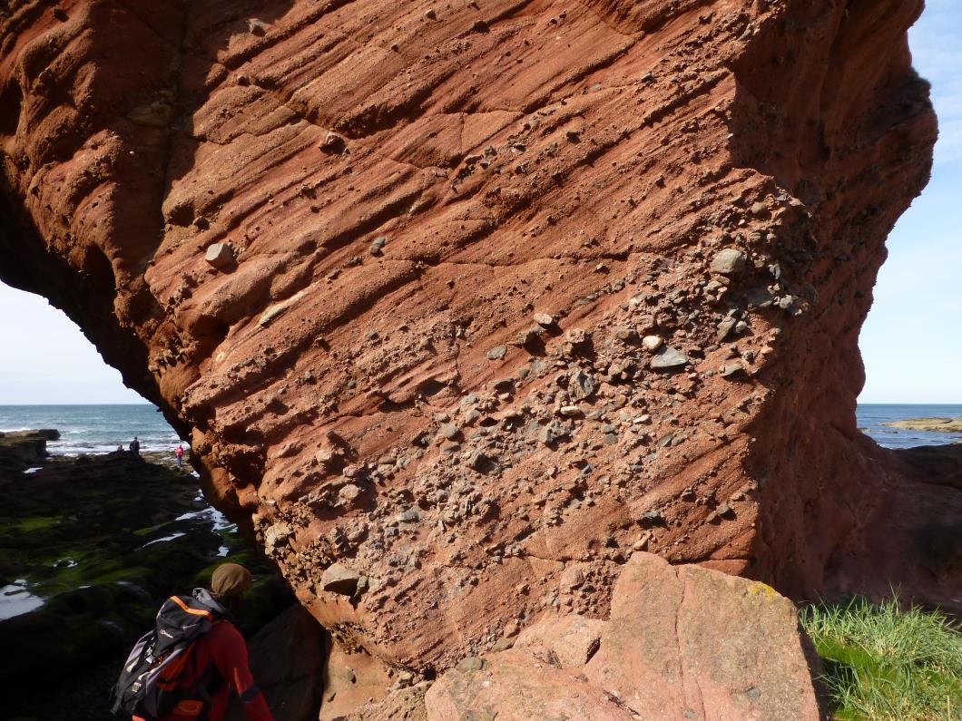
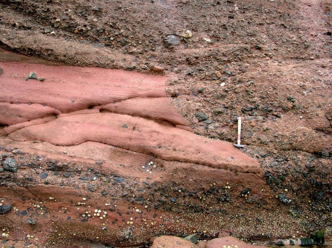
With increasing distance from the unconformity, a greater uniformity is seen in the sediments. The incoming of abundant granitic debris in typically coarse red conglomeratic sandstones, with much angular feldspar and quartz and a grain size of 2–10 mm, is seen between Localities 4 and 5 (equivalent to the offshore reef of Locality 2). The conglomeratic sandstones consist of irregular beds up to 1 m thick which frequently have erosive bases with concentrations of pebbles and some boulders up to 50 cm in diameter. All the coarse pebbles are of local Dalradian rock types together with felsite, vein quartz and granite. Rounding is generally poor indicating a short transport distance. Channel structures up to 2 m deep are present, filled with crudely cross-bedded conglomerate.
Locality 5 [NJ 8955 6490]
On the east side of the promontory on which Dundarg Castle stands, a wide channel is filled with low- angle cross-bedding in which individual beds are each about 10 cm thick and crudely graded. Many of the sandstone beds are structureless and have 'floating' pebbles (matrix supported). These beds were deposited by rapid intermittent transport of sand and gravel possibly by flash floods. The exceptionally poor sorting and rounding, presence of matrix supported boulders and pebbles, lack of abundant cross-bedding and other structures seem to rule out a fluvial environment with permanent streamflow. The conglomeratic sandstones are part of alluvial fan structures over which violent flash floods deposited their sediment load. The abundant granitic debris comes from the Strichen Granite which is exposed 4 km inland. The granite was undergoing deep weathering and granular decomposition in
Locality 6 [NJ 894 649]
At Locality 6 a marked change in sedimentation occurs with the deposits becoming finer grained.
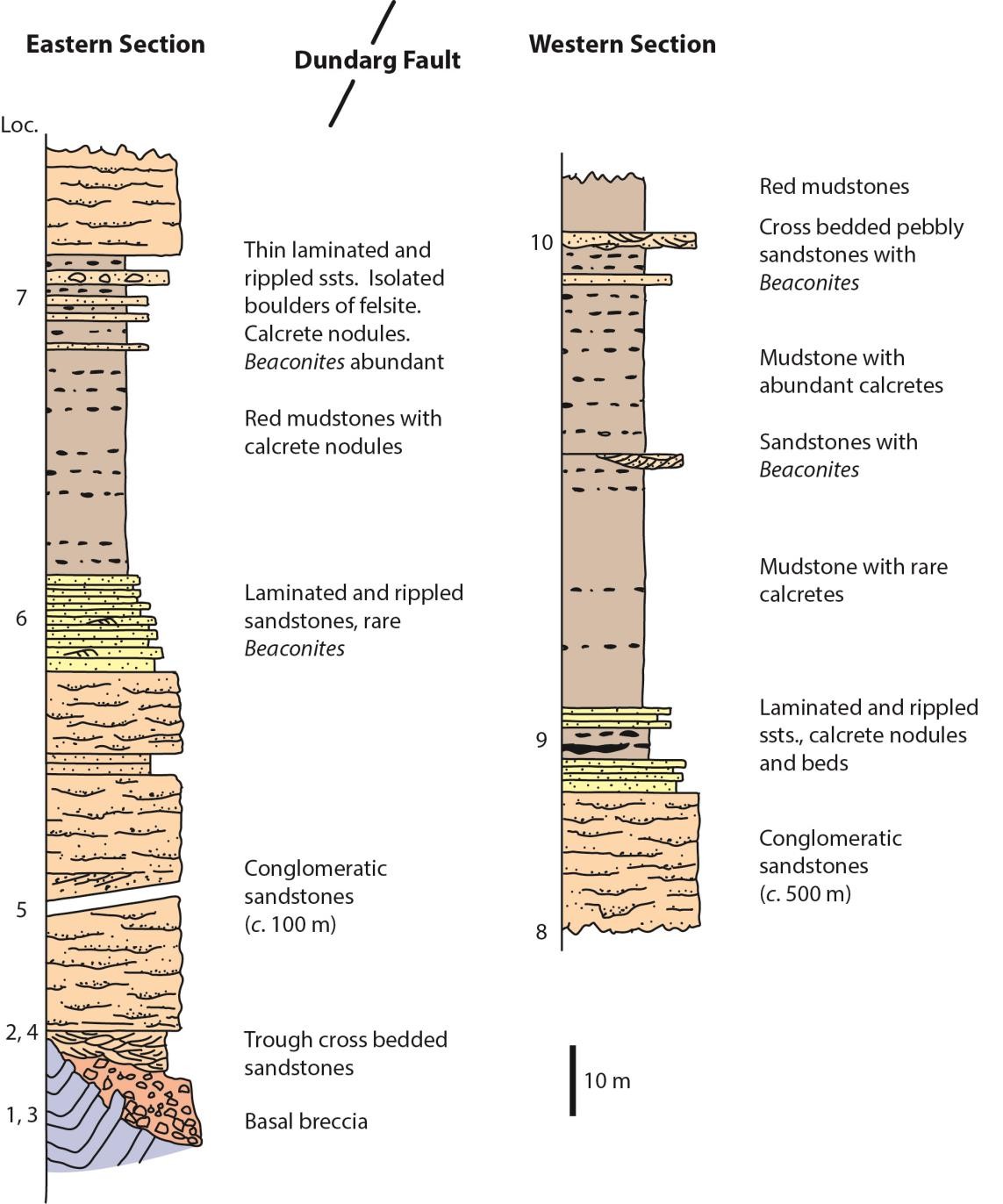
Large and small pebbles reduce in abundance and are succeeded by 2 m of red finely-laminated sandstone with some ripple- lamination. Isolated boulders are still present and the lithology reverts upwards to 12 m of sandstones with some minor conglomeratic beds and channel fills as before. A more permanent return to fine-grained deposition occurs a few metres further on in the middle of the bay, opposite a small isolated cliff west of the cliff top wall. Over a few metres maximum grain-size diminishes rapidly and channels and their conglomeratic fills become thinner and finer. The following 13 m of sandstones consist of beds up to 30 cm thick which show parallel-lamination, small-scale cross-bedding and ripple lamination. Concentrations of sorted granitic wash are present throughout with a few clasts up to 10 cm in size. The large burrow Beaconites occurs sporadically in some sandstone beds, but it is better seen further up the succession. The marked fining-up of the sequence records the passage from a coarse fan through fan-toe and on to an alluvial plain or playa surface.
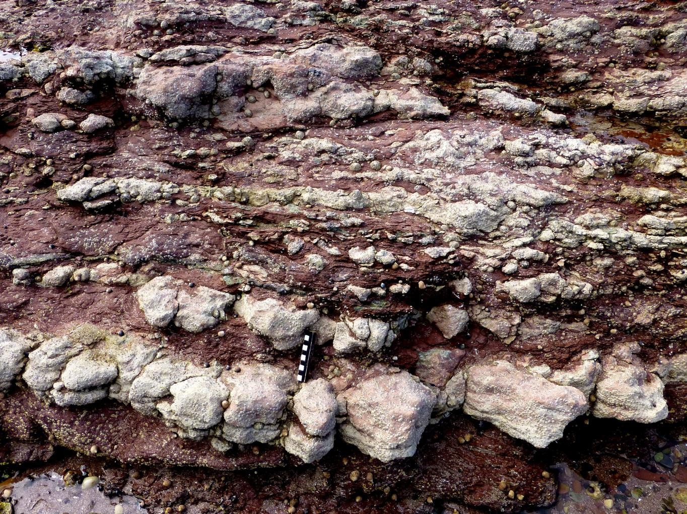
The alluvial plain or playa sediments comprise 32 m of red and green mudstones and shales with limestones. The limestones comprise; bands of carbonate nodules, generally 1–20 cm in diameter which occur only a few centimetres apart; some nodule beds which are up to 50 cm thick and laterally continuous limestones up to 15 cm thick are also present
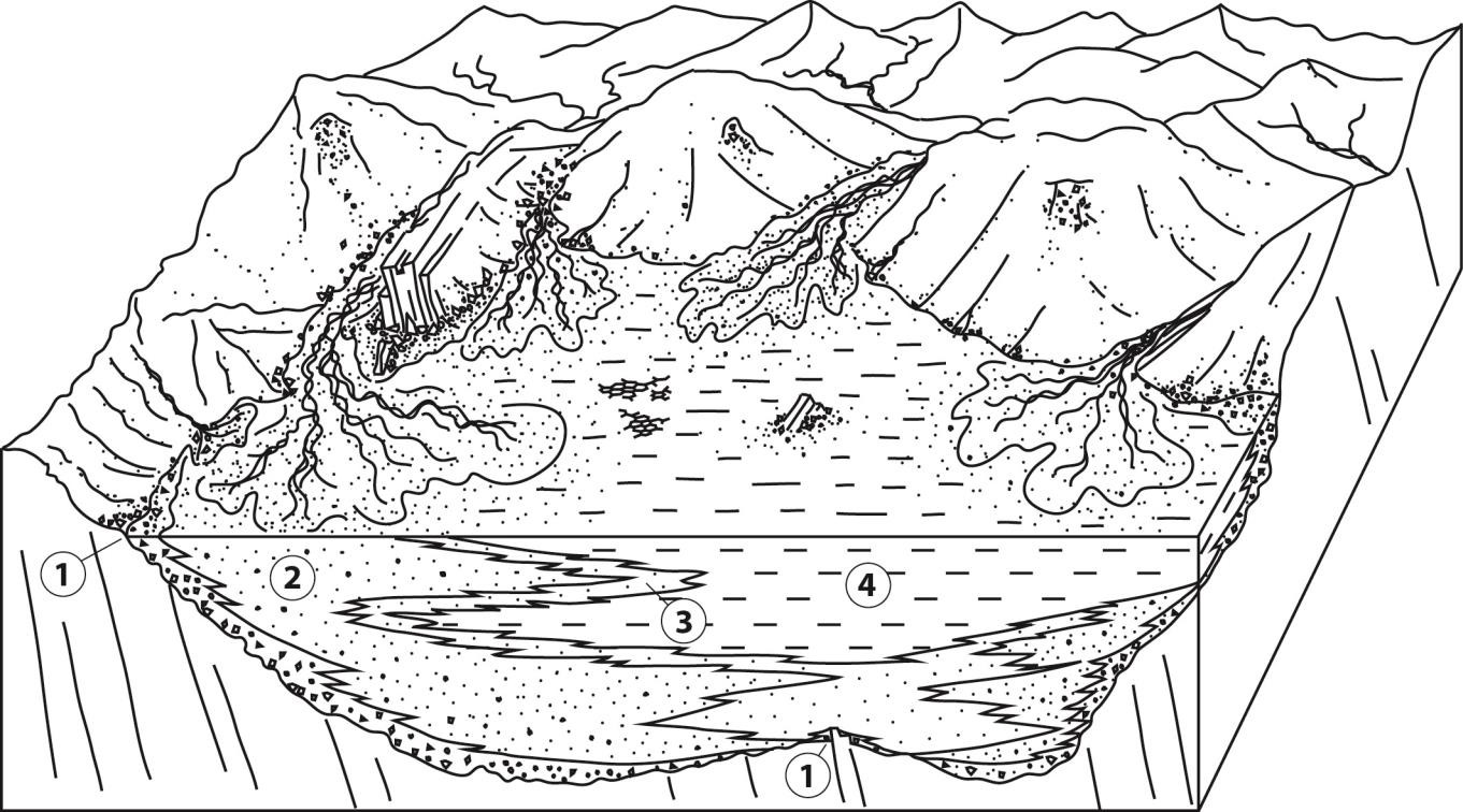
The presence of oscillation ripples indicates the presence of a standing body of water in which waves could rework the sediment surface. A setting such as a shallow lake can be envisaged which would also be consistent with the low energy environment required for the settling of fine grained material to form the mudstones. Desiccation cracks indicate that this was only an ephemeral lake, termed a playa, and the presence of calcretes hint at the aridity which may have led to its regular desiccation. The fining-up sequence passed through between Locality 1 to here could represent a transition from the conglomeratic facies of an alluvial fan, through a sandy fan margin into a mud and sand flat which had a temporary water cover in wet seasons but was subject to desiccation in dry seasons.
Locality 7 [NJ 839 649]
The fine-grained succession comprising mudstones and further calcretes continues to Locality 7 on the wave cut platform where coarse-grained sediment again appears in the succession in the form of thin beds with coarse-grained (to 5 mm) erosive bases sometimes with small scale cross-bedding, primary current lineation (N–S), current ripples and oscillation ripples (E–W).
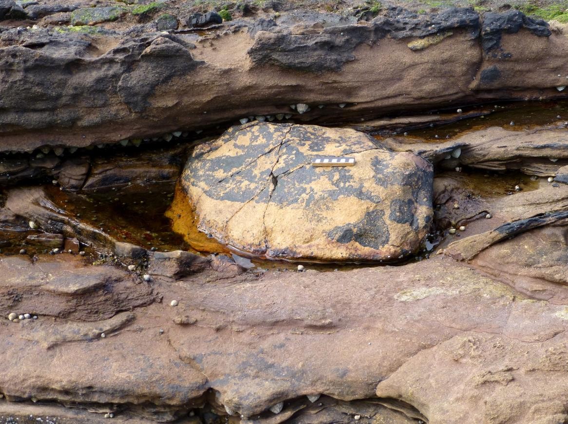
The marl and cornstone lithologies continue interbedded with the coarser material. A surprising feature is the presence of pink felsite pebbles and boulders up to 60 cm in diameter, set in fine- grained laminated sandstone and even within mudstone beds
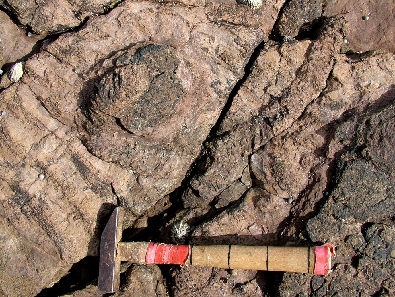
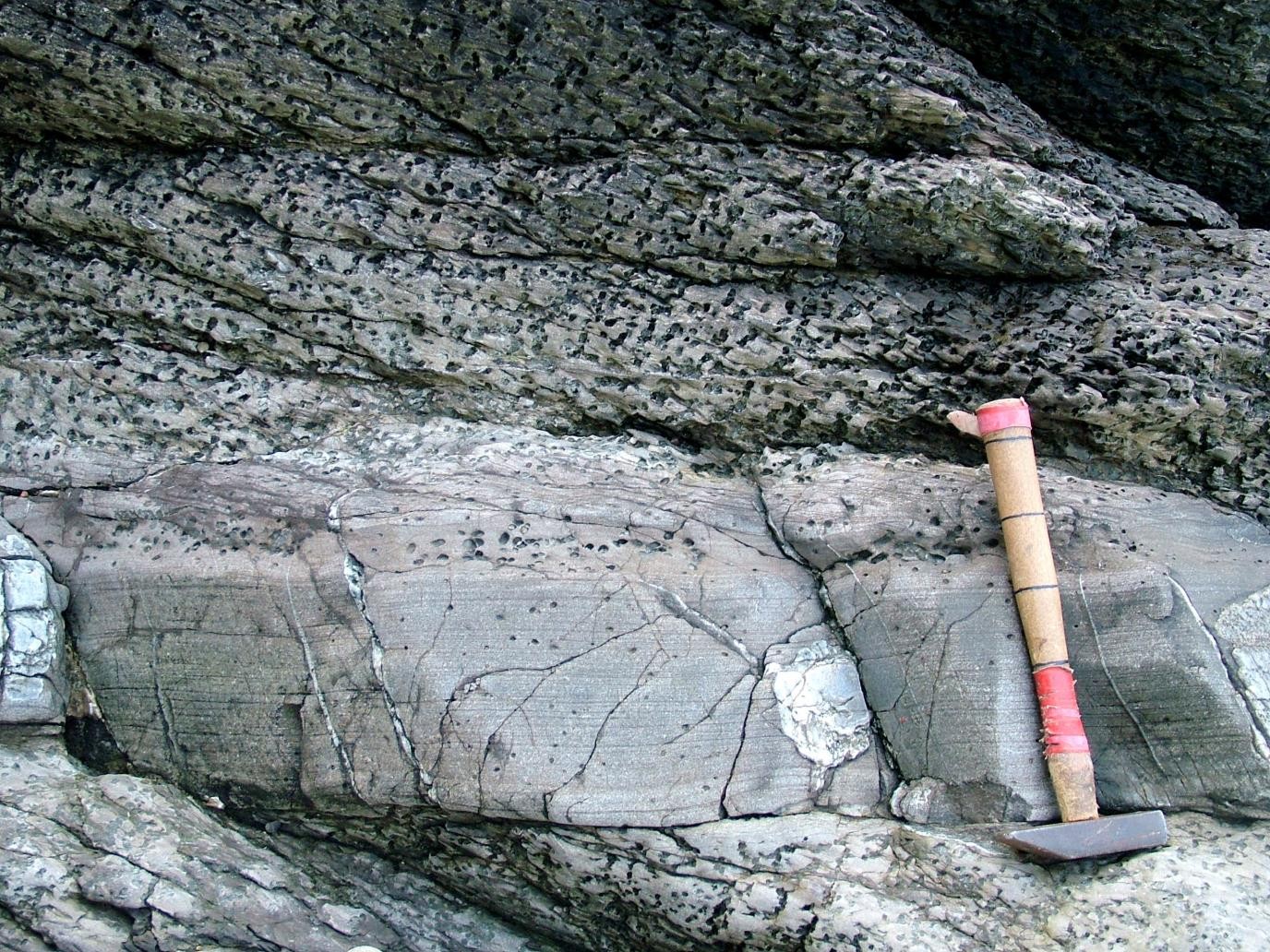
Another striking feature in this part of the succession is the appearance of the trace fossil burrow Beaconites
Near low tide mark on the seaweed covered ledges forming the succession above the beds with Beaconites, the sediment coarsens again and beds contain abundant angular felsitic debris in a sand matrix. Occasional thin mudstones and calcretes are still present but form only a minor part of the succession. The large boulders of the Beaconites beds appear to be absent. The succession is terminated by the Dundarg Fault which is thrown down to the west and controls the headland position at the west end of the bay.
Locality 8 [NJ 889 647]
Between the Dundarg Fault and the central unexposed area of New Aberdour Bay the typical conglomeratic sandstone lithology
Localities 9-12 [NJ 886 648] to [NJ 882 650]
On the western side of the bay at Locality 9 the same lithology continues but between this point and the end of the bay a fine-grained sequence similar to that previously described is present. The succession exposed between Localities 9 and 10 is illustrated in
The succession continues, with minor faulting, through about 70 m of purple and red marls, with calcrete nodules and beds increasing in abundance upwards. Occasional thin rippled sandstone beds occur and one thin, laterally impersistent, development of arkosic grit with Beaconites is present. At Locality 10 more grit and conglomerate beds occur in the succession with channels and cross- bedding. Beaconites burrows again appear at two levels along with this coarse material, but whereas at Locality 7 the Beaconites beds were succeeded by conglomeratic sandstone with abundant felsite clasts they are here followed by more than 10 m of red mudstones. West of the fault at Locality 10 the foreshore consists of faulted blocks of mudstones with the coarser beds containing Beaconites exposed again at Localities 11 and 12.
Current directions recorded on cross-bedding, channels and primary current lineation are generally to the north and NW. Orientations of oscillation ripple axes are highly variable but generally N–S at the top of this section in the Beaconites beds.
Interpretation of Devonian sequence
The faulted nature of the succession makes correlation difficult. It is possible that the two fine-grained sequences described on either side of the Dundarg Fault are roughly equivalent and are repeated by faulting. Even if this is the case rapid lateral variation must occur as can be seen by the difference in facies (mudstones and conglomeratic felsite-rich sandstone) that overlie the prominent Beaconites bearing lithologies. Considerable lateral variation is certainly present near the unconformity and probably continues up the succession. The thickness of conglomeratic sandstone between the unconformity at Locality 1 and the first fine grained unit is about 100 m, whereas the thickness seen below the second unit (Localities 9–10) is about 500 m assuming no significant faulting is present. If the two fine-grained units are correlated the conglomeratic sandstone must thicken rapidly westwards. Total thickness of this Lower ORS succession is at least 600 m and possibly as much as 800 m. Although similar facies sequences are present in the two sections there is little evidence for any facies boundary correlations as suggested by Sweet (1985).
The lithologies seen include basal breccias which mantle the
Dalradian metamorphism and structure
Locality 13 [NJ 882 649]
Lower ORS is juxtaposed against
The
At this Locality the dominant lithologies are cross-laminated and graded pelites and fine sandstones, usually in beds 1-10 cm thick. Differential porphyroblast development clearly picks out compositional variation within and between pelites. Within individual graded beds, andalusite and cordierite porphyroblasts are sometimes concentrated in the iron-, magnesium- and aluminium-rich fraction towards the top of the bed, reflecting the original segregation of detrital clay minerals, chlorite and mica. This feature can be used to identify graded bedding
Locality 14 [NJ 883 648]
Eastwards, the first conspicuous promontory is created by an amalgamated sandstone unit folded by a large D3 antiform, with a typical steep western limb. Quartz veins developed near the hinge (which trends about 020°, plunge about 10°) are disposed in a crude fan about the axial plane. An axial- planar crenulation cleavage (S3) is locally well-developed in adjacent pelites. The D3 folds are asymmetric with a consistent westerly vergence, axial planes and associated S3 cleavage dipping east or ESE at a moderate angle. Much of the fracturing here can be attributed to the proximity of the fault bounding the ORS, along which a thick fault generated breccia is developed.
Locality 15 [NJ 884 648]
Small scale structures are well displayed. The andalusite and cordierite porphyroblasts are seen in thin section to overgrow an early cleavage (S1) which is more or less parallel to bedding in these exposures. This cleavage has been interpreted by Fettes (1970) as the same cleavage as that found in the nonporphyroblastic pelites of the Macduff Slates. It is crenulated by a later (S3) fabric, which is axial-planar to the prominent local (D3) folds, and post-dates porphyroblast growth. The S3 crenulation cleavage is usually the most obvious structure in pelites at this Locality, and dips east at about 20°. Note the lithological control on cleavage development — psammites are almost devoid of a tectonic fabric, at least to the naked eye.
Alignment of andalusite and cordierite porphyroblasts within the S1 planes forms a lineation roughly parallel to D3 fold axes, and to the S1/S3 intersection (a fine crenulation), normally plunging gently to the NE. These structures can be seen on the numerous surfaces roughly parallel to bedding. Abundant grading and cross-lamination demonstrate that the rocks are right-way-up at this Locality. The Dalradian section is brought to an end by a fault trending about 025°. This truncates the NW trending fault and throws down to the east.
References
ASHCROFT, W.A. & WILSON, D.V. 1976. A geophysical survey of the Turriff basin of Old Red Sandstone, Aberdeenshire. Journal of the Geological Society, London. 132. 27–44.
DONOVAN, R.N., PEACOCK, J.D. & MYKURA, W. 1978. South of the Moray Firth. In Friend, P.F. and Williams, B.P.J. (eds) A field guide to selected outcrop areas of the
FETTES, D.J. 1970. The structural and metamorphorphic state of the Dalradian rocks and their bearing on the age of emplacement of the basic sheet. Scottish Journal of Geology. 6. 108–118.
HUDSON, N.F.C. 1987. Macduff to Whitehills, Buchan-type regional metamorphic zones, Excursion 5, In: Trewin, N.H., Kneller, B.C. & Gillen, C. (eds), Excursion guide to the geology of the Aberdeen area, Scottish Academic Press, Edinburgh, 89–98.
KNELLER, B.C. 1987. A geological history of N.E. Scotland, In: Trewin, N.H., Kneller, B.C. & Gillen, C. (eds), Excursion guide to the geology of the Aberdeen area, Scottish Academic Press, Edinburgh, 1–50.
MACHETTE, M.N. 1985. Calcic soils of the southwestern United States. Special Paper of the Geological Society of America, 203, 1–21.
SWEET, I. 1985. The sedimentology of the Lower Old Red Sandstone near New Aberdour, Grampian Region. Scottish Journal ofGeology, 21, 239–259.
TREWIN, N.H. 1987. Pennan, unconformity within the Old Red Sandstone, Excursion 8, In: Trewin, N.H.T, Kneller, B.C. & Gillen, C. (eds), Excursion guide to the geology of the Aberdeen area, Scottish Academic Press, Edinburgh, 127–130.
TREWIN, N.H. & KNELLER, B.C. 1987. Old Red Sandstone and Dalradian of Gamrie Bay. Excursion 8, In: Trewin, N.H.T, Kneller, B.C. & Gillen, C. (eds), Excursion guide to the geology of the Aberdeen area, Scottish Academic Press, Edinburgh, 113–126.

