Show interactive timeline
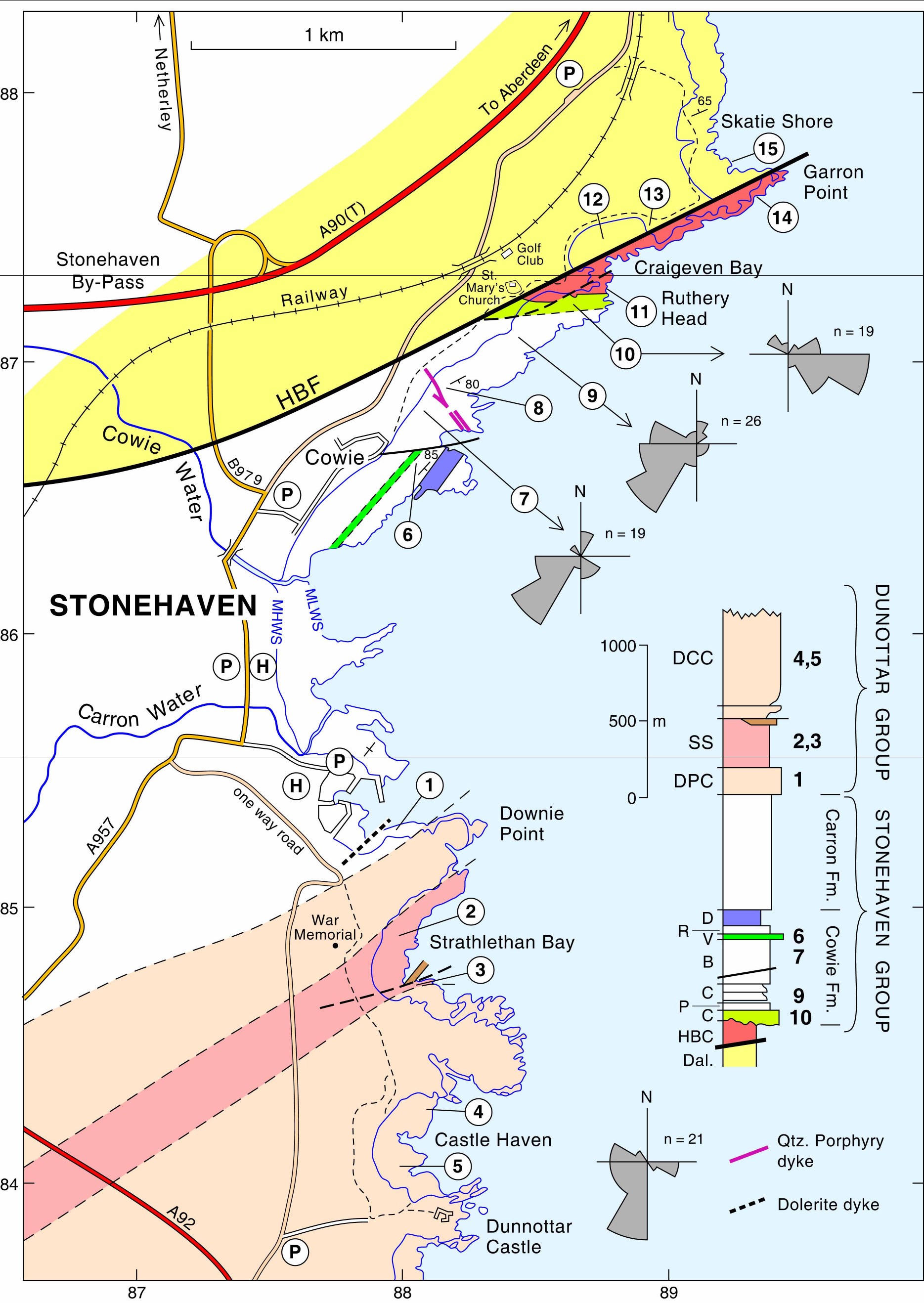
23 Dunnottar to Stonehaven and the Highland Boundary Fault
C. Gillen And N.H. Trewin
An illustrated PDF download is available from the Aberdeen Geological Society website
Purpose
To examine Lower Old Red Sandstone sediments of the Stonehaven and Dunnottar Groups; the
Access
Stonehaven is situated 24 km (15 miles) south of Aberdeen and can be reached by the A92T road. The excursion involves walking along rough shores and clifftop paths, with occasional scrambling up and down fairly steep grassy slopes. A full day will be required to complete the excursion which can be divided into two parts with a lunch and refreshment stop at Stonehaven. Low tide is required for localities 2–5 and 6–10
Introduction
The Old Red Sandstone rocks at Stonehaven lie on the steeply dipping NW limb of the Strathmore Syncline, which is cut by the Highland Boundary Fault
Dunnottar Group conglomerates and sandstones are underlain by the
the
Itinerary
Park either at Stonehaven Harbour
Locality 1. Stonehaven Harbour [NO 877 854]
To the south of the harbour a near-vertical
The base of the Downie Point Conglomerate of the Dunnottar Group is well displayed in the face of the quarried cliff where it rests erosively on the underlying sandstones. This conglomerate represents a dramatic influx of coarse material with rounded boulders up to a metre in size consisting mainly of contemporaneous lavas and also resistant quartzites. Follow the path back to Stonehaven Harbour and opposite the central harbour pier turn up Wallace Wynd and left up Castle Street (also signposted to Dunnotter Castle) Follow the path up the brae, past the information board mounted on a structure made from Ballachulish slate with pyrite cubes, and then follow the road to the first sharp bend where the path to Dunnottar leaves the road. Follow the path past the War Memorial to Strathlethan Bay.
Locality 2. Strathlethan Bay [NO 880 849]
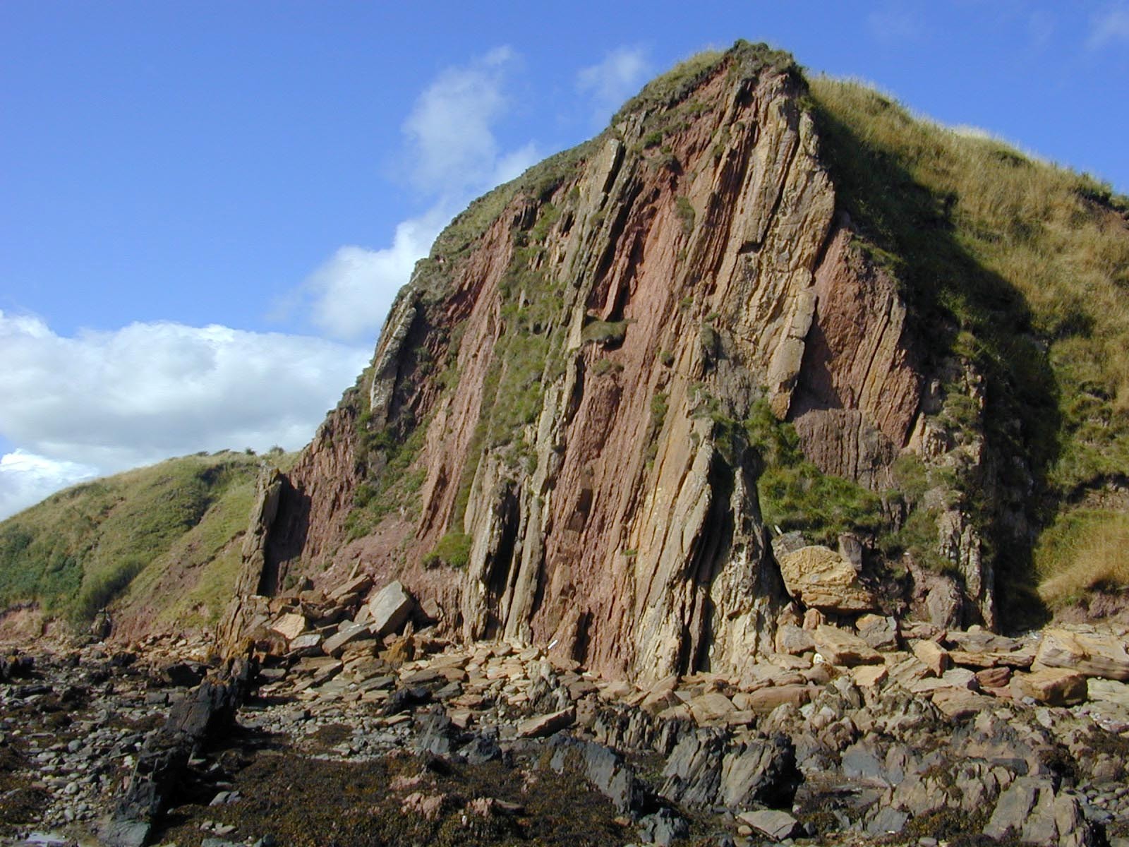
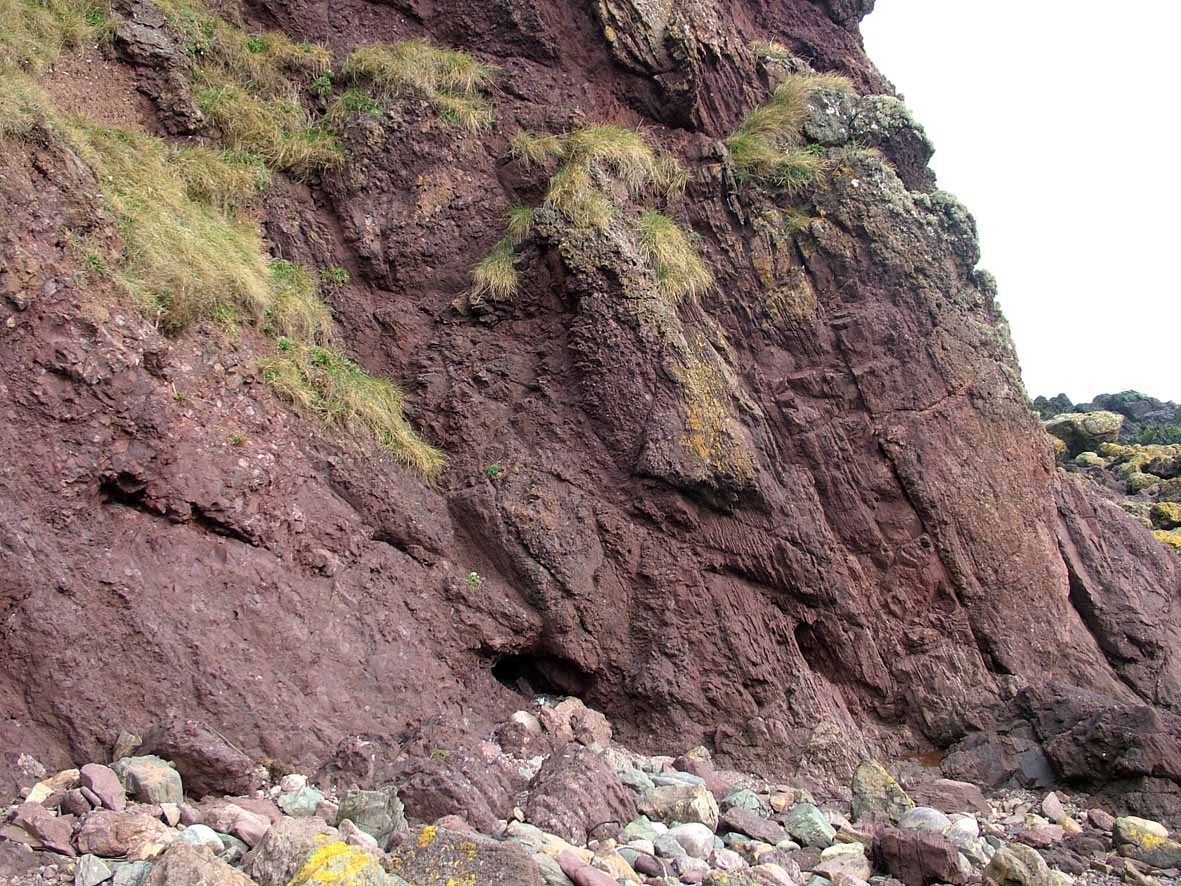
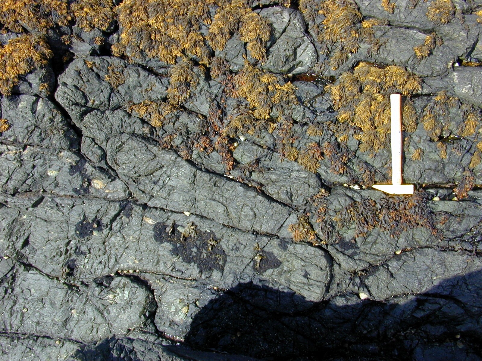
Follow the cliff top path to the southern end of the bay. The top of the path down into the bay can be found about 20 m beyond the point where the main path to Dunnottar leaves the cliff edge and crosses fields. Descend the grassy path to the beach. The features to be seen are only well exposed at low tide on the wave cut platform. The bay is cut in sandstones of the Strathlethan Formation, a sandstone unit which overlies the Downie Point Conglomerate seen in the cliffs to the north of the bay. A thin unit of volcanic debris lies close to the junction and is exposed in the first sea cliff at the north end of the bay. The sandstones on the foreshore here show spectacular disruption features affecting a zone Some 100 m wide. Disruption features are most intense at the base of the sandstone where much of the original fabric has been destroyed and sandstone blocks occur in a sandstone matrix which has a 'foliated' appearance with the matrix curving around partly rounded blocks of sandstone. Much of the rock has taken on a completely new streaky-foliated texture. The main part of the deformed zone contains large disoriented blocks of sandstone, some larger than 10 m, set in a sandstone matrix. The blocks tend to be more angular and the matrix less foliated than at the base of the deformed zone. The deformation features die out upwards (stratigraphically) and the top of the deformed zone is seen opposite the point where a small stream enters the bay. Here the disruption is less and is confined to a few separated areas, but again sand filled veins separate the disrupted strata.
The disruption clearly took place soon after deposition when the sandstones were very poorly lithified. The sand was in parts capable of liquefaction, but in other areas was partly cemented and remained coherent during the movement which took place. The movement may have been due to sediment failure on a slope induced by seismic shock due to earthquake or volcanic eruption. Movement was concentrated at the base of the sand unit and the upper part slid as one mass with little disruption.
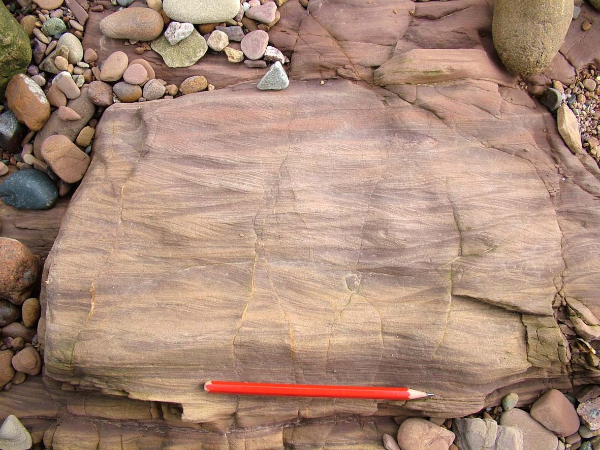
Above the disrupted zone the main feature of the sandstone is the well developed trough cross-bedding, often at fairly low angles but in sets over a metre thick. Grain-size and set size of cross-bedding decrease up the succession and red mudstones are interbedded with the sandstones near the centre of the bay.
Locality 3. Strathlethan Bay [NO 880 847]
Return to the south end of the bay where the stack known as Carlin Craig is composed of andesite and some agglomeratic material and appears to be part of a lava flow, but it cannot be traced laterally.
Immediately south of the stack brick-red mudstones with green reduction areas are exposed; ripples and laminae of fine-grained sandstone are present within the mudstones. This sequence coarsens rapidly upwards through thin tuffaceous sandstone beds and plane-laminated sandstone, to sandstones and conglomerates with cross-bedding and channels showing erosive bases. These conglomerates of the Dunnottar Castle Conglomerate contain mainly quartzite clasts but also include jasper and jasper-rich 'grit' pebbles typical of the
Return to the cliff top and follow the path across the fields
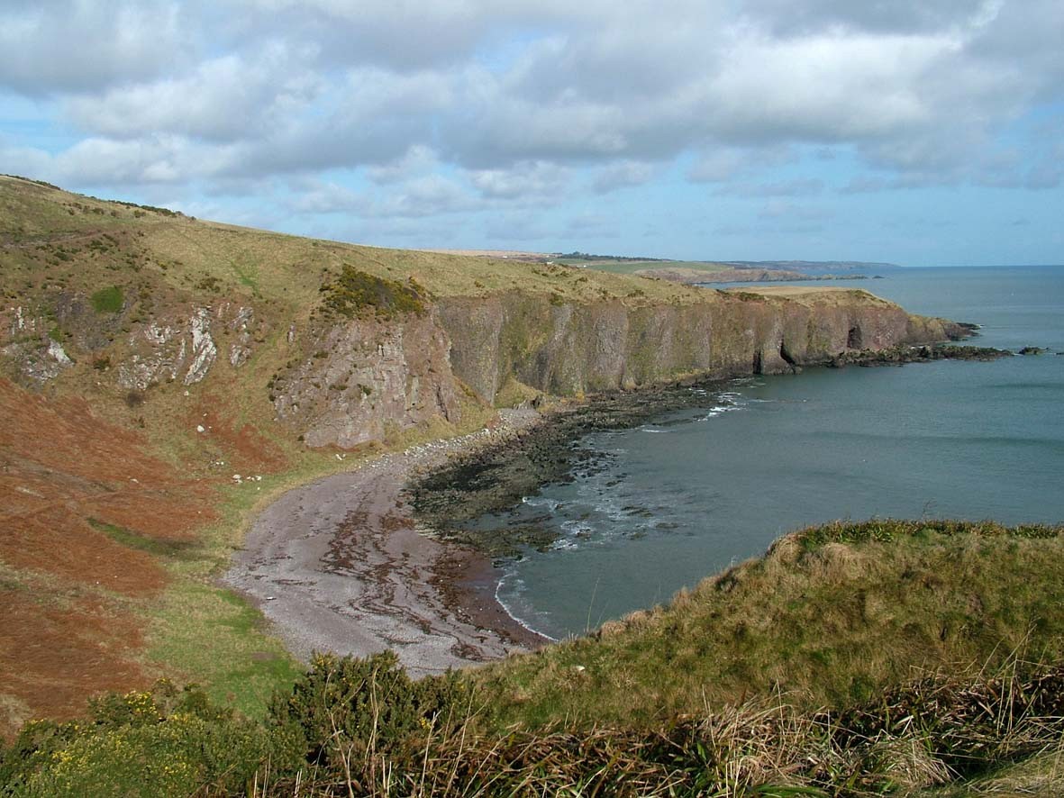
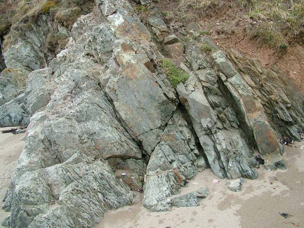
Locality 4. Castle Haven [NO 880 842]
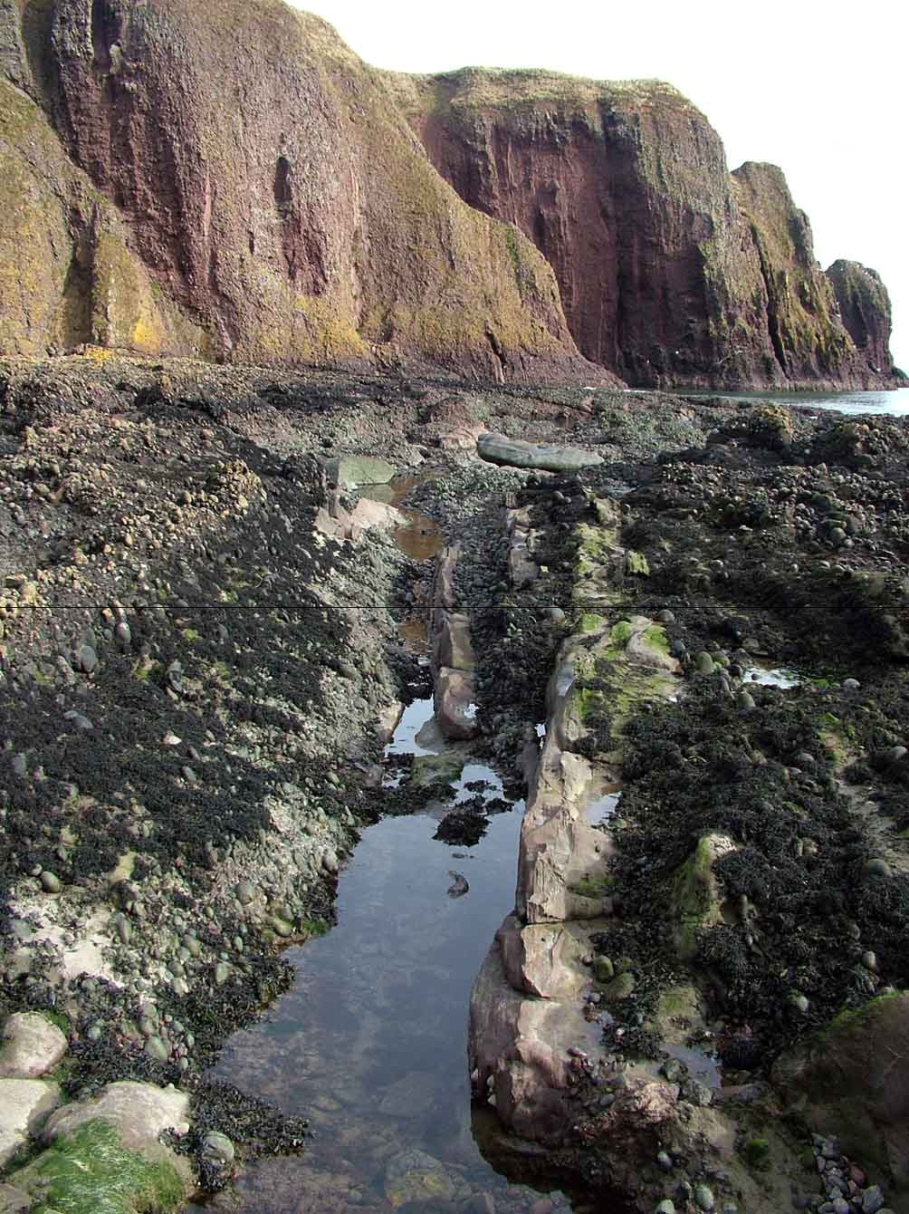
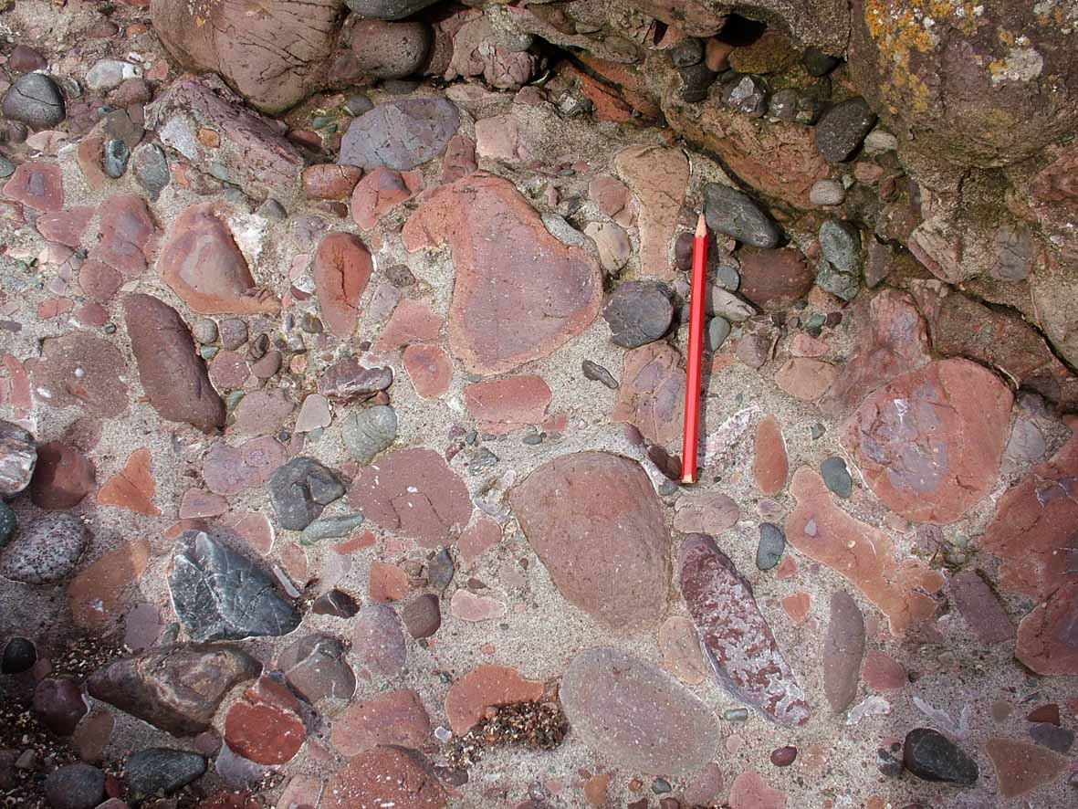
Descend the grassy slope into Castle Haven at the north end of the bay. Here the wave-cut platform shows typical features of the conglomerates with marked sorting and current imbrication of pebbles. Thin sandstones are also present which appear to represent the sandy 'tails' to gravel bars in a dominantly gravel bed river system. Cross-bedding determinations from these sandstones
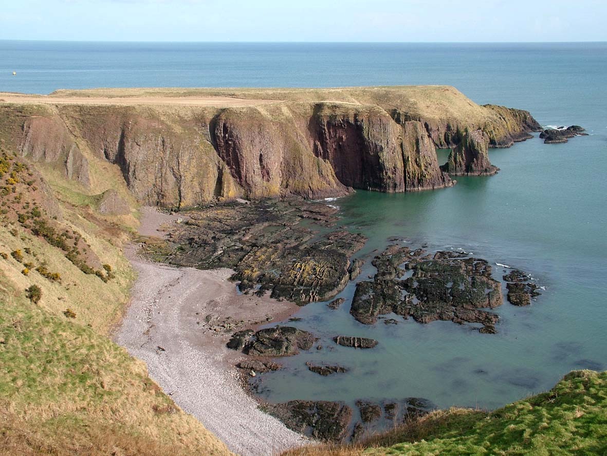
Locality 5. Castle Haven [NO 880 840]
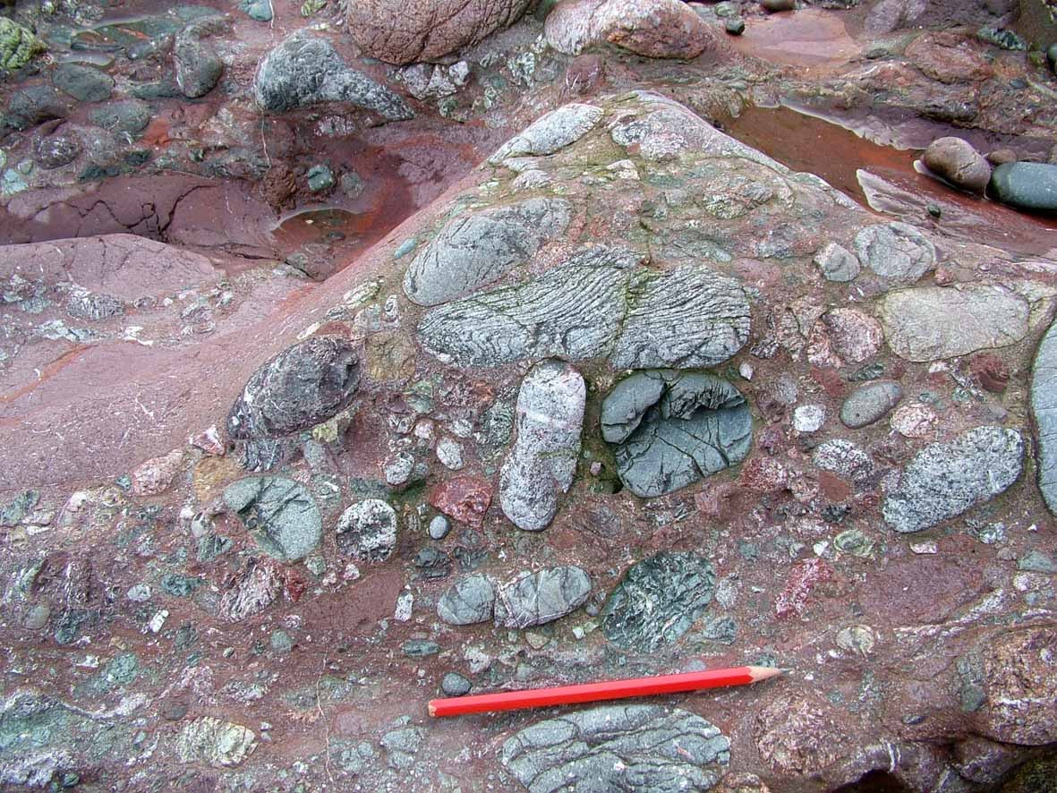
Near the southern end of Castle Haven a marked change in clast composition is seen in a conglomeratic unit exposed near H.W.M. The clasts are not as well rounded and are composed of low-grade metamorphic rocks with a spaced cleavage. The coarser lithologies contain partly flattened quartz and feldspar clasts. These clasts are indistinguishable from the rocks of the Dalradian
The next unit in the succession is also distinctive in consisting largely of red weathered lava boulders and pebbles. The conglomerates between here and the Castle also contain clasts of apparent Dalradian origin. If the identification of the Dalradian clastic material is accepted, then it can be concluded that the Grampian Block was in place and shedding some material south in early Gedinnian times. This is in contrast to the view of Bluck (1984) who did not recognise proven Dalradian clasts in this part of the ORS. The real paucity of such Dalradian clasts and the abundance of quartzites require further explanation. Possibly a considerable quartzite conglomerate cover existed on the Grampian Block and Dalradian bedrock was unavailable for erosion prior to the deposition of the beds at this locality, and only small areas of Dalradian bedrock remained available through the rest of the time of ORS deposition.
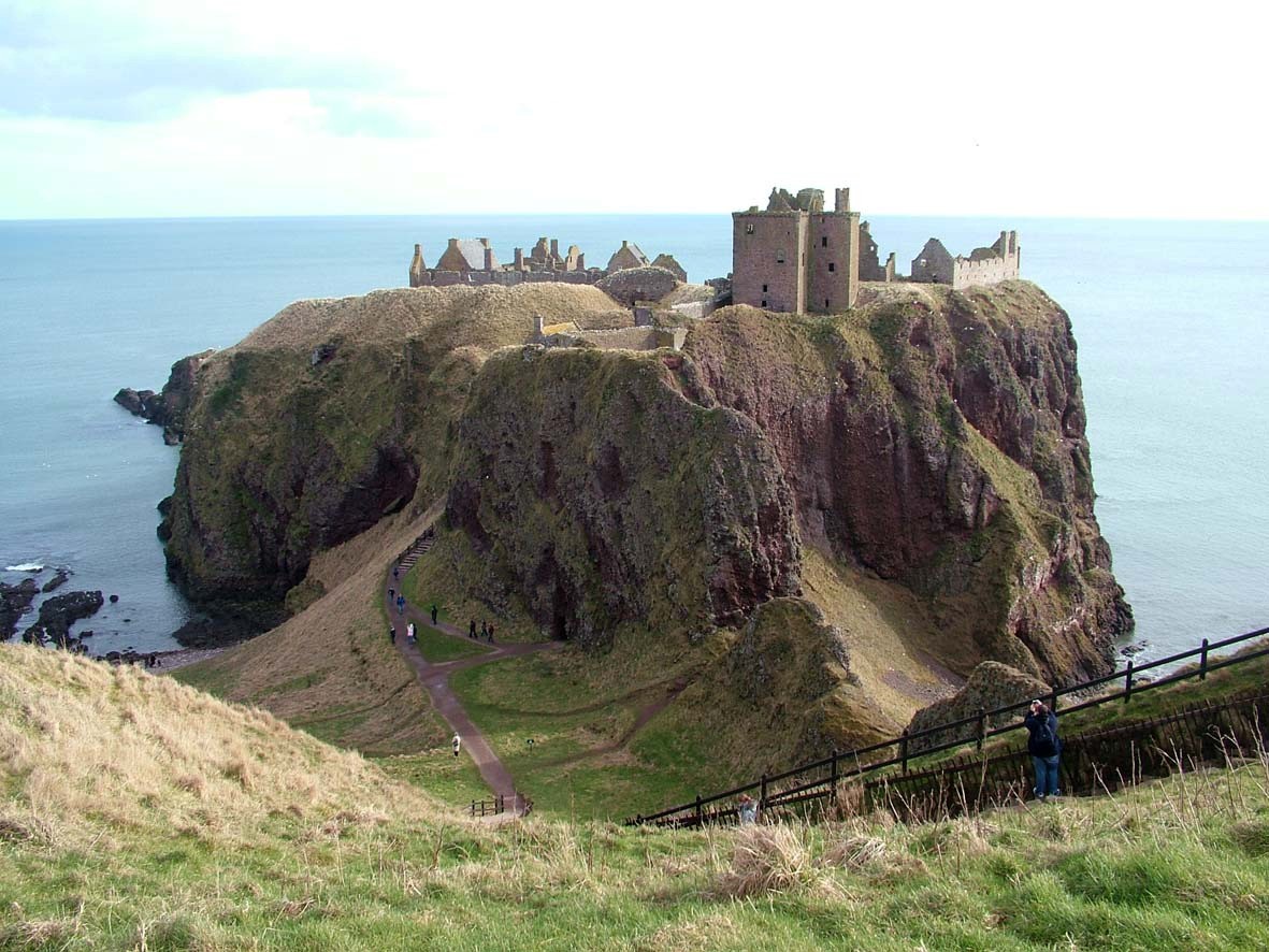
A visit can be made to Dunnottar Castle at this point in the excursion. Return to Stonehaven by the clifftop path.
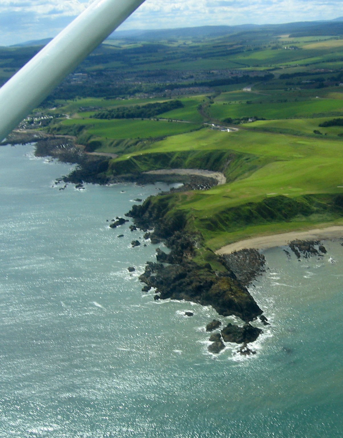
Locality 6. Cowie Harbour [NO 881 867]
From Stonehaven Harbour drive through Stonehaven main street and turn right to Cowie and the swimming pool where coaches can be parked
Seaward of the conglomerate are medium-grained sandstones (
calcareous nodules constitute the Dictyocaris Member which includes the Cowie Harbour fish bed. Fish remains considered by (Westoll 1951; list in Cameron and Stephenson 1985) to be of
Locality 7 [NO 8810 8685]
At the end of the seawall past the concreted sewage pipe are some normally clean exposures of medium- to coarse-grained sandstones forming part of the Brown and
Locality 8. Quartz-porphyry dyke [NO 8815 8690]
An irregular quartz-porphyry dyke is exposed on the shore and in the cliffs at the back of the beach. The rock contains phenocrysts of idiomorphic feldspar together with quartz and biotite. The dyke appears to be intruded into a fault line, the rocks to the south of the dyke being fractured.
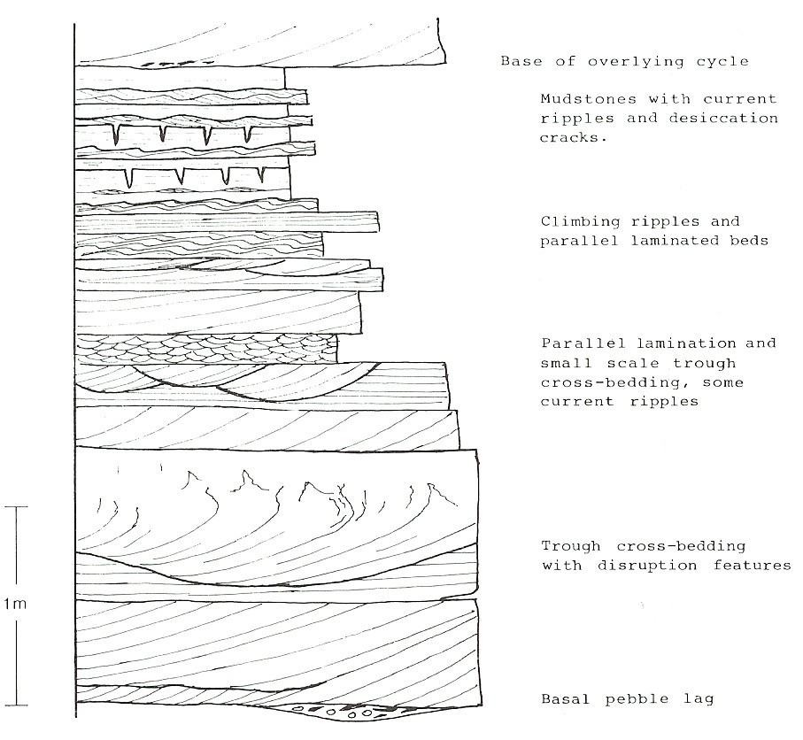
Locality 9. Fluvial cycles [NO 884 871]
The sandstones and mudstones between localities 8 and 9 comprise a series of fining-up cycles of sedimentation and are part of the Castle of Cowie Member of the Cowie Formation. A log of a typical cycle is shown below in
Trough and planar cross-bedding are characteristic of the sandstones at the base of each cycle. Individual cross-bed sets seldom exceed 60cm in thickness and the larger sets tend to show disruption structures at the bed top. The base of each cycle is sharp and represents erosion at the base of a fluvial channel, with the cross-bedded sandstones being the deposits of sand bars within the channel. Central parts of cycles show smaller scale cross- bedding and ripple lamination which in some instances shows excellent climbing-ripple sets.
These rocks were deposited in lower energy conditions near channel margins. Some units of planar - laminated sandstone might represent deposition during higher energy flood conditions. The tops of the cycles mainly comprise red mudstone and thin ripple-laminated fine sandstones which were probably deposited on an alluvial plain as overbank deposits from the channels. The presence of polygonal mud cracks shows that the muds frequently dried out due to exposure. A few surfaces display small (c. 3 mm) vertical sand-filled burrows possibly produced by small arthropods. The burrow sections frequently appear to be paired and the burrows may have been U-shaped. Current directions in this area are variable from cycle to cycle, indicating that the river channels had moderate sinuosity. Current directions are dominantly from the NW
Locality 10. The unconformity [NO 8865 8725]
The irregular unconformity of the Cowie Formation on the
The cross-bedded units are typically coarse sandstone with a few small pebbles. Interbeds of sandstone are plane laminated or rippled and desiccation cracks affect both sandstone and red mudstone. A thin andesitic lava flow is present within the sandstones. Current directions in the sandstone
Locality 11 [NO 888 874]
Follow the high water mark round the corner into the next bay to the north. If the tide is low, go as far east as possible out onto the small promontory and look westwards onto the pillow lavas, which have clear outlines. They are half to one metre long and appear to young northwards. Please do not hammer the pillows.
Most of the lavas at this locality are badly sheared and do not display pillow structures. The rocks are usually termed 'greenstones' owing to the fact that they have been altered to chlorite schists. See Brown (1983, p. 174–5) for a discussion of the geochemistry of igneous rocks in the
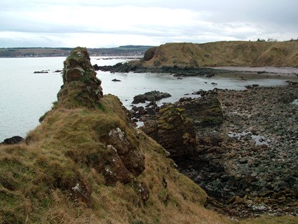
Continue into Craigeven Bay where the position of the HBF is marked by exposures of the fault rock on the shore. It is a distinct yellow-coloured rock and can be seen across the bay, dipping to the NW at 70°–75°. It is a silicified dolomitic limestone, extensively brecciated and recemented and cut by numerous thin carbonate veins. No bedding structures are present in the fault rock, and it is considered to be a highly altered serpentinite body that was emplaced along the line of the HBF.
Locality 12 [NO 888 876]
Walk round to Craigeven Bay and examine the exposures at the base of the grassy cliffs and on the foreshore below the golf course. Here the rocks are
Locality 13 [NO 890 875]
At the NE end of Craigeven Bay, the fault rock is well exposed and shows deep irregular erosion hollows. In the lowest of these is a block of dark green to black rock which may be a serpentinite pod. Just east of the HBF and fault rock are sheared lavas, black shales and cherts with thin seams of sulphide. The HBC rocks here dip at around 70° to the NW, cleavage being parallel to bedding.
Locality 14 [NO 893 877]
Climb up the steep grassy slope to the top of the cliff and walk around the edge of the golf course past the ruined coastguard hut (Only a concrete base now remains) down to Garron Point. Highly altered serpentinite pods occur here, adjacent to the fault rock. Eastwards the carbonate 'dyke' thins out, and eventually the
Locality 15 [NO 891 878]
Dalradian grits on Skatie Shore show intense effects of movement on the HBF. They are sheared, buckled and kinked and many of the narrow fractures are filled with quartz. Bedding can be picked out on the basis of grain size, and larger grains have been flattened in the cleavage which is more intense than in Craigeven Bay. Depending on vehicular arrangements return to Cowie Harbour along the shore or by the cliff top path. Do not take short cuts over the golf course, and avoid annoying the golfers. Alternatively continue north along the path at the back of Scatie Shore past two narrow gaps marked by old tank traps and take the path up the cliff to Den of Cowie. The path goes beneath the most northerly arch of the railway viaduct. Cross the main track that contours the hillside and continue on the path to the layby at
References
Armstrong, M. and Patterson, I.B. 1970. The Lower Old Red Sandstone of the Strathmore region. Rep. Inst. Geol. Sci. No 70/12.
Armstrong, M., Donovan, R.N. & Paterson, I.B. 1978. Angus and Kincardine. In: Friend, P.F. & Williams, B.P.J. (eds) A field guide to selected outcrop areas of the
Bluck, B.J. 1983. The role of the Midland Valley in the Caledonian Orogeny. Transactions of the Royal Society of Edinburgh: Earth Sciences, 74, 119–139.
Bluck, B.J. 1984. Pre-
Bluck, B.J. 2000. Old Red Sandstone basins and alluvial systems of Midland Scotland. In: Friend, P.F. & Williams, B.P.J. (eds) New perspectives on the Old Red Sandstone. Geological Society, London, Special Publications, 180, 417–437.
Brown, P.E. 1983. Caledonian and earlier magmatism. In Craig. G.Y. (ed). The Geology of Scotland 2nd Edn. Scottish Academic Press, Edinburgh. 167–204.
Cameron, I.B. and Stephenson,D. 1985. British Regional Geology: The Midland Valley of Scotland. B.G.S. H.M.S.O.
Haughton, P.D.W. & Bluck, B.J. 1988. Diverse alluvial sequences from the Lower Old Sandstone of the Strathmore Region, Scotland. Implications for the relationship between late Caledonian tectonics and sedimentation. In: McMillan, N.J., Embry, A.F. & Glass, D.J. (eds)
Haughton, P.D.W., Rogers, G. & Halliday, A.N. 1990. Provenance of Lower Old Red Sandstone conglomerates, SE Kincardineshire: evidence for the timing of Caledonian terrane accretion in central Scotland. Journal of the Geological Society, London, 147, 105–120.
Marshall, J.E.A. 1991. Palynology of the
Mykura, W. 1991. Old Red Sandstone. In: Craig, G.Y. (ed.) Geology of Scotland (3rd Edn.) Geol. Soc. London. 297–346.
Trewin, N.H. and Thirlwall, M.F. 2002. Old Red Sandstone. In: Trewin,N.H. (ed.) The Geology of Scotland (4th Edn.) Geol. Soc. London. 213–249.
Wellman, C.H. 1993. A land plant microfossil assemblage of Mid
Westoll, T.S. 1951. The vertebrate-bearing strata of Scotland. Report of the 1 th International Geological Congress, 2, 5–21.
Westoll, T.S. 1977. Northern Britain. In: House, M.R., Richardson, J.B., Chaloner, W.G., Allen, J.R.L., Holland, C.H. & Westoll, T.S. (eds) A correlation of the
Wilson, H. M. and Anderson, L. I. 2004. Morphology and taxonomy of Palaeozoic millipedes (Diplopoda: Chilognatha; Archipolypoda) from Scotland. Journal of Palaeontology, 78, 169–184.