Show interactive timeline
Geology of the country around Wells and Cheddar (Explanation of one-inch geological sheet 280, New Series)
By G. W. Green and F. B. A. Welch
London: Her Majesty's Stationery Office, 1965 © Crown copyright 1965.
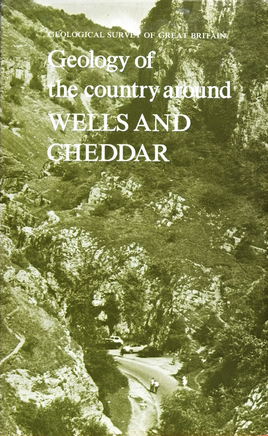
(Front cover)
(Rear cover)
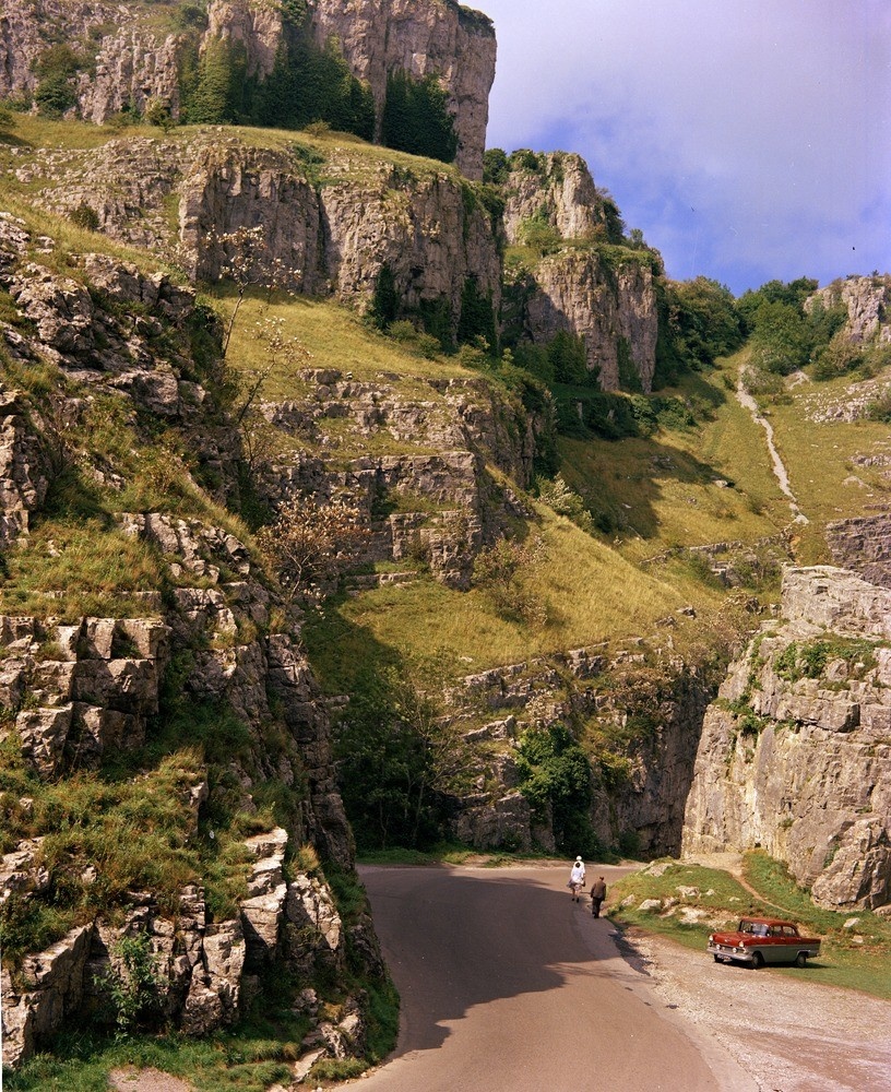
(Frontispiece. Plate 1) Cheddar Gorge, at the upper (east) end of the Horseshoe, view looking west (see (Figure 4)). The rocks belong to the Clifton Down Limestone. The precipitous nature of the cliffs is due to the presence of strong vertical joints in the Carboniferous Limestone (A9756). Frontispiece.
Contents
(References are listed at the end of each chapter).
Title page and preliminaries
Chapter numbers are in Roman numerals in the original.
Preface by the Director iii
List of illustrations-text-figures vii
Explanation of plates viii
List of six-inch maps ix
Chapter 1. Introduction
Geographical Features, 1. Geological Sequence, 2. Geological History, 4.
Chapter 2. Silurian
Details, 8.
Chapter 3. Old Red Sandstone
Upper Old Red Sandstone, Portishead Beds, 10.
Details, 11.
Chapter 4. Lower Carboniferous, Carboniferous Limestone Series
Lower Limestone Shale, 17. Black Rock Limestone, 17. Clifton Down Group, 18. Burrington Oolite, 18. Vallis Limestone, 18. Clifton Down Limestone, 19. Hotwells Limestone, 21. Lithology and Conditions of Deposition, 21.
Details: Blackdown Pericline, 23. North Hill Pericline, western half, 34. North Hill Pericline, eastern half, 37. Stoke Woods Syncline, 39. Pen Hill Pericline, 41. Beacon Hill Pericline, 43. South of the Ebbor Fault Belt, 46.
Chapter 5. Upper Carboniferous
Millstone Grit Series, 52.
Details, 52. Coal Measures, 54. Classification, 54. Lower Coal Series, 56. Pennant Series, 57. Upper Coal Series, 58. Farrington (and Bromley) Group, 58. Barren Red Group, 60. Radstock (and Pensford) Group, 60. Publow Group, 61.
Chapter 6. Triassic
Previous work, 63. Keuper, 63. Dolomitic Conglomerate, 64. Keuper Marl, Tea Green Marl, 65. General Stratigraphy, 66. Rhaetic, 69.
Details : Keuper, 70. Rhaetic, 81.
Chapter 7. Jurassic
Lower Lias, 87. The Ammonite Zones of the Lower Lias, 87. White Lias, 88. Blue Lias and Lower Lias Clay, 88. Upper Lias, 93. Inferior Oolite, 93. Harptree Beds, 94.
Details: White Lias, 95. Lower Lias (excluding White Lias and fissure deposits), 98. Fissure deposits (Central Mendips), 106. Upper Lias, 107. Inferior Oolite, 107. Harptree Beds, 108.
Chapter 8. Pleistocene and Recent
Introduction, 111. Burtle Beds, 112. Head, 112: Cave Deposits, 11; River Terraces, 117. Alluvial Fan, 118. Higher Estuarine Alluvium, 119. Estuarine Alluvium, 121. Peat, 122. Fluviatile Alluvium, 123. Calcareous Tufa, 124. Mendip Gorges, Dry Valleys, and Drainage, 124.
Chapter 9. Structure
Introduction, 127. Pre-Upper Old Red Sandstone (Caledonia), 12; Intra-Carboniferous, 128. Permo-Carboniferous (Armorican), 128. Post-Armorican, 143.
Chapter 10. Geophysical investigations
Gravity Surveys, 149. Magnetic Surveys, 156: Seismic Measurements, 159. Electrical Measurements, 160. Conclusions, 160.
Chapter 11. Economic geology
Introduction, 162. Roadstone and Aggregates, 162. Lime, 162. Building Stone, 162. Lead and Zinc Ores, 163. Iron Ore, 165. Manganese Ore, 166. Baryte, Barytocelestine, 166. Celestine, 167. Peat, 168. Gravel, 168. Fuller’s Earth, 168. Moulding Sand, 169. Agriculture, 169. Water Supply, 170.
Appendix 1. The faunal succession in the Carboniferous Limestone of Burrington Combe
Appendix 2. Records of some important boreholes
Appendix 3. List of Geological Survey photographs
Index 210
Illustrations
Text-Figures
(Front cover)
(Rear cover)
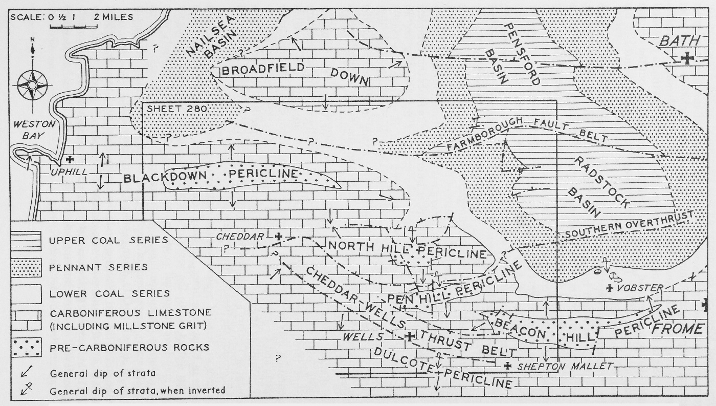
(Figure 1) Sketch-map showing probable distribution of exposed and concealed Palaeozoic formations in the Wells area and the surrounding country.
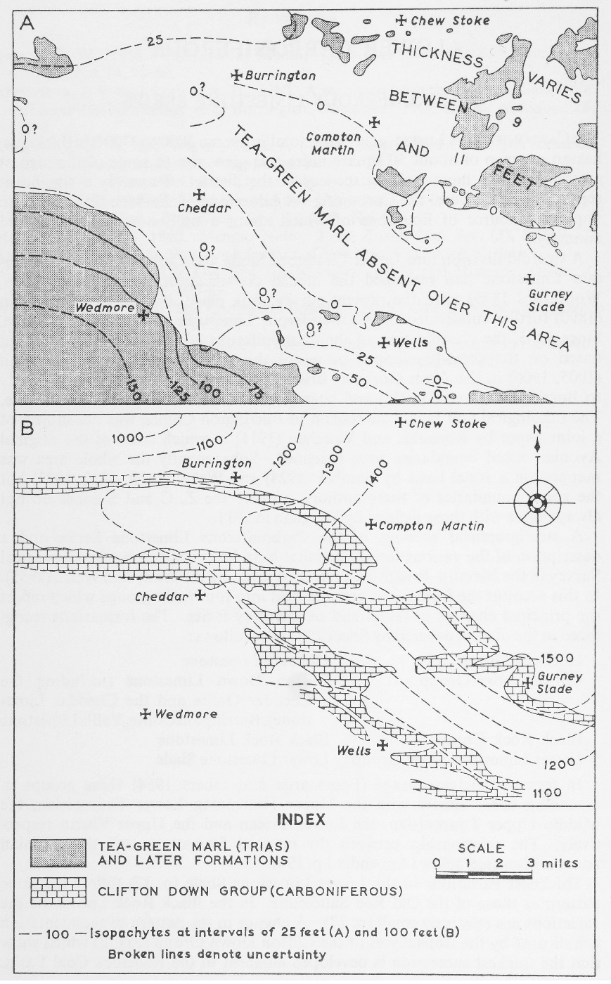
(Figure 2) Sketch-maps showing isopachytes of A. Tea Green Marl (Triassic) and B. Clifton Down Group (Carboniferous Limestone Series).
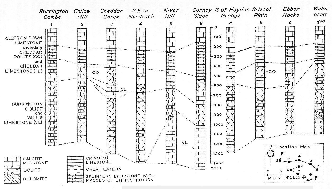
(Figure 3) Comparative vertical sections showing the lithological variations of the Clifton Down Group of the Carboniferous Limestone Series.
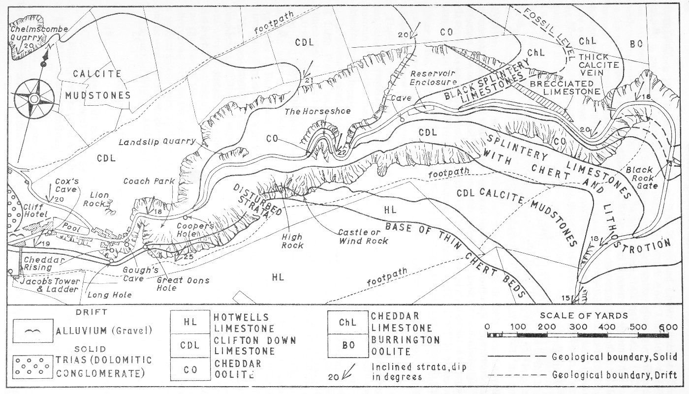
(Figure 4) Sketch-map of the Geology of the Carboniferous rocks of the Cheddar Gorge district.
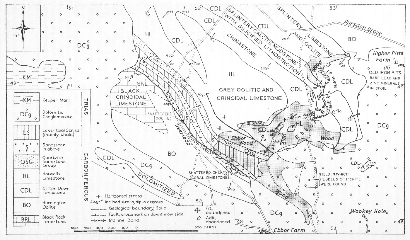
(Figure 5) Sketch-map of the Geology of the Ebbor Rocks area, near Wookey Hole.
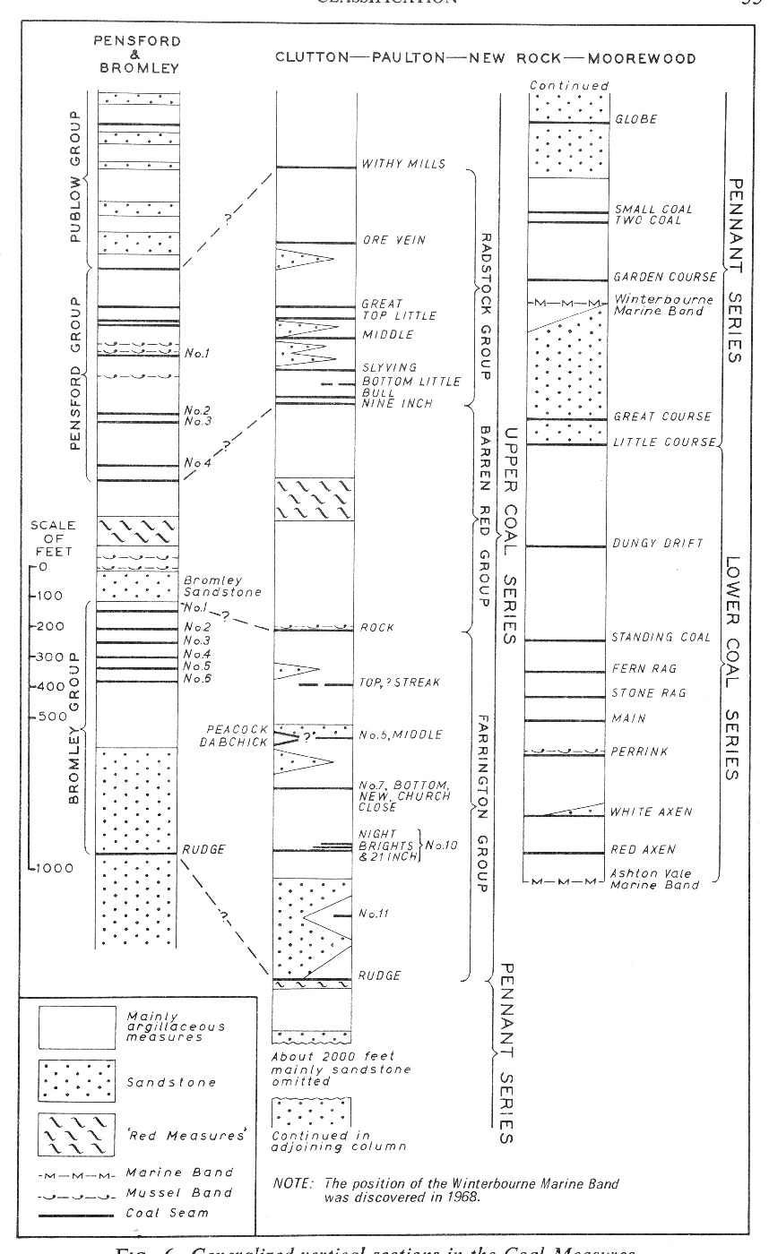
(Figure 6) Generalized vertical sections in the Coal Measures.
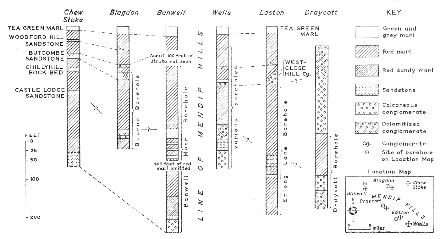
(Figure 7) Comparative vertical sections in the Keuper deposits occurring north and south of the Mendip Hills.
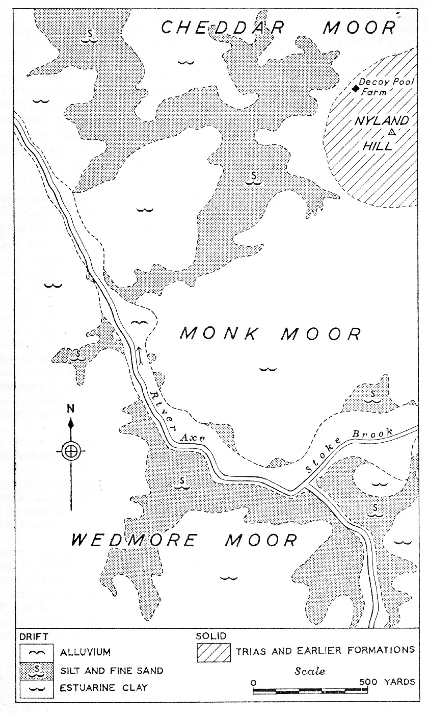
(Figure 8) Sketch-map showing the distribution of Recent sediments over the moors west and south of Nyland Hill, Cheddar.
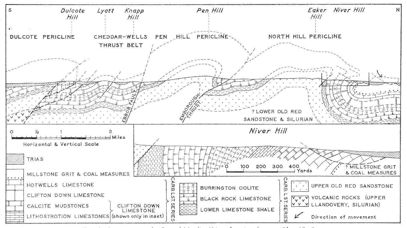
(Figure 9) Section across the Central Mendips (Line of section shown on (Plate 5)). Part of section through Niver Hill is shown enlarged.
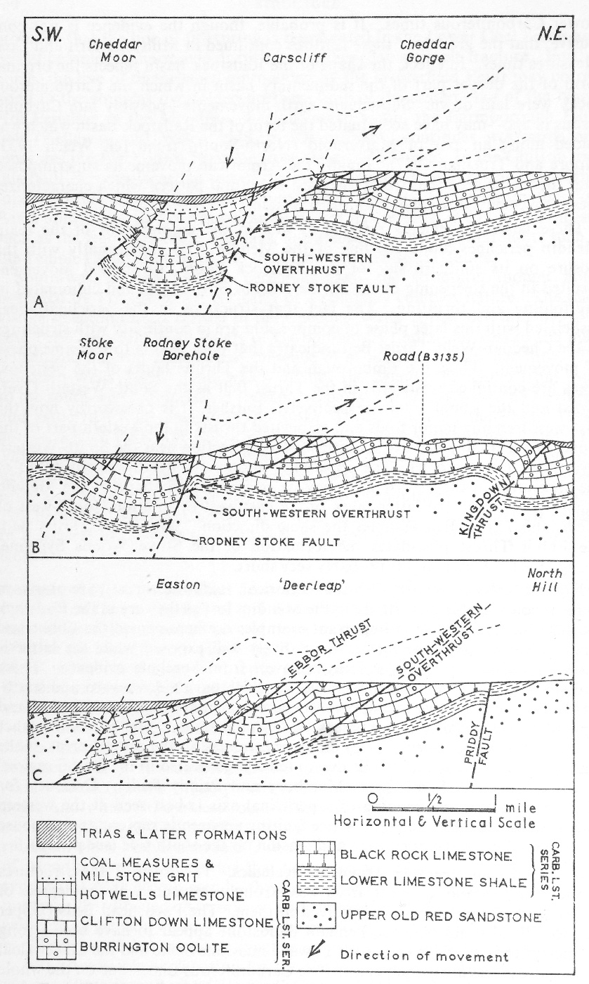
(Figure 10) Sections across the Cheddar—Wells Thrust Belt (Lines of sections shown on (Plate 5)).
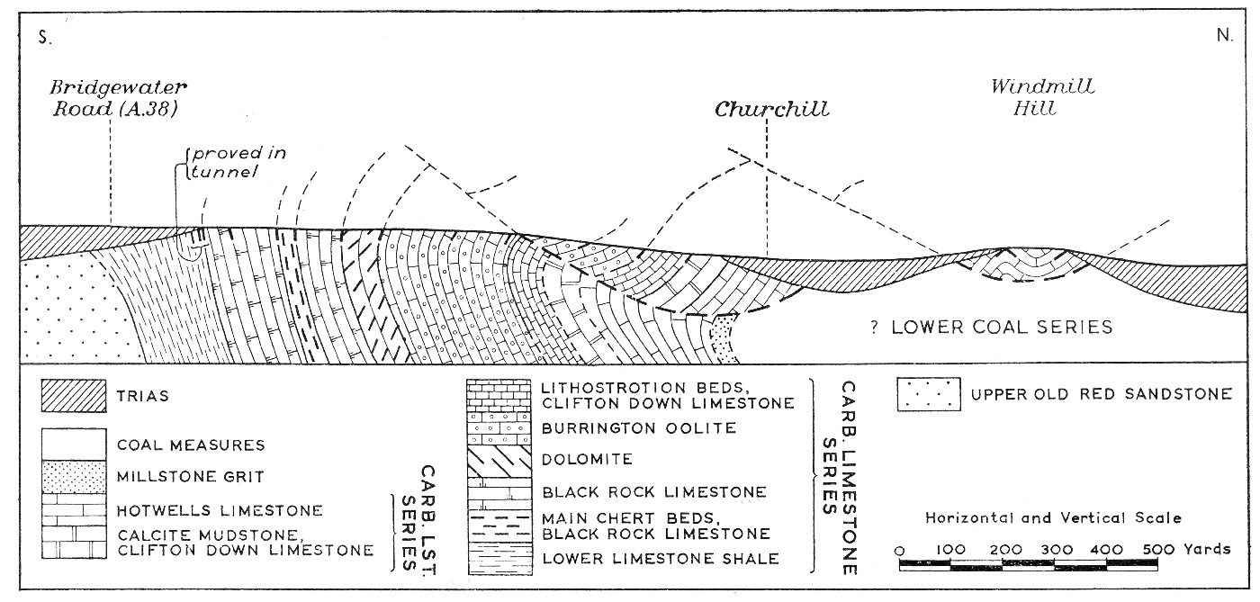
(Figure 11) Section across the northern limb of the Blackdown Pericline in the Churchill area.
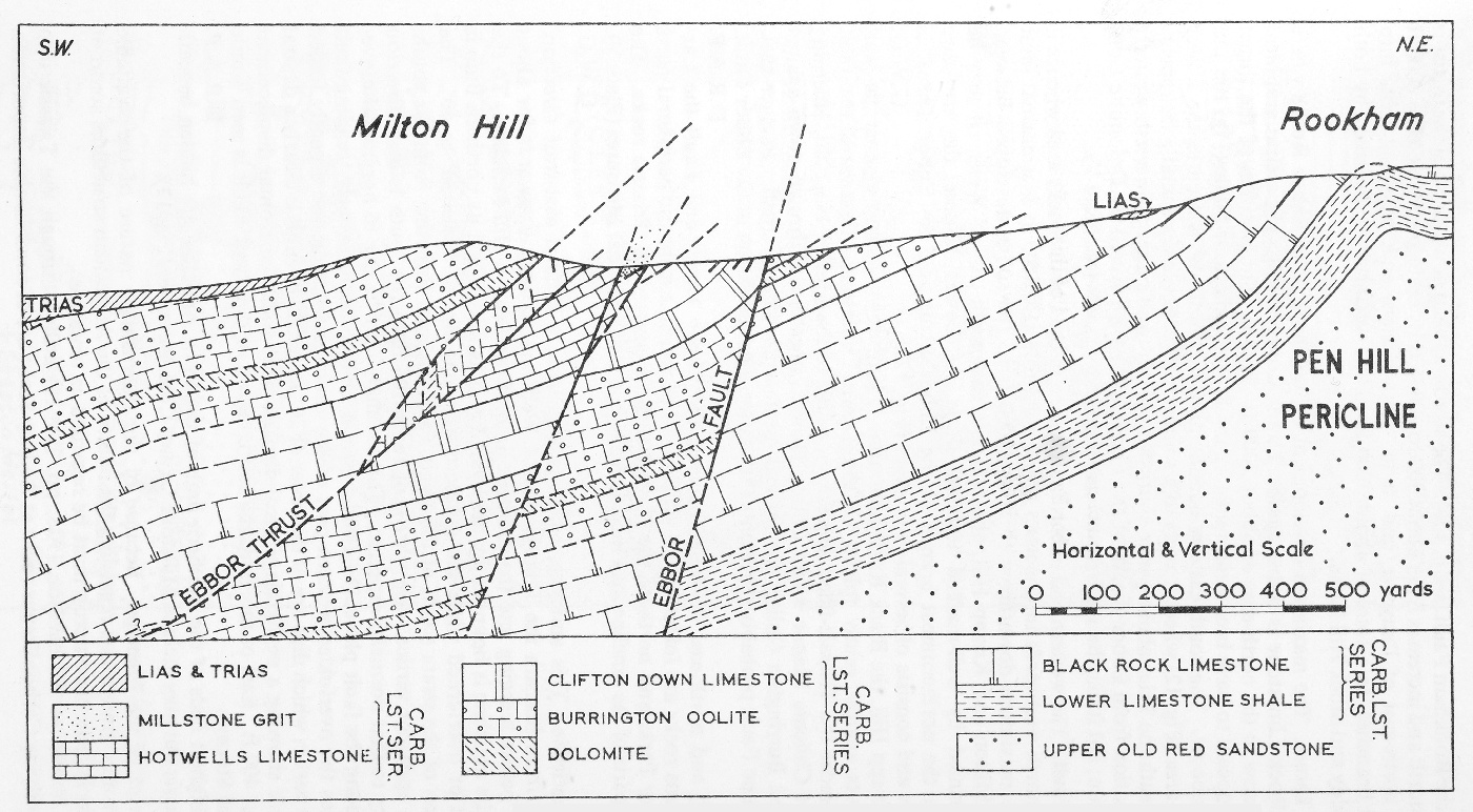
(Figure 12) Section across part of the Cheddar–Wells Thrust Belt in the Milton Hill area, near Wells.
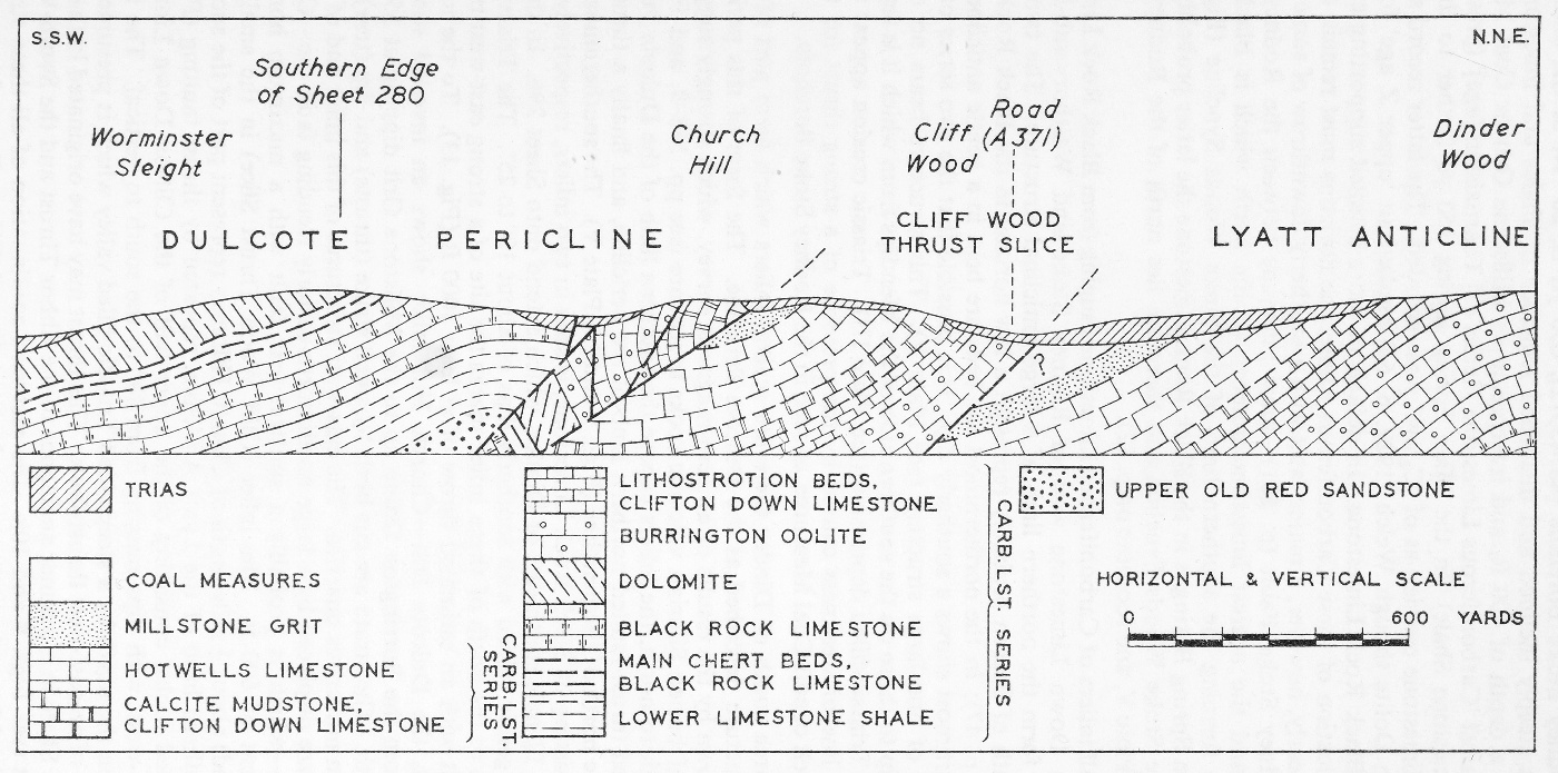
(Figure 13) Section across the Dulcote Pericline and part of the Cheddar–Wells Thrust Belt.
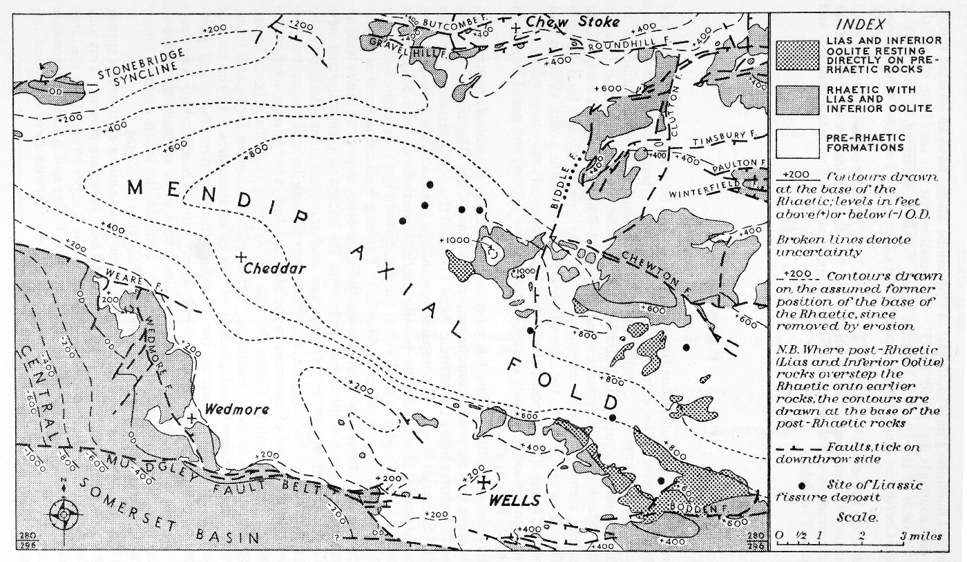
(Figure 14) Sketch-map showing (a) the major post-Triassic structures and (b) the sites of Liassic fissure deposits.
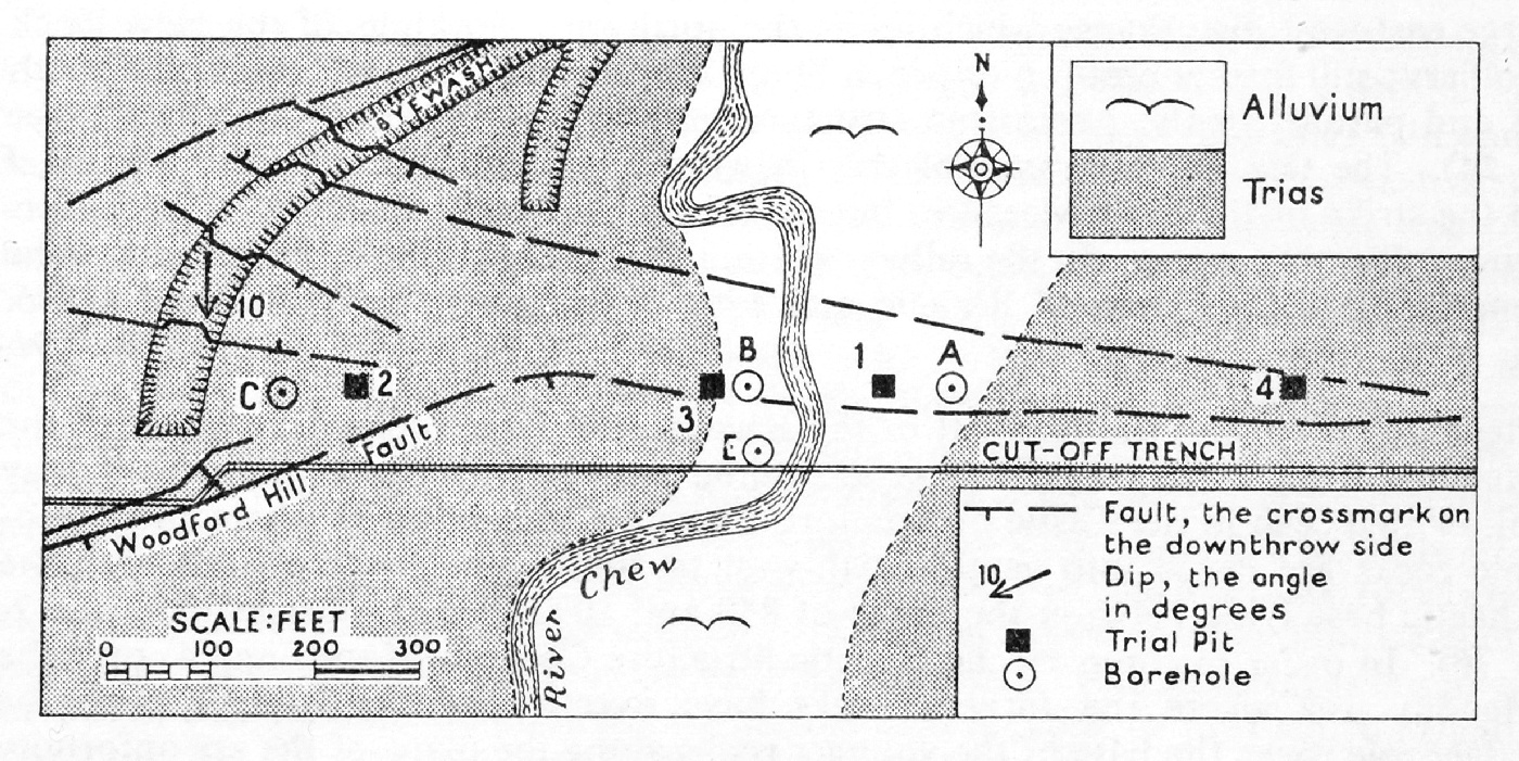
(Figure 15) Chew Stoke Reservoir. Sketch-map showing line of cut-off trench and sites of boreholes and trial pits.
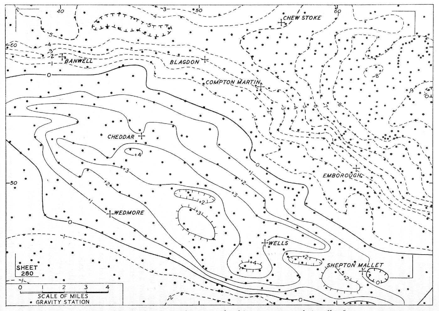
(Figure 16) Bouguer anomalies at sea level (Contour interval: 1 milligal).
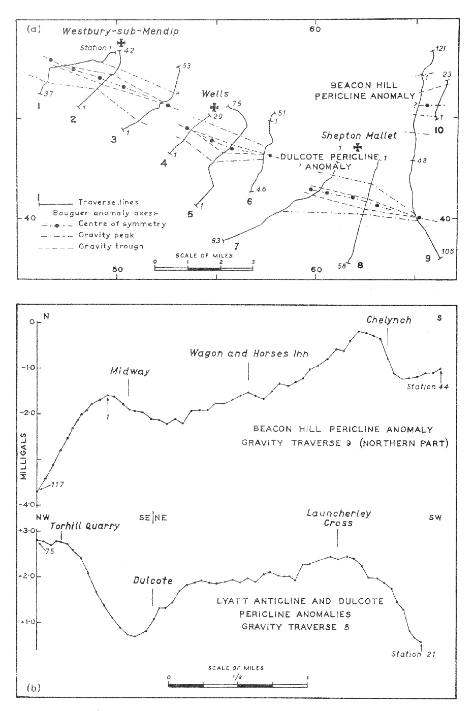
(Figure 17) Gravity traverses south of the Mendip Hills and across Beacon Hill: a. Traverse lines and Bouguer anomaly connexions, b. Typical Bouguer anomaly profiles.
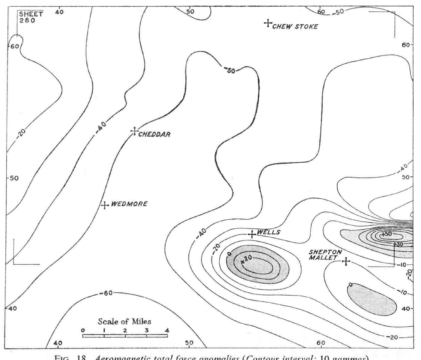
(Figure 18) Aeromagnetic total force anomalies (Contour interval: 10 gammas).
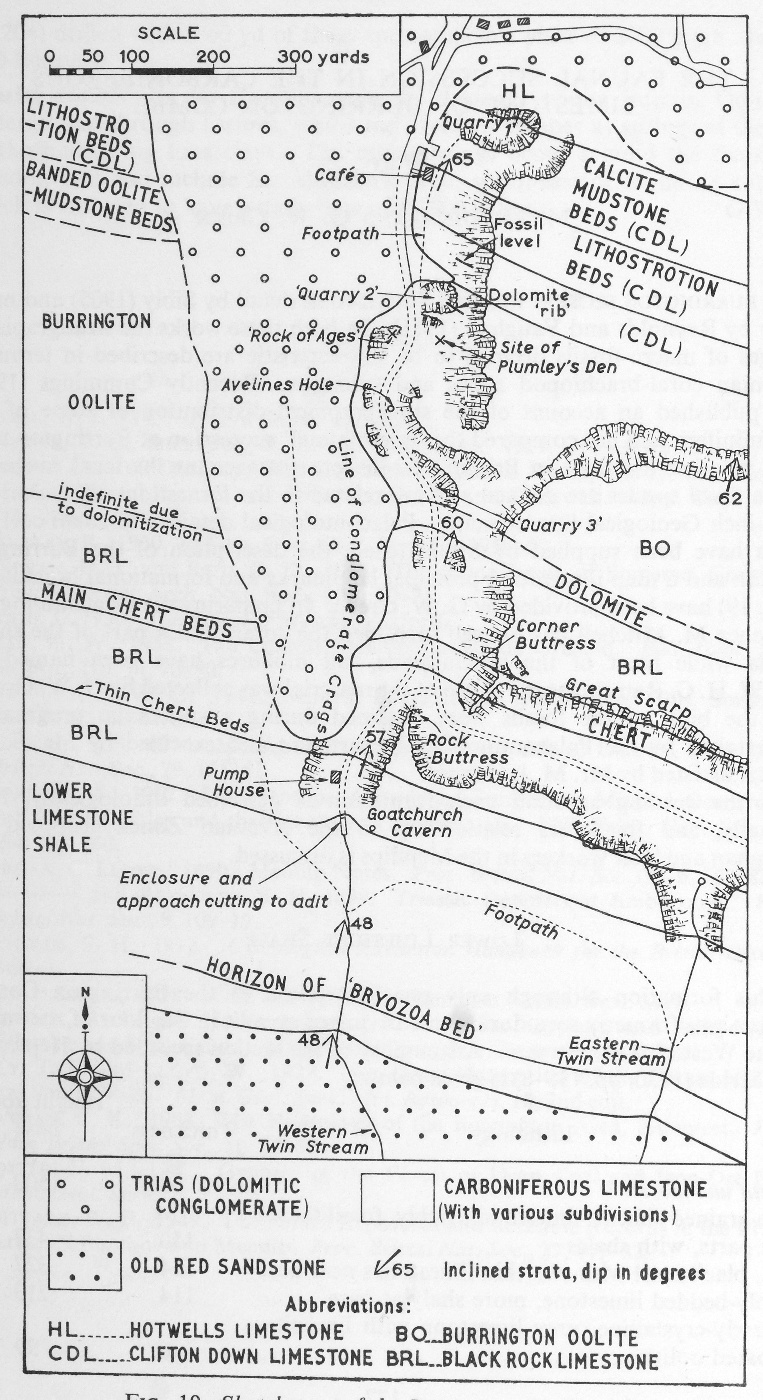
(Figure 19) Sketch-map of the Burrington Combe area.
Plates
(Plate 1) Cheddar Gorge, at the upper (east) end of the Horseshoe, view looking west (see (Figure 4)). The rocks belong to the Clifton Down Limestone. The precipitous nature of the cliffs is due to the presence of strong vertical joints in the Carboniferous Limestone (A9756). Frontispiece.
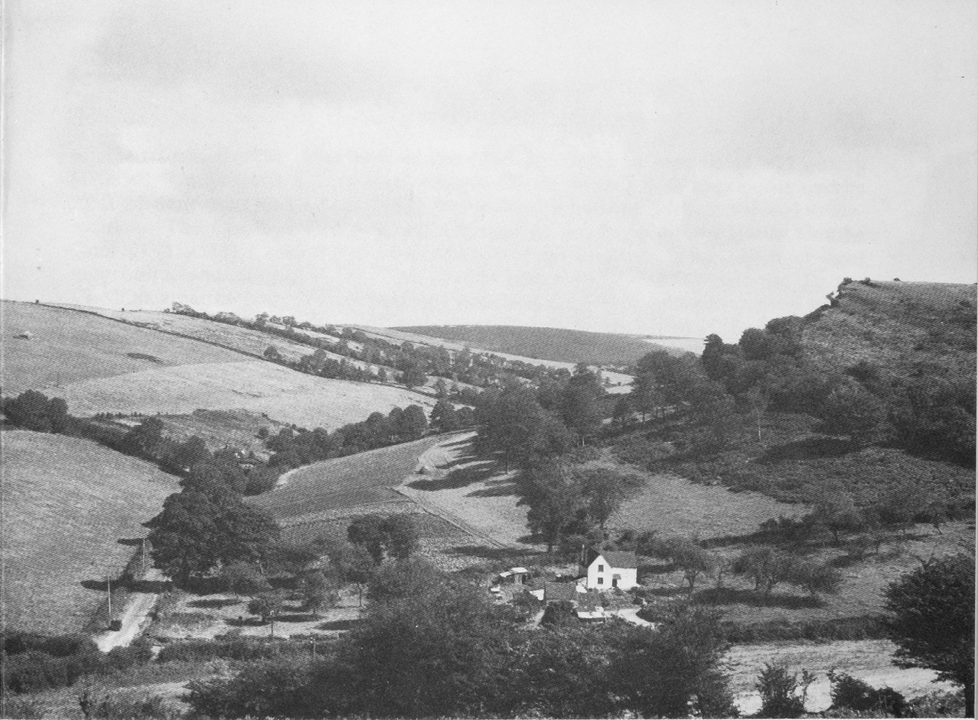
(Plate 2A) Strike valley in Lower Limestone Shale, Longbottom, Shipham. View looking eastwards towards Black Down. The Old Red Sandstone gives rise to a dip slope on the north (left) side of the valley and the large hill, Black Down, in the background. A limestone at the base of the Lower Limestone Shale forms a feature (left centre) at the bottom of the Old Red Sandstone dip slope whilst the remaining part of the Lower Limestone Shale floors the valley bottom and extends up the lower slopes of the south (right) side of the valley which is capped by crags of Black Rock Limestone (Carboniferous Limestone) (A9162).
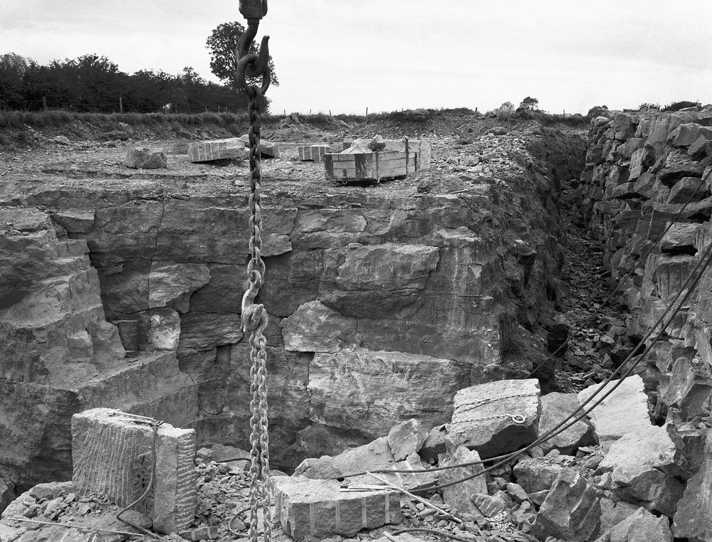
(Plate 2B) Upper Inferior Oolite (Doulting Stone), St. Andrew's Quarry, Doulting. Workings in freestone, showing method of stacking waste stone (on right) and trimming blocks with pneumatic drills (left foreground). Overburden of weathered rubbly rock, 3 to 4 ft in thickness, has been cleared back to boundary fence on the left (A9213).
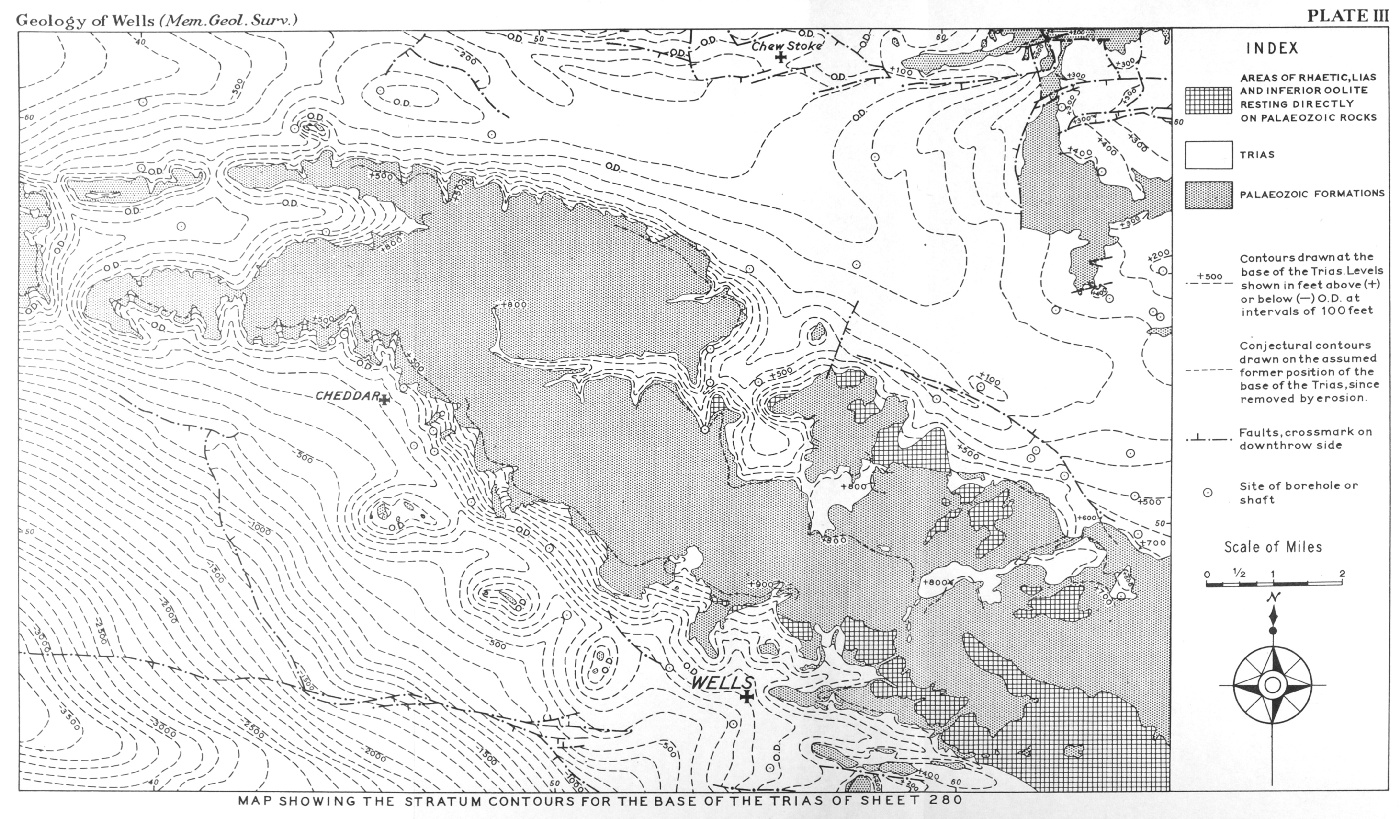
(Plate 3) Map showing stratum contours for the base of the Trias of sheet 280.
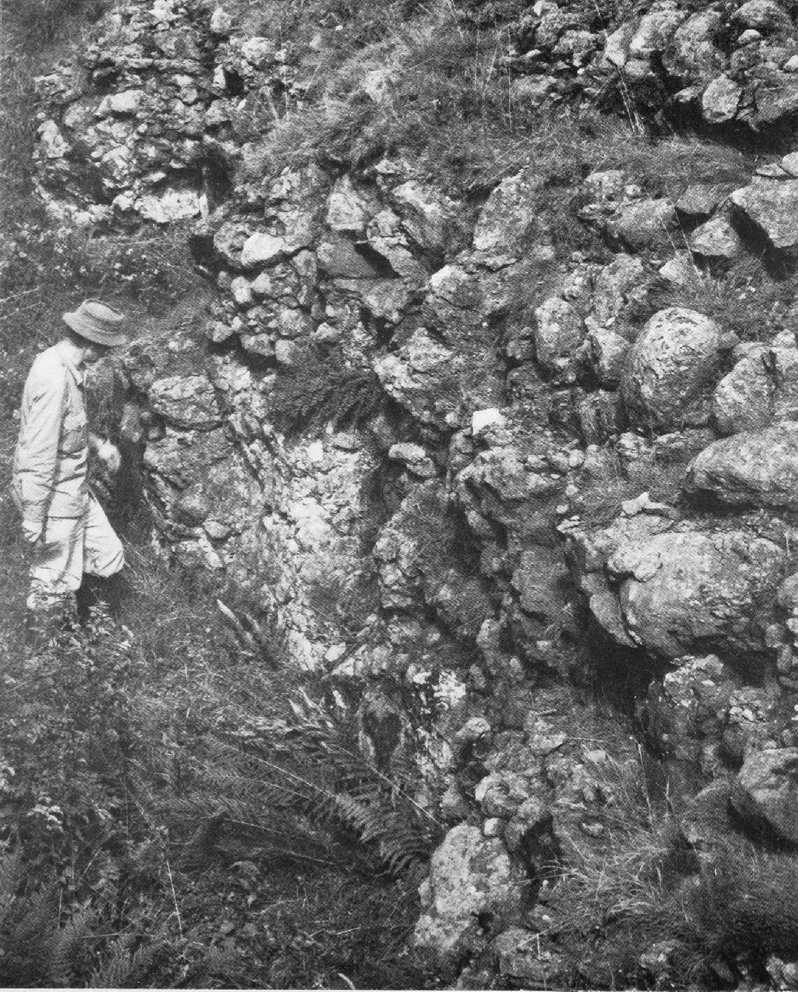
(Plate 4A) Dolomitic Conglomerate (Triassic), Chewton Rabbit Warren, near Priddy. The strata are approximately horizontal (A9181).
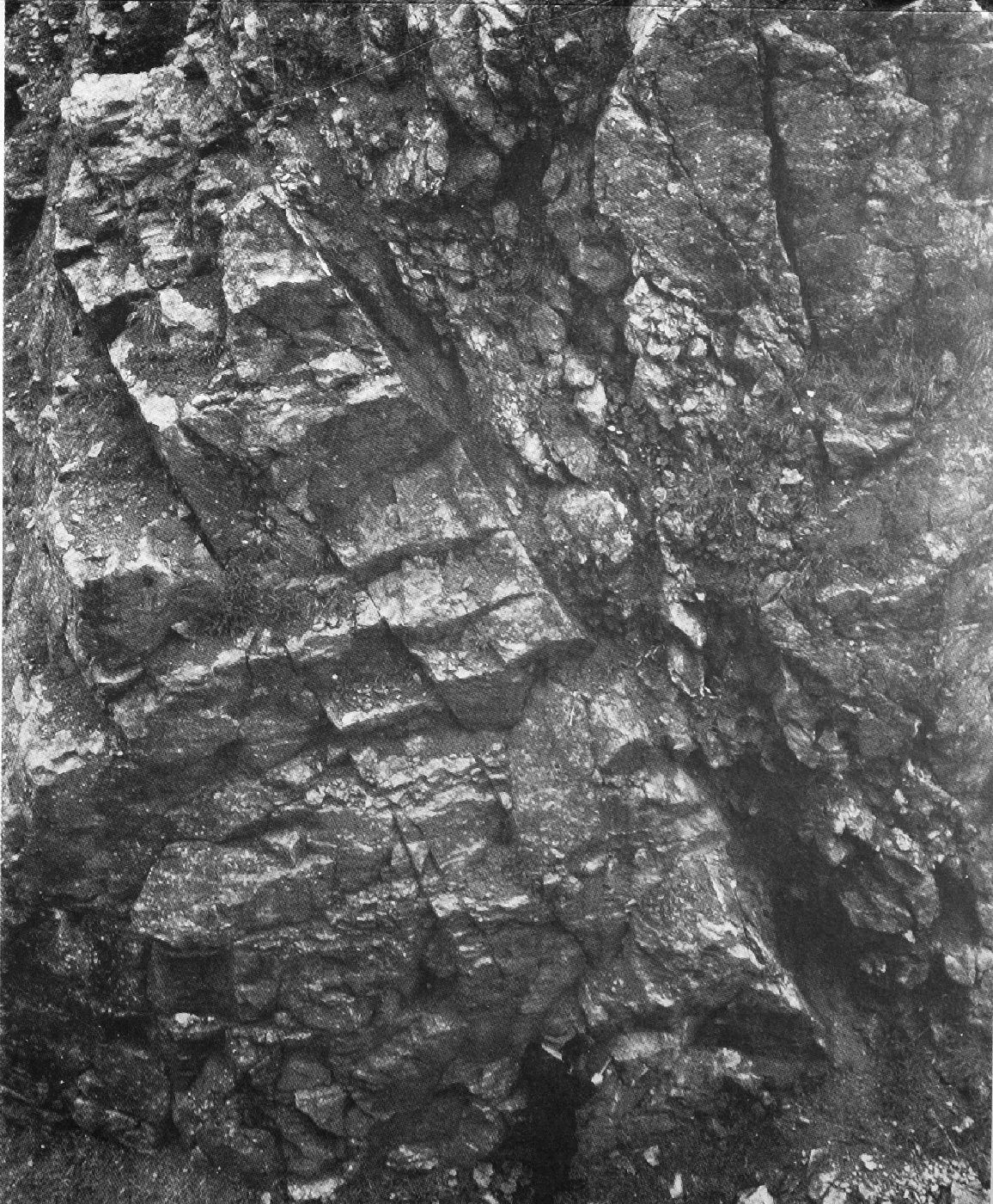
(Plate 4B) Exposure of the Maesbury Fault, quarry west of Maesbury Castle in Black Rock Limestone (Carboniferous Limestone). Strong jointing is developed in gently inclined limestones on either side of the fault plane which is seen dipping at about 60° to south (right). The scale is given by the geologist at the foot of the rock wall (A9202).
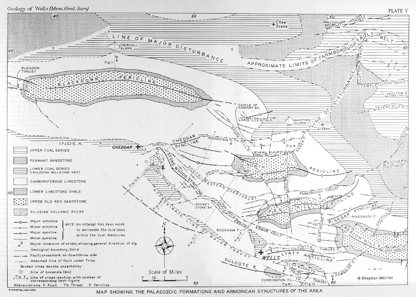
(Plate 5) Map showing the Palaeozoic formations and Armorican structures of the area.