Show interactive timeline
West Lothian geodiversity — contents
Geology and Landscape North Programme Volume 1 — Report by H F Barron, M A E Browne and A Finlayson. Contributors S L B Arkley, S M Clarke, A Matthewson, A Pickering , K I G Lawrie and E K Hyslop.Editor D J D Lawrence
Bibliographical reference Barron, H F, Browne, M A E, And Finlayson, A. 2005. West Lothian Geodiversity. British Geological Survey Commissioned Report, CR/06/008N. 190pp.
(Front cover)
West Lothian geodiversity — title page and preliminaries
Download full PDF report from NORA (NERC Open Research Archive)
Contents
Summary
1 Introduction
1.1 Project Aims
1.2 Project background
1.3 Legislative and policy context
1.3.1 Nature Conservation (Scotland) Act 2004
1.3.2 Modernising the planning system
1.3.3 Strategic environmental assessment
1.3.4 West Lothian Local Plan
1.3.5 West Lothian Biodiversity Action Plan
1.3.6 West Lothian Soil Sustainability Report
1.3.7 EU Soil Directive
1.3.8 Guidance note on geodiversity to biodiversity groups
1.3.9 Guidance on Local Nature conservation site systems in Scotland
2 Geodiversity and its importance
2.1 Geodiversity — why is it important?
2.2 Geodiversity — linking with biodiversity.
2.3 Scotland's geodiversity
3 The geodiversity of West Lothian
3.1 Geological background.
3.1.1 Geological history
3.2 Use of geological resources
3.2.1 Mineral resources and extraction
3.2.2 Built heritage
3.3 Evaluating the geodiversity of West Lothian
3.3.1 Site desk study
3.3.2 Field audit
3.3.3 Project database (GeoDiversitY)
3.3.4 Project GIS
3.4 The geodiversity resource
3.4.1 Geodiversity site review
3.4.2 Inverclyde Group rocks
3.4.3 Strathclyde Group rocks
3.4.4 Bathgate Group rocks
3.4.5 Clackmannan Group rocks
3.4.6 Coal Measures (Scotland) Group rocks
3.4.7 Volcanic vent rocks
3.4.8 Alkali-dolerite sills
3.4.9 Quartz-dolerite sills and dykes
3.4.10 Quaternary deposits, landscapes and soils
Site descriptions
1 Baad Park Burn
2 West Cairn Hill, East Burn
3 Linhouse Water - Above Carstairs Viaduct
4 East Kirkton Quarry
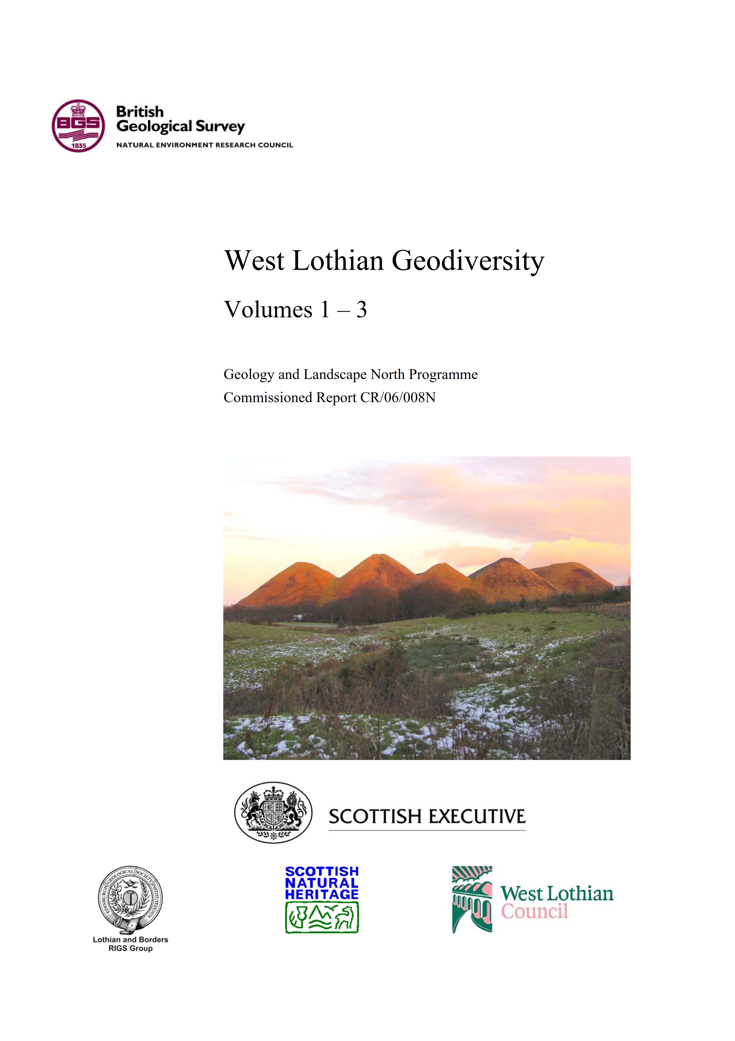
5 Five Sisters
6 Seafield Law
7 Greendykes
8 Almond Valley Heritage Centre
9 Murieston Water 2
10 Almondell and Calder Wood
11 Upper Uphall
12 Union Canal, Winchburgh
13 Hopetoun Obelisk Quarry
14 Society East Shore
15 Society Point
16 Society Shore
17 Hopetoun Shore
18 Abercorn Point
19 Midhope Burn
20 Cairnpapple Hill
21 Wairdlaw Quarry
22 Union Canal Museum
23 Levenseat working quarry
24 Levenseat quarries & mines
25 Skolie Burn
26 Petershill Quarries
27 Rifle Range Quarries
28 Hilderston Silver Mine Quarry
29 Hilderston Silver Mine
30 Hillhouse Quarry and Mine
31 Muiravonside, Carribber Glen
32 Wallace's Arch
33 Barbauchlaw Quarries and 34 Barbauchlaw Burn Quarries
35 Carsie Hill
36 Auchinoon Quarry
37 Linhouse Water - Glasgow Viaduct 2
38 The Knock
39 Witch Craig Viewpoint
40 Cockleroy
41 Beecraigs Quarry
42 Binny Craig
43 Kildimmery Fishery Quarry
44 Craigton (Hill) Quarry
45 Linhouse Water - Calderwood 1
46 Tophichen Hill
47 Linlithgow Loch
48 Tailend Moss
49 Longridge Moss
50 Easter Inch Moss
51 Calder Wood
4 West Lothian Geodiversity Action Plan (WLGAP)
4.1 Introduction.
4.2 Aims
5 Bibliography
5 Glossary
6 Acronyms and abbreviations
West Lothian Geodiversity Volume 2 — Figures
Volume 3 Appendices
Appendix 1 Natural heritage designations in West Lothian
Appendix 2 Geodiversity guidance for LBAPS
Appendix 3 Detailed geology of West Lothian
Appendix 4 Potential sites from desk study
Appendix 5 GeoDiversitY Database
Appendix 6 GIS data layers supplied to West Lothian Council and SNH