A1 D6 Denaby Lane
Site information
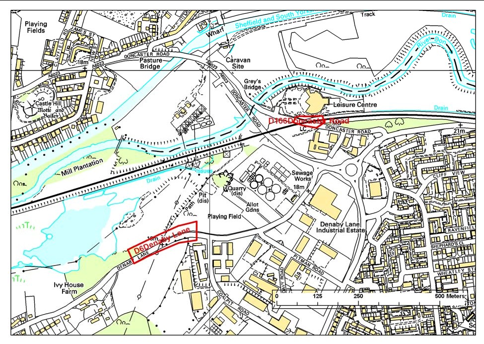
Site name: Denaby Lane
Site key: D6
Grid reference:
Site type: cutting, road
Local authority: Doncaster Metropolitan Borough Council, South Yorkshire
Site dimensions: 30 m x 3 m
Site owner: Highways Agency
Conservation status: Regionally Important Geological Site Date: 14/9/97
Field surveyor: Scott Engering Date: 16/2/07
Stratigraphy and rock types
Time unit: Carboniferous, Westphalian Rock unit:
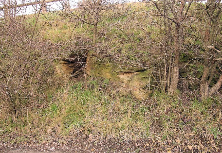
Rock type: Sandstone Details: Cross bedded fine to medium grained, buff and iron stained flaggy sandstone
Site map
This map is based upon Ordnance Survey topographic material with the permission of Ordnance Survey on behalf of The Controller of Her Majesty’s Stationery Office, © Crown copyright. Unauthorised reproduction infringes Crown Copyright and may lead to prosecution or civil proceedings. Licence Number: 100017897 [2007]
Site description
Limited outcrop of
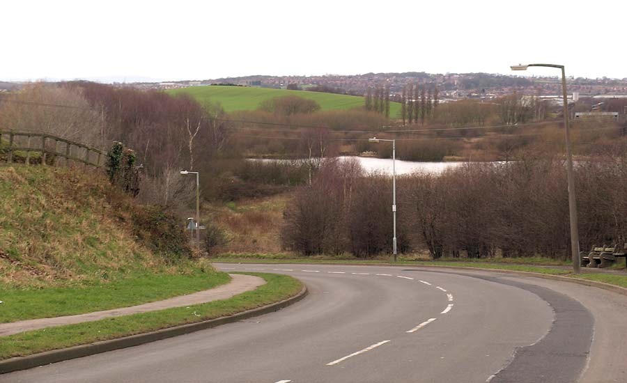
The position of the roadside exposure coincides with a steep drop in the road down an escarpment that is formed by a south-west trending fault line, with a down throw to the north. The fault is part of the South and North Don Fault system and contributes to the topography of the
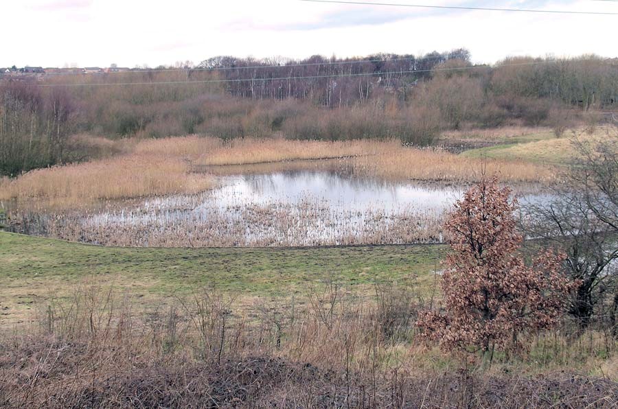
The wetlands, river terraces etc associated with the meandering and floodplain of the Don and Dearne in this area merit further investigation and it is considered that a large area should possess Geodiversity value and not just single, isolated sites. There are strong links to biodiversity in this area.
RIGS assessment of site value
Ratings: 1–2 very poor; 3–4 poor; 5–6 acceptable/useful; 7–8 quite good; 9–10 very good/excellent; N/A not applicable; D/K don't know
Access and safety
Aspect/Description/Rating
Road access & parking Wide access road to industrial estate is located opposite the exposure with small parking area at
Safety of access Accessible from public path on roadside. Rating: 7
Safety of exposure Some flaggy beds are slightly loose but there is no danger from rock overhangs. Rating: 7
Permission to visit Not applicable N/A
Current condition Much of the section is overgrown and would be improved by selective clearance and removal of large shrubs/small trees. Rating: 5
Current conflicting activities None envisaged
Restricting conditions No collecting at the site
Nature of exposure Roadside cutting but displacement of escarpment is evidence of faulting
Multiple exposures/prospect for trail
Notes Consider trail relating to exposures/dip and scarp topography of
Culture, heritage & economic
Aspect/Description/Rating
Historic, archaeological & literary associations None known. Rating: 0
Aesthetic landscape Excellent. Very distinctive dip and scarp topography and fluvial morphology of the River Don with meanders and floodplains. Rating: 9
History of earth sciences Type locality for
Economic geology Not applicable. Rating: 0
Notes
Education and science
Surface processes Modern and recent fluvial processes and landforms. Rating: 7
Geomorphology Folding and faulting, dip and scarp topography, meanders, oxbow lakes, braiding, river terraces. Rating: 9
Sedimentary Cross bedding and lithology in
Fossils Not seen although certain horizons within the formation are rich in fossil trees. Rating: 0
Igneous Not applicable. Rating: 0
Metamorphic Not applicable. Rating: 0
Tectonic: structural Folding, faulting and topographic evidence of the Don Monocline. Rating: 8
Minerals Not applicable. Rating: 0
Stratigraphy Good opportunity to correlate
Notes Potentially an excellent area to study structures, dip and scarp topography and fluvial geomorphology at A level upwards
Geodiversity value
Excellent geodiversity site (to be extended) for geology and a wide variety of landforms and fluvial geomorphology. Rating: 9