A2 D166 Doncaster Road
Site information
Site name: Doncaster Road
Site key: D166
Grid reference:
Site type: disused quarries, pits and cuttings
Local authority: Doncaster Metropolitan Borough Council, South Yorkshire
Site dimensions: 8 m x 3 m
Site owner: Not known
Conservation status: Regionally Important Geological Site Date: 19/8/97
Field surveyor: Scott Engering Date: 21/2/07
Stratigraphy and rock types
Time unit: Carboniferous, Westphalian Rock unit:
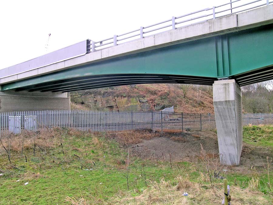
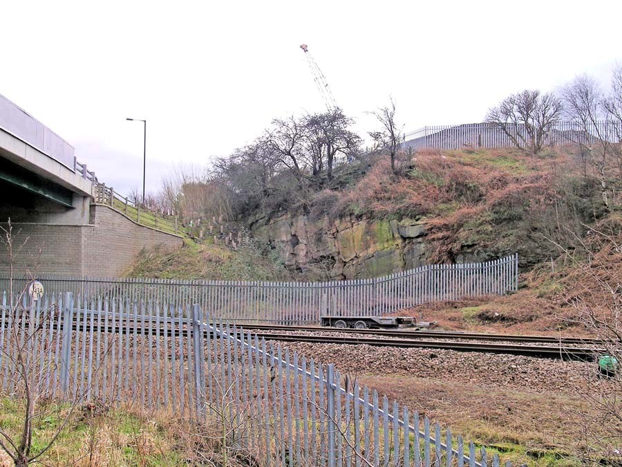
Rock type: Sandstone Details: Massive cross-bedded medium grained buff sandstone
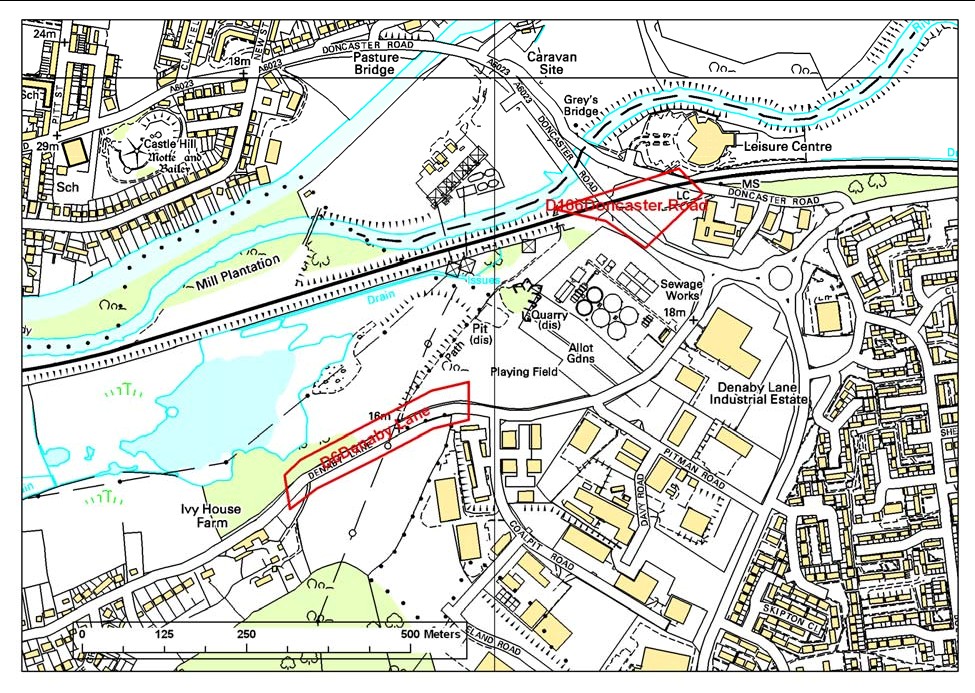
Site map
This map is based upon Ordnance Survey topographic material with the permission of Ordnance Survey on behalf of The Controller of Her Majesty’s Stationery Office, © Crown copyright. Unauthorised reproduction infringes Crown Copyright and may lead to prosecution or civil proceedings. Licence Number: 100017897 [2007]
Site description
The old quarry which once had an extensive of exposure of Mexborough is now virtually entirely developed and incorporated into the road scheme. A very small exposure now exists adjacent to the railway line with maximum dimensions of 8 m x 3 m. It is visible from the northern side of the railway, accessible over made ground that is not likely to remain undeveloped. The exposure itself is fenced off and for most practical purposes is inaccessible; although in the absence of other good exposures of
The exposure comprises massive, cross bedded, medium grained buff coloured sandstone.
RIGS assessment of site value D166 Doncaster Road
Ratings: 1–2 very poor; 3–4 poor; 5–6 acceptable/useful; 7–8 quite good; 9–10 very good/excellent; N/A not applicable; D/K don't know
Access and safety
Aspect/Description/Rating
Road access & parking Good parking in nearby leisure centre. Rating: 8
Safety of access Best view is obtained by walking onto mound of made ground and uneven. Moderate care required. Grassed. Rating: 5
Safety of exposure Safe. Viewed only from other side of railway line. Rating: 5
Permission to visit Not required at present. Rating: 5
Current condition Partially overgrown. Rating: 5
Current conflicting activities Development of area
Restricting conditions Inaccessible
Nature of exposure Remains of old quarry face
Multiple exposures/prospect for trail Limited due to lack of access
Notes
Culture, heritage & economic
Aspect/Description/Rating
Historic, archaeological & literary associations Not applicable. Rating: 0
Aesthetic landscape Negligible. Rating: 1
History of Earth Sciences One of only two recorded exposures of
Economic geology Formerly a building stone quarry for local use
Notes Limited cultural value
Education and science
Surface processes Weathering of rock face. Rating: 5
Geomorphology Not applicable. Rating: 0
Sedimentary Large scale cross bedding and massive beds indicative of fluvial conditions. Rating: 5
Fossils Not applicable. Rating: 0
Igneous Not applicable. Rating: 0
Metamorphic Not applicable. Rating: 0
Tectonic: structural Not applicable. Rating: 0
Minerals Not applicable. Rating: 0
Stratigraphy An example of
Notes Limited value due to inaccessibility and position but it is one of only 2 recorded exposures of
Geodiversity value
Moderately high, just because it is still the best exposure of