Crackington Coast
Highlights
Crackington Coast provides the most complete section through the
Introduction
This stretch of coast lies between Rusey Beach and Widemouth Sands, near Crackington Haven, north Cornwall
Description
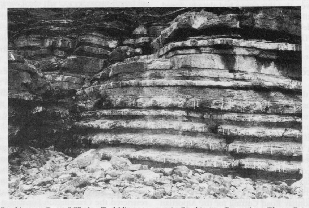
Lithostratigraphy
Structural disturbance has made it impossible to establish a stratigraphical log for the sequence here, or to determine its full thickness. The strata are mainly alternating sandstones and shales, the arenaceous sediments becoming more dominant towards the top of the succession. Many of the sandstones have sole marks, flutes, lodes and flames, typical of turbidites
These strata were first named the Crackington Measures by Ashwin (1958). Edmonds (1974) later used the name to include both the original Crackington Measures and the Boscastle Measures, found south of the Rusey Fault Zone. However, Selwood et al. (1985) showed that the strata south of the fault were Lower Carboniferous, as well as being of completely different facies, and so restricted the
Biostratigraphy
The only stratigraphically diagnostic fossils found here are ammonoids. They are rare and usually poorly preserved, but sufficient have been found to identify several zones (Freshney et al., 1972).
The Chokierian is represented by assemblages of both the Isohomoceras subglobosum and Homoceras beyrichianum zones, found between Rusey Cliff and Crackington Haven. Freshney et al. give few species identifications, however, beyond I. cf. subglobosum (Bisat) found on the south side of Crackington Haven.
The presence of Alportian fossil assemblages is questionable. Freshney et al. mention localities near Crackington Haven yielding Homoceratoides? and Homoceras of the H. undulatum Subzone, associated with bivalves Dunbarella sp. However, the fossils are badly distorted and their identifications are far from certain.
There is apparently rather better palaeontological evidence available for the Kinderscoutian, at several localities between Crackington Haven and Millook Haven. Freshney et al. mention assemblages belonging to the Reticuloceras circumplicatile, R. nodosum and possibly the R. reticulatum zones. However, the composition of these assemblages is not documented.
Basal Marsdenian fossils were reported from near Cancleave Strand, in the form of abraded goniatites of the Bilinguites gracilis Zone (although Freshney et al. again fail to give identifications). At Foxhole Point, Verneuilites sigma (Wright) and Bilinguites cf. superbilinguis Bisat have been reported. This suggests the V. sigma Subzone (B. superbilinguis Zone) at the very top of the Marsdenian.
Biostratigraphical evidence of the Yeadonian has yet to be found in this section. The Langsettian, in contrast, has been proved at two levels. Near Wanson Mouth, Gastrioceras cf. coronatum Foord and Crick, G. cf. listeri (Sowerby) and Dunbarella sp. have been found at several points and indicate a level equivalent to the
Interpretation
This site may be provisionally regarded as the stratotype for the
The
The evidence from Crackington suggests that the Culm Trough was filled during the Namurian by progressively more proximal turbiditic sediments. The broadly westerly palaeocurrents indicate that the turbidites flowed along the axis of the trough, although elsewhere, easterly orientated palaeocurrents have also been recognized (Edmonds et al., 1968). Thomas (1988) argued that the turbidites were probably generated by slumping of sediments on the shelf margin. He also suggested that the flows were not constricted laterally, although Melvin (1986) has argued that they may have occurred within broad, shallow channels.
The
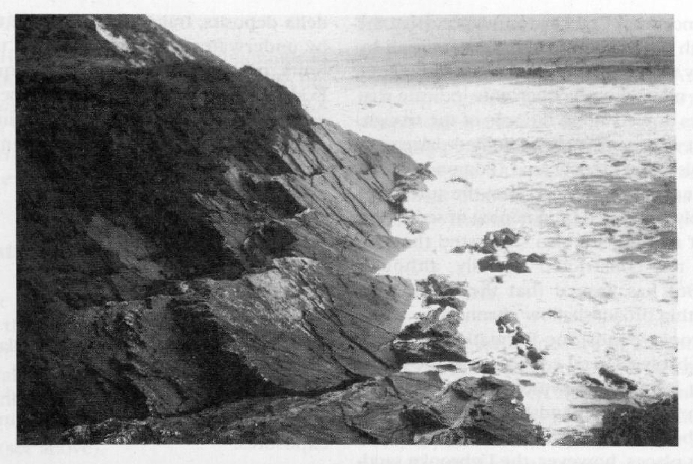
The Rusey Fault Zone, at the southern limit of the site, is an important geological boundary in south-west England, separating rocks of different age, facies, structural style and metamorphic grade (Selwood et al., 1985). According to the model of Selwood et al., it marks where a complex suite of allochthonous nappes to the south underthrust a more or less autochthonous flysch basin. In contrast, Turner (1986) has argued that the strata to the south represent a compartmentalized basin, in which sedimentation and structural evolution were controlled by movements along vertical basement faults, and that the Rusey Fault Zone was not a persistent line of underthrusting. Whichever model is accepted, however, the Rusey Fault Zone is important for understanding the geological evolution of the Culm Trough.
Conclusions
Crackington Coast is the best place to study the