EDC 31: Wilderness Plantation
Grid reference: [NS 59604 72548]
Site type: Artificial quarry works
Site ownership: Not known
Current use: Disused
Field surveyor: Sarah Arkley & Mike Browne
Current geological designations: None
Date visited: 6th April 2009
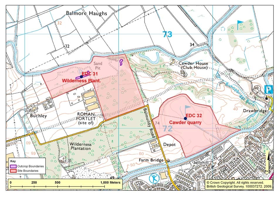
Site map
(Figure 31) Wilderness Plantation Location Map
Summary description
Disused sand and gravel quarry and completed landfill site.
Type locality of the Wilderness Till FormationTill Formation, overlying older sand and gravel deposits of the Cadder Sand and Gravel Formation from which a radiocarbon dated (27 550 years Before Present) woolly rhinoceros humerus bone was found in 1963 close to Balmuildy Road.
After some searching the type exposure was relocated, although largely degraded and overgrown, the critical contact with the underlying sand and gravels is now obscured but can be re-exposed.
Exposures of till found at the top of the degraded face are hard reddish brown, generally fine-grained with scattered boulders and other smaller clasts. There are no sedimentary structures in the till, but a fabric (glaciotectonic) is observed.
Samples of the underlying sands are visible towards the edge of the face where rabbits have exploited them for burrows.
EDC 31: Stratigraphy and rock types
Age: Quaternary Formation: Wilderness Till FormationTill Formation
Rock type: Glacial deposits: diamicton
Age: Quaternary Formation: Cadder Sand and Gravel Formation
Rock type: Sand and Gravel
Assessment of site value
Access and safety
Aspect/Description
Road access and parking Parking possible for a few cars by the side of the bonded warehouses south of the site
Safety of access A track heads northwards towards the River Kelvin from where the sections can be accessed.
Safety of exposure Exposures are only visible in the upper quarter of the face; the rest has been covered by fallen material and forms a steep slippery slope. The area at the base of the sections is very wet and smells, it is likely a contaminated site, a deep green pool sits at the bottom of part of the section.
Permission to visit No permission sought
Current condition Possible contaminated site
Current conflicting activities None known
Restricting conditions Smell
Nature of exposure Degraded quarry face
Culture, heritage & economic
Historic, archaeological & literary associations. Rating: 0.
Aesthetic landscape Landscaped landfill site, view across the Kelvin valley. Rating: 2.
History of earth sciences None known. Rating: 0.
Economic geology Site was worked for sand and gravel for decades. Rating: 5.
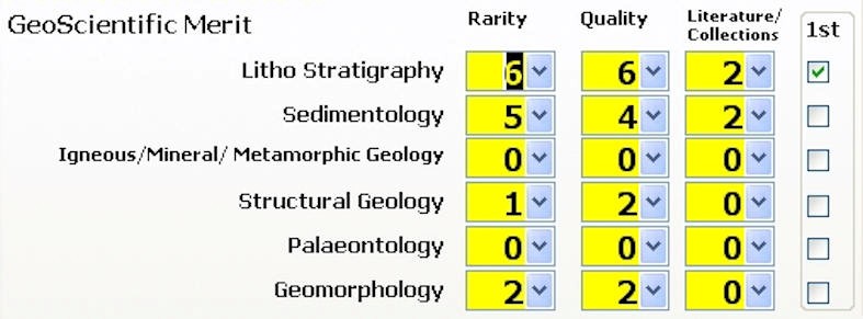
EDC 31: Geoscientific merit
EDC 31: Wilderness Plantation, Buchley. Geoscientific merit.
Total Geoscientific merit score 32
Current site value
Community. Rating: 5.
Education. Rating: 6.
Fragility and potential use of the site
Fragility Weathering/Erosion, Natural overgrowing, Dumping
Potential use Research, Higher/Further Education, School
Geodiversity value
This site is the type locality for the Wilderness Till FormationTill Formation, a glacial deposit which stretches across much of Central Scotland. Glaciotectonic structures at and around the contact between the till and the underlying sand and gravel worthy of re-excavation and academic research. As a site with a dated woolly rhinoceros bone it is also important in the understanding of Quaternary ice age events in central Scotland Rating: 6
Photographs
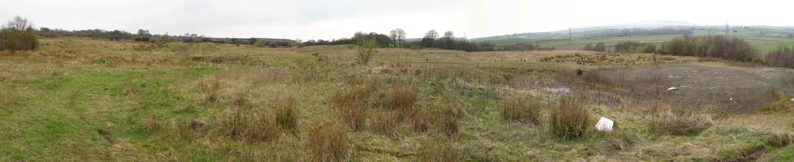
(Photo 195) View looking westwards across the former sand and gravel pit and landfill site at Wilderness Plantation.
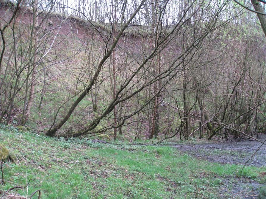
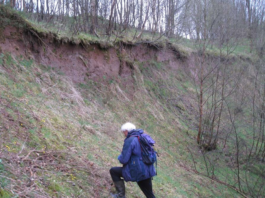
(Photo 196) View towards main section of the Wilderness Till FormationTill Formation overlying the Cadder Sand and Gravel Formation. Access to the site is not easy; the section is degraded and slips into stagnant pools beneath. Despite this, it is a very important site, showing the relationship between these units, and with some clearing of the main face could be improved greatly. Looking SW.
(Photo 197) View along the main face which since being actively quarried has become degraded. Only the reddish consolidated glacial till of the Wilderness Till FormationTill Formation is visible towards the top of the section, the underlying deposits of the Cadder Sand and Gravel Formation can no longer be seen. Looking WSW.
(Photo 198) Small exposure of sand near the base of the quarry face, thought to belong to the Cadder Sand and Gravel Formation which underlies the Wilderness Till FormationTill Formation. Typically such deposits of sand make good dwelling places for rabbits. Looking east.
(Photo 199) View along the main face. The reddish consolidated glacial till belonging to the Wilderness Till FormationTill Formation is visible in the upper part of the section. The degraded slope below the exposure is steep and slippery. Looking East.
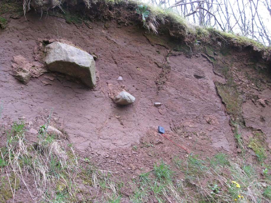
(Photo 200) The Wilderness Till FormationTill Formation is a hard, reddish brown, sandy, silty glacial till with isolated boulders and smaller stones. Note the inclined shear joints dipping to the west in this part of the section. The material was laid down beneath the ice sheet which covered the area during the Dimlington Stadial, approximately 27,500-13,500 years before present. At its maximum the ice is thought to have been over 1 km thick in Central Scotland. Looking south.
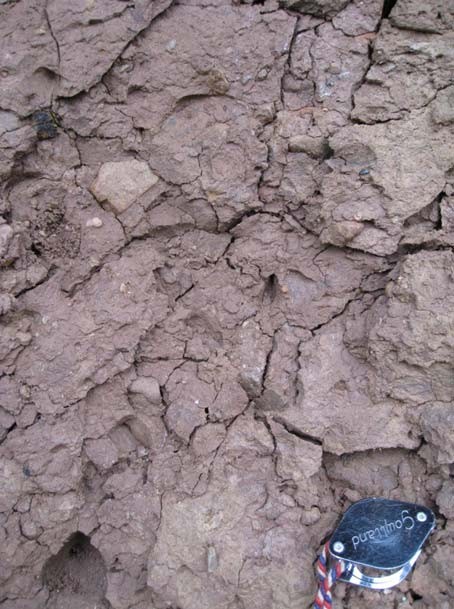
(Photo 201) Close-up of the Wilderness Till FormationTill Formation, showing fractures in the over- consolidated glacial till.
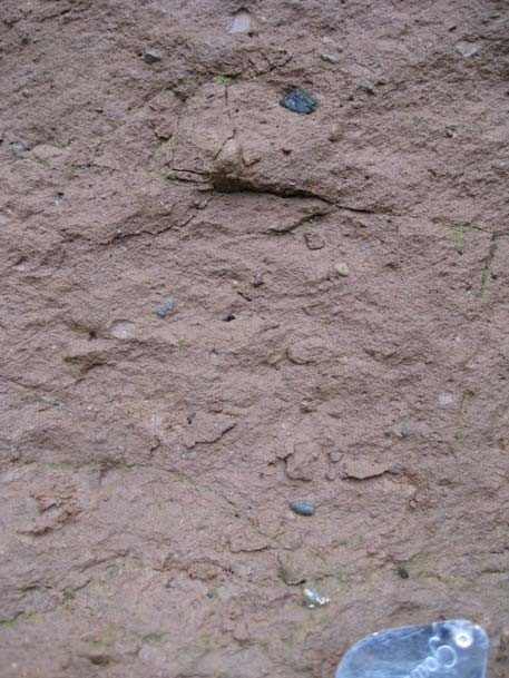
(Photo 202) Close-up of the Wilderness Till FormationTill Formation, showing the nature of the matrix of the glacial till; sandy with scattered gravel.
Bibliography