ELC_16: Cockenzie and Port Seton
Site information
Location and summary description:
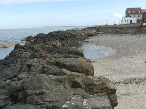
Cockenzie and Port Seton are located approximately 9 kilometres east of Edinburgh. The 1.7 kilometre long site displays sedimentary strata from of the Carboniferous age Upper Limestone, Passage and Lower Coal Measures formations, which are locally intruded by dykes. The Crossgatehall Fault trends south-west to north-east through the site. This site is the only known natural exposure of the Lower Coal Measures Formation in East Lothian.
National Grid reference:
Mid-point:
West end:
East end:
Site type: Natural section/exposure; Natural landform
Site ownership: Crown Estates
Current use: Open shoreline
Field surveyors: Sarah Arkley and Eileen Callaghan
Current geological designations: Firth of Forth SSSI
Date visited: 14th May and 28th May 2014
Other designations: Firth of Forth SPA
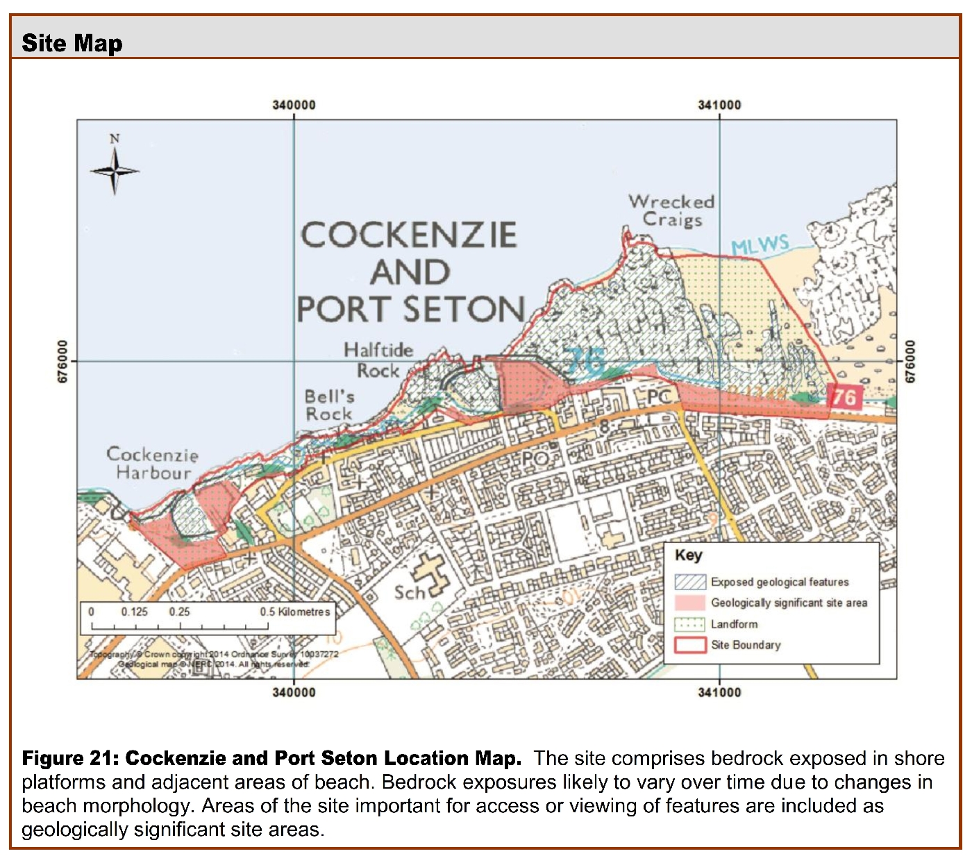
Site map
Site description
Background
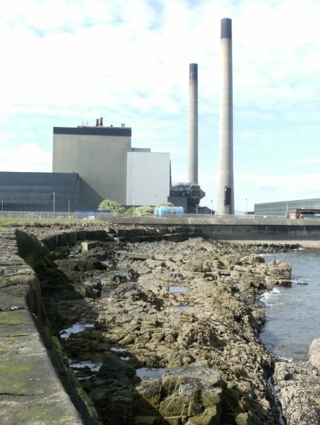
The villages of Cockenzie and Port Seton have a long and rich history; their harbours are used for fishing and in the past for the export of local coal. The coal that was mined within the area was used in the process of making salt and also to power the local power station. Cockenzie Power Station
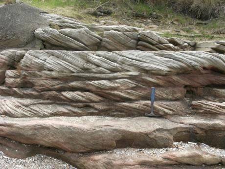
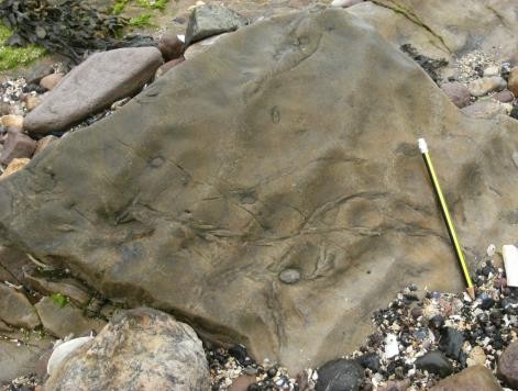
Sedimentary rocks
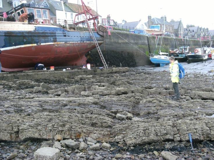
The Lower Coal Measures Formation lies at the core of a gentle downward fold (syncline) within Port Seton Harbour. This formation is part of the Coal Measures Group and this exposure is the only one seen within East Lothian. The cyclic sequence shows mudstones, sandstones, siltstone and thin seams of coal which are exposed within the harbour at low tide
The older
Sedimentary Rocks of the
The
Igneous rocks
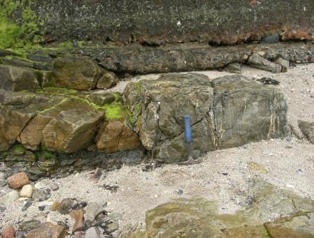
The Port Seton-Spittal Dyke is exposed in this site at Black Rocks to the west of Cockenzie Harbour, and also to the east at Cockenzie old harbour at Bell’s Rocks
Quaternary deposits and landforms
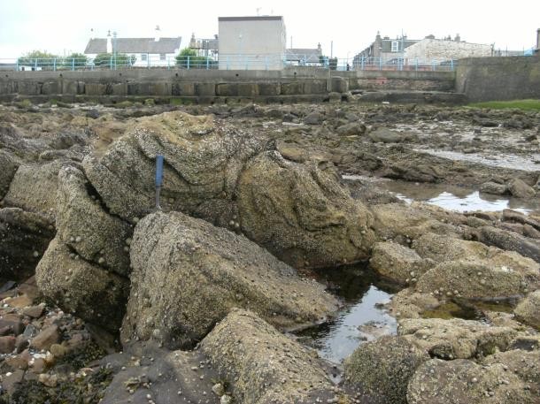
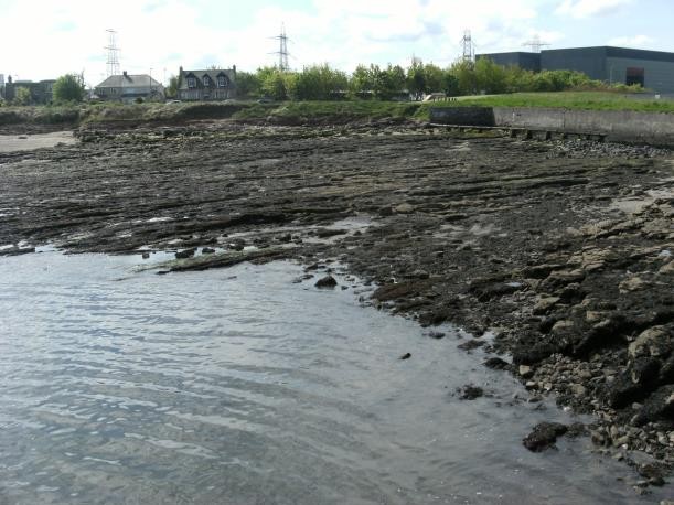
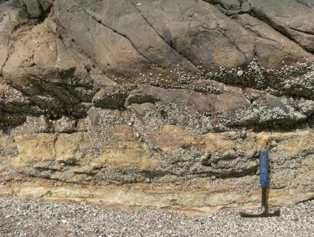
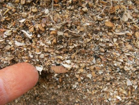
The bedrock strata at the site are exposed on coastal rock platforms in the intertidal zone, which contains minor inlets and small bays. To the landward side of Cockenzie Harbour there is a section of a raised beach approximately 1 metre in thickness; this section contains closely packed shells
Structural geology
The site seen at Cockenzie and Port Seton is a broad syncline with axis running approximately south- east, north-west through Port Seton harbour. Younger strata of the Lower Coal Measures are exposed in the core of the syncline with older, underlying strata exposed on the eastern and western limbs. Minor faulting is observed in the
Access and additional information
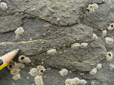
Access to the coastal site is very good via the John Muir Way which follows the southern edge of the site boundary. The majority of the exposures only visible at low tide and the sedimentary strata tend to be partly covered with seaweed and barnacles. There is parking within Cockenzie and Port Seton and there are a few interpretation boards along the John Muir Way.
Stratigraphy and rock types
Age: Westphalian, Carboniferous
Formation: Lower Coal Measures Formation
Rock type: Sandstone, siltstone, mudstone with seatearths and coals
Age: Namurian–Westphalian, Carboniferous
Formation:
Rock type: Sandstone, mudstone, siltstone and seatearths
Age: Namurian, Carboniferous
Formation:
Rock type: Sandstone, siltstone, mudstone, limestone and seatearths.
Age: Carboniferous
Formation: Central Scotland Late Carboniferous Tholeitic Dyke Swarm
Rock type: Quartz-Microgabbro
Assessment of site: access and safety
Road access and parking There is also parking within the town with access onto the shore.
Safety of access Easy access to the shore but all visitors should be aware of the tide times when planning a visit, as the majority of the exposures are only visible at low tide and when exposed can be covered in seaweed.
Safety of exposure The rocky exposures have an uneven surface and are often slippery with seaweed. Stout footwear is recommended. The site is exposed to the open sea and the weather forecast should be checked before visits.
Access Access along the foreshore/beach, the John Muir Way follows the southern edge of the site.
Current condition The rocks can be covered in barnacles and seaweed. The exposures at the landward edge of Cockenzie Harbour and at West Links are clear of vegetation.
Current conflicting activities None.
Restricting conditions Tide: many of the geological exposures are located in the intertidal range and therefore covered at high tide.
Nature of exposure Intertidal and beach exposures.
Assessment of site: culture, heritage & economic value
Historic, archaeological literary associations The sea has played an important part in the history of both Cockenzie and Port Seton, Cockenzie has had a fishing harbour since the 16th century and the building of fishing vessels and yachts continued up to the 1990’s. Both Cockenzie and Port Seton harbours were also used in the export of local coal and the locally mined coal was used in the extraction process of removing salt from seawater.
Historic houses within or near Port Seton are: Seton Castle, privately owned, built on the site of 17th Century Seton Palace and also Seton Collegiate Church, 15th Century and managed by Historic Scotland.
Aesthetic landscape Coastal
History of earth sciences John Muir Way passes along the southern edge of the site.
Economic geology Both Cockenzie and Port Seton harbours are still used in the fishing industry and local fish merchants and curers can be found in the town.
Cockenzie Power Station was opened in 1968 and brought significant prosperity to the area but the power station was decommissioned in 2013. Tourism also adds to the towns in the form of Seton Sands Caravan Park which is located just outside Port Seton.
Assessment of site: geoscientific merit
| Rarity | Quality | Literature/collections | Primary interest | |
| Lithostratigraphy | Regional | Excellent | X | |
| Sedimentology | Local | Good | Poor | |
| Igneous/mineral/metamorphic geology | Local | Moderately good | X | |
| Structural geology | Regional | Good | ||
| Palaeontology | Local | Good | ||
| Geomorphology |
Site geoscientific value
This site displays a sequence of the Upper Carboniferous; the
Cockenzie and Port Seton provides an excellent example of Upper Carboniferous strata with regional lithostratigraphical and palaeontological significance.
Assessment of site: current site usage
Community The easy access to the shore and the shore walkway is used regularly by locals.
The John Muir Way passes through Cockenzie and Port Seton which attracts visitors from further afield.
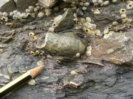
Education The site displays a variety of features suitable for amateur geologists to study depositional sedimentary environments. The limestone strata exposed in this site offers the study of fossils. The Port Seton-Spittal dyke is well exposed and provides some evidence of contact with the sedimentary rocks.
Assessment of site: fragility and potential use of the site
Fragility Weathering/erosion
Potential use There are various places where on-site interpretation could be located also a geo-trail extending to Prestonpans could be considered. The area could be studied by, school and higher education.
Geodiversity summary
This site contains a good variety of geological features especially associated with sedimentary strata. It exposes a sequence of the Upper Carboniferous including the Lower Coal Measures Formation, the only coastal exposure in East Lothian; also the Port Seton-Spittal dyke is seen intruding into this sequence. The sedimentary structures and the fossils seen in the Calmy and Orchard limestones allow interpretation of the depositional environments of each formation. The fossils at this site are one of the best exposures on the East Lothian coast.
The coastline is attractive and has easy access. There are numerous possibilities for adding geological interpretation to this site, especially along the John Muir Way.