Figures
(Figure 57) Trace fossils found at Scordale, probably formed small molluscs or worms around 320 million years ago.(See PDF)
(Figure 71) Spar box with North Pennines minerals (See PDF)
(Figure 57) Trace fossils found at Scordale, probably formed small molluscs or worms around 320 million years ago.(See PDF)
(Figure 71) Spar box with North Pennines minerals (See PDF)
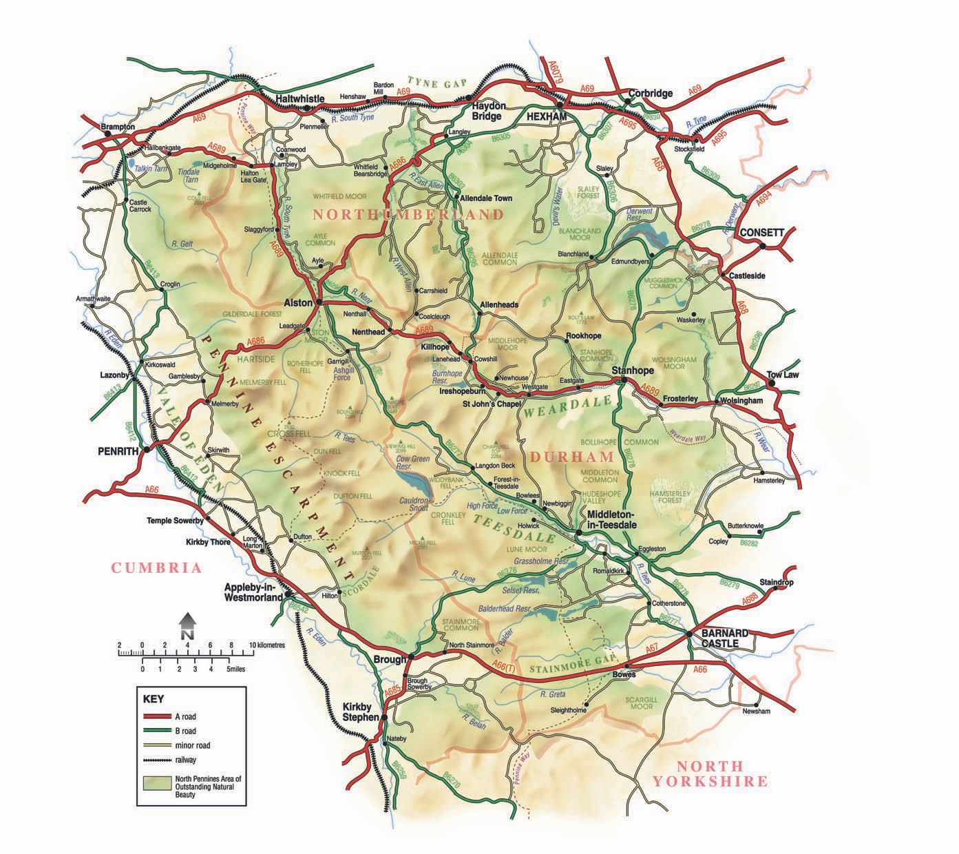
Map of the North Pennines Area of Outstanding Beauty.
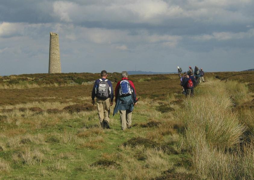
Jeffrey's chimney above Ramshaw Elizabeth Pickett/NPAP.
North of Nenthead – Charlie Hedley © Countryside Agency.
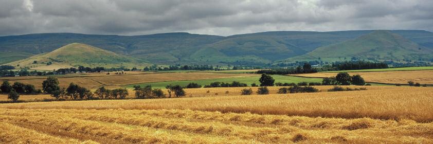
Dufton Pike (left), Knock Pike (right) and Dufton Fell – Charlie Hedley © Countryside Agency.
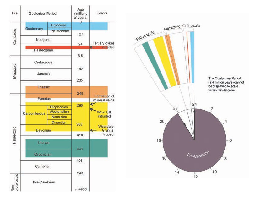
Geological time. Stratigraphic column.
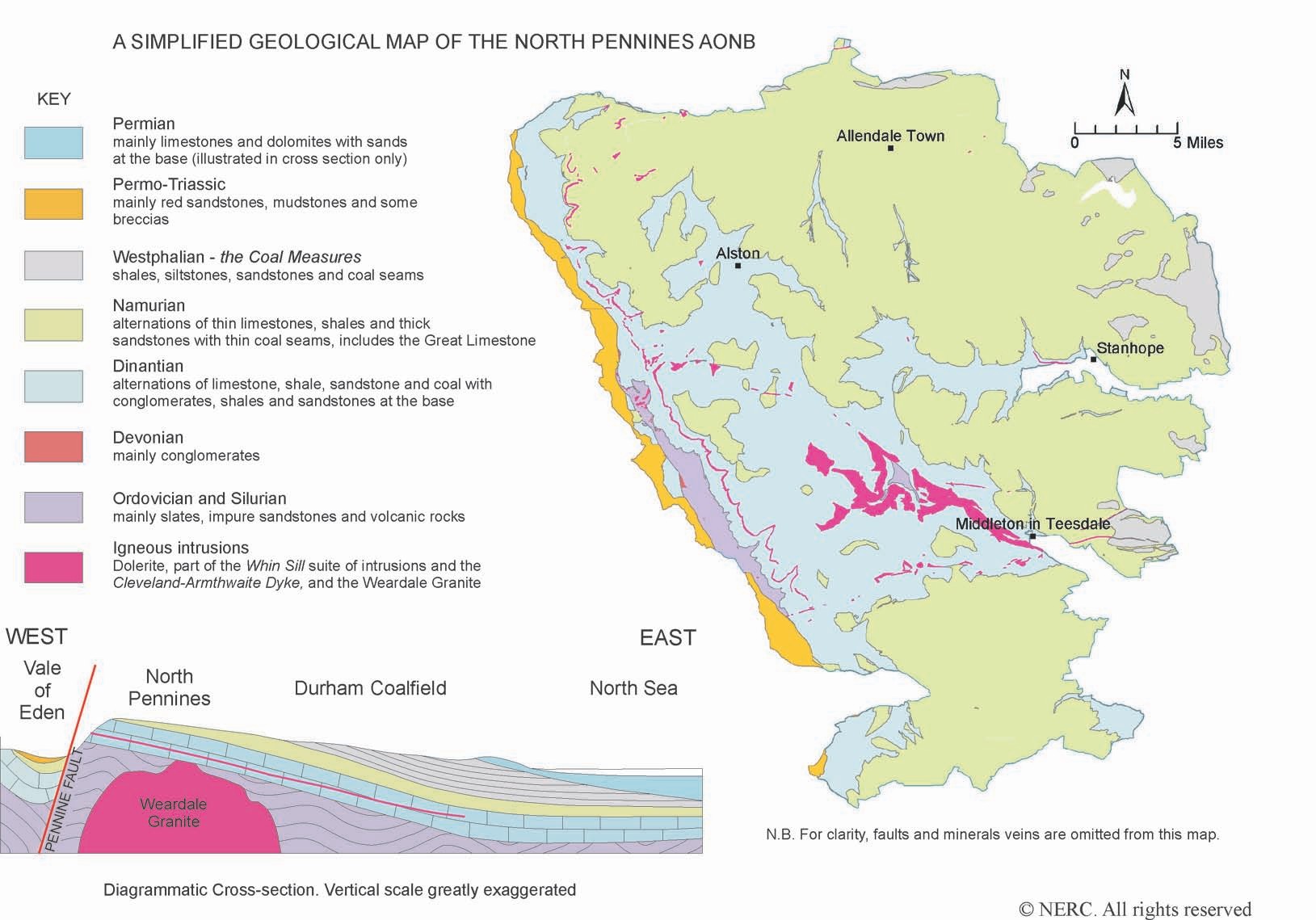
A simplified geological map of the North Pennines AONB
Park Level, Killhope © Elizabeth Pickett/NPAP
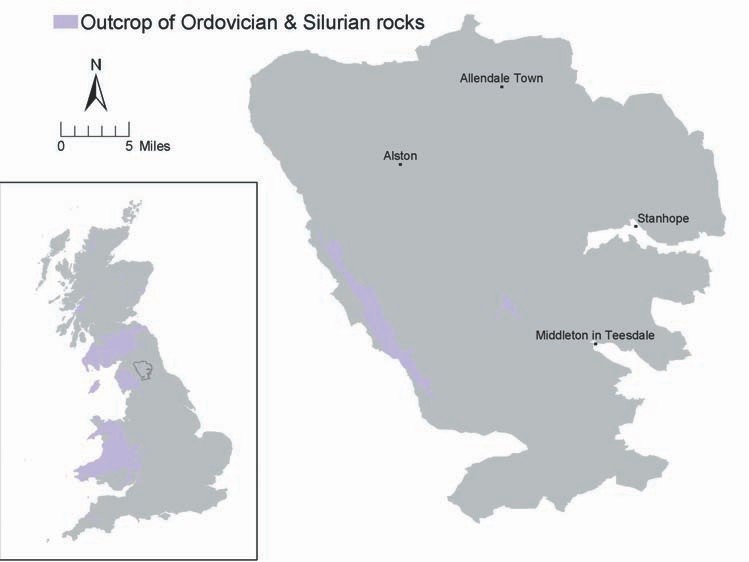
Outcrop of Ordovician and Silurian rocks
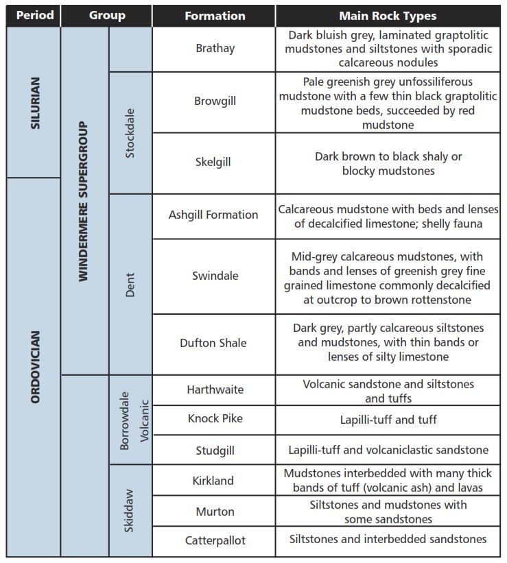
The currently accepted classification of the Ordovician and Silurian rocks of the AONB is shown in the table above.
Keisley Limestone Quarry, Dufton. © S. Clarke, BGS, NERC.
Knock Pike and Dufton Pike. © B. Young, BGS, NERC.
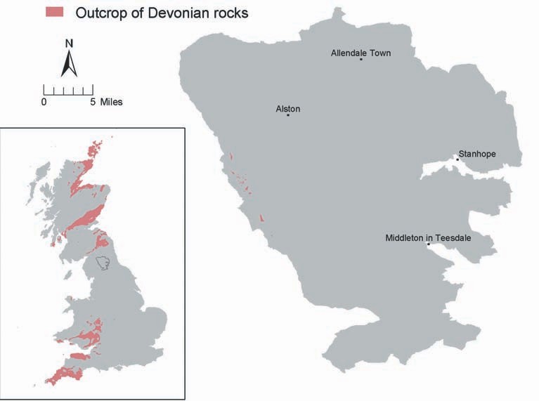
Outcrop of Devonian rocks.

Exposure of the ‘polygenetic Conglomerate’ near Melmerby. © B. Young, BGS, NERC.
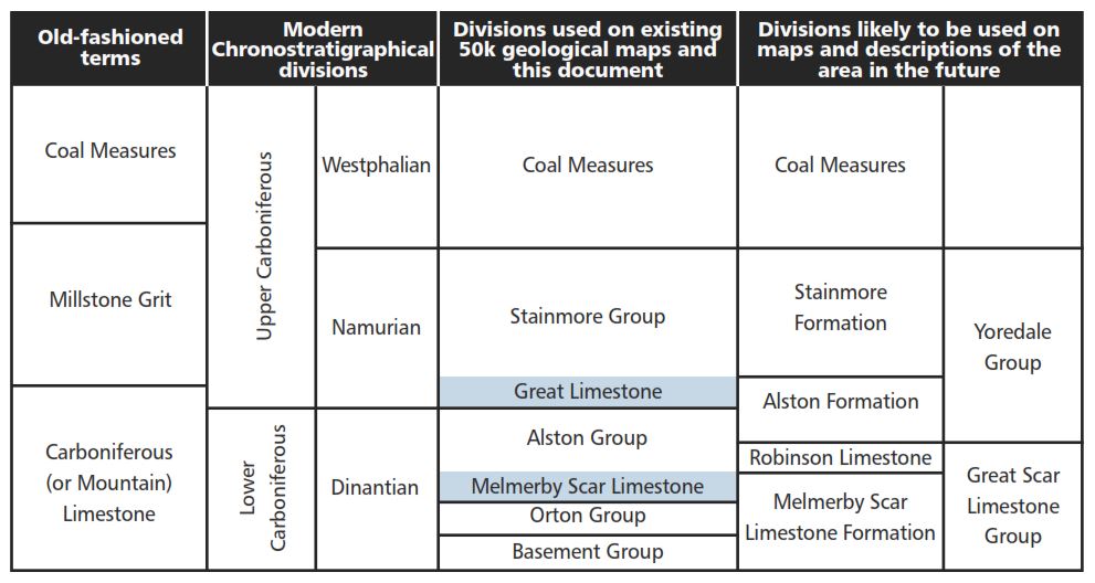
Stratigraphy of the Carboniferous table.
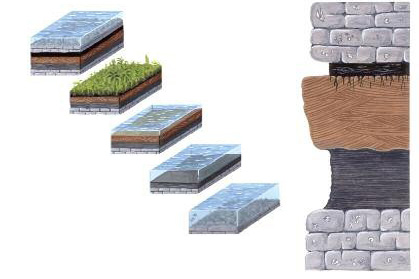
The formation of Yoredale Cyclothems. © Elizabeth Pickett/NPAP
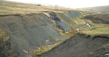
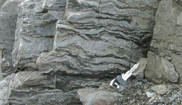
Namurian shales in old ironstone workings © B. Young, BGS, NERC.
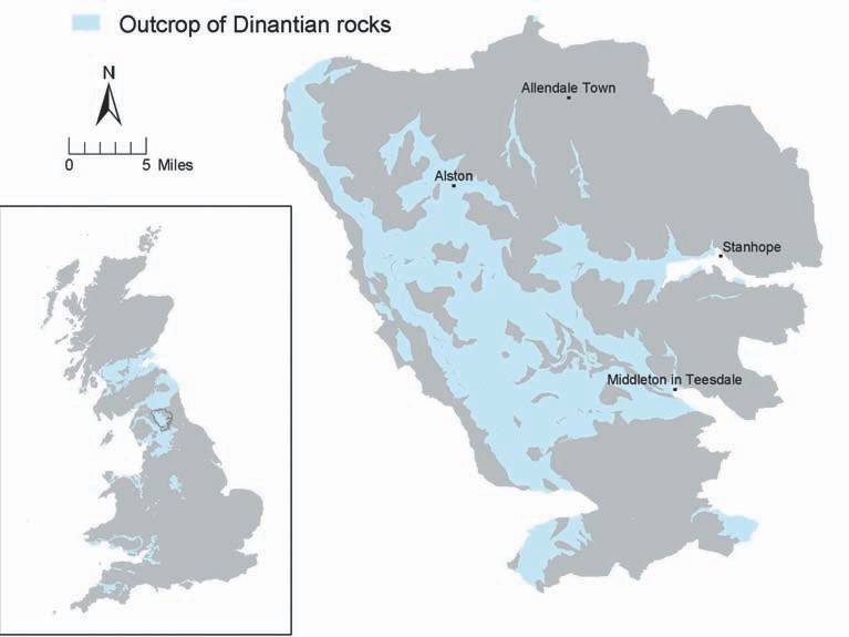
Outcrop of Dinatian rocks.
Falcon Clints, Teesdale. Conglomerates and shales of the Orton Group. © B. Young, BGS, NERC.

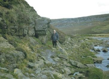
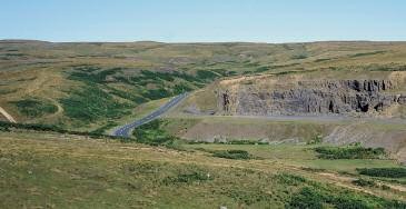
Hilton Mines, Scordale. Crags of Whin Sill overlying Melmerby Scar Limestone. © B.Young, BGS, NERC.
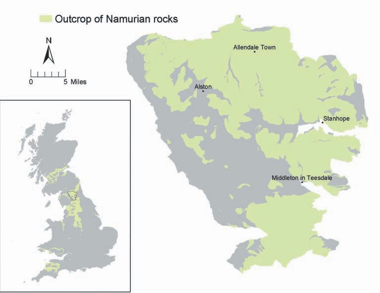
Outcrop of Namurian rocks
Chaetetes Band, River Nent, Nenthead Mines. © D. Millward, BGS, NERC.
Characteristic terraced hillside, Blagill, Nent Valley. S.Clarke © BGS, NERC.
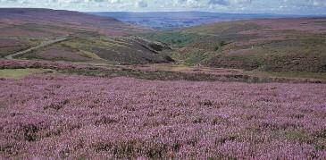
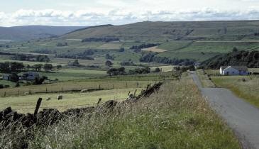
Middleton Common. Heather moorland on outcrop of Namurian Rocks. © Charlie Hedley, Countryside Agency.
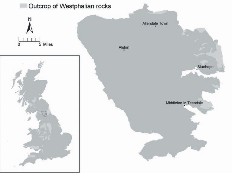
Outcrop of Westphalian rocks.

Carboniferous swamp. © Elizabeth Pickett.
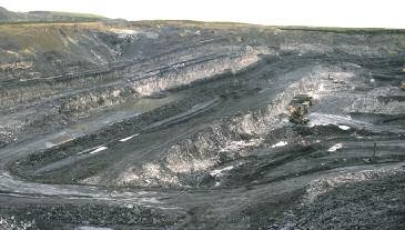
Plenmeller Opencast Coal Site in 1980's. © B. Young, BGS, NERC.
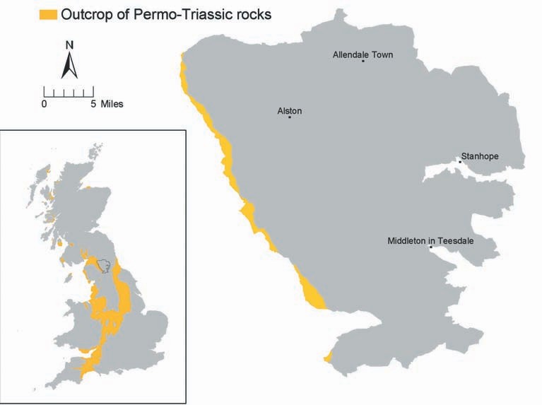
Outcrop of Permo-Triassic rocks.

St Bees sandstone in Croglin Quarry Charlie Hedley © Countryside Agency.
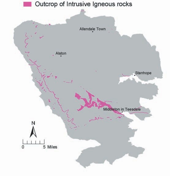
Outcrop of intrusive igneous rocks.
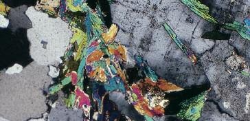
Photomicrograph of thin section of Weardale Granite © H. Emeleus, Durham University.
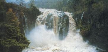
High Force, Whin Sill overlying Tynebottom Limestone. © NPAP.
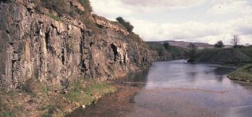
The Little Whin Sill exposed in the abandoned Greenfoot Quarry, Weardale. © B. Young, BGS, NERC.
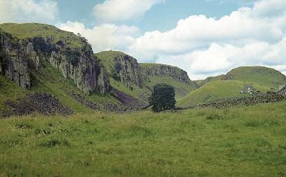
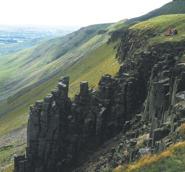
Crags of columnar jointed Whin Sill, Holwick Scar, Teesdale © BGS, NERC.
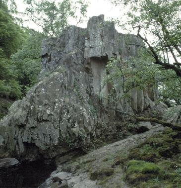
Raft of altered sandstone in Whin Sill, Wynch Bridge, Teesdale. © S. Clarke, BGS, NERC.
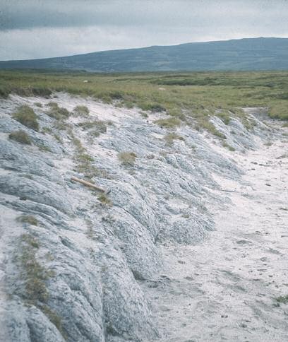
Outcrops of 'Sugar Limestone' Widdybank Fell © B. Young, BGS, NERC.
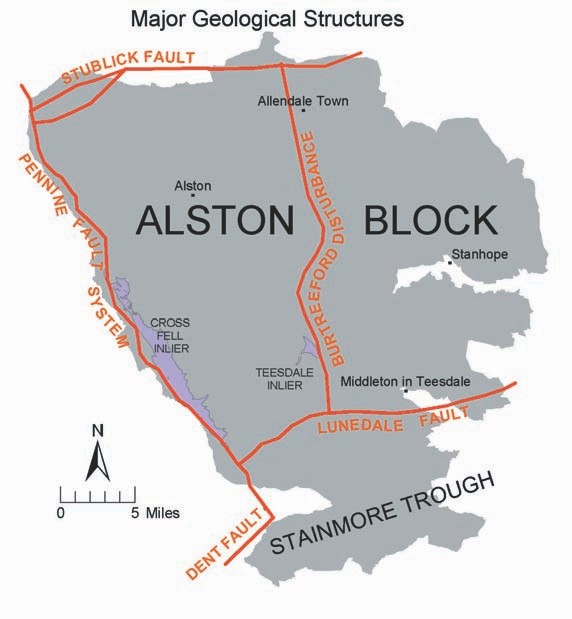
Major geological structures.
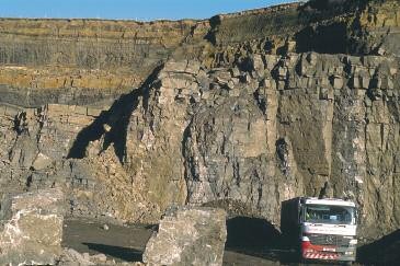
Normal fault in Great Limestone and overlying beds, Heights Quarry, Eastgate, Weardale © B. Young, BGS, NERC.
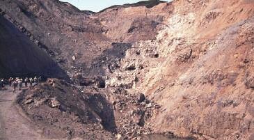
Folded limestones adjoining the barites deposit, Closehouse Mine, Lunedale in 1984. © B. Young, BGS, NERC
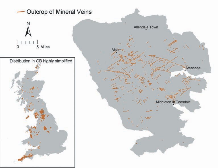
Outcrop of mineral veins
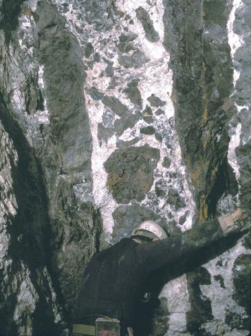
Witherite vein, Scraithole Vein, Scraithole Mine, Carr Shield © P601083. BGS.
Slitt Vein and worked – out ironstone flats, West Rigg, Westgate, Weardale © B. Young, BGS, NERC.
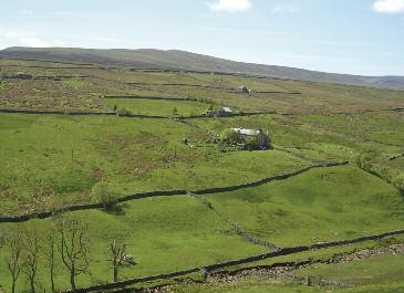
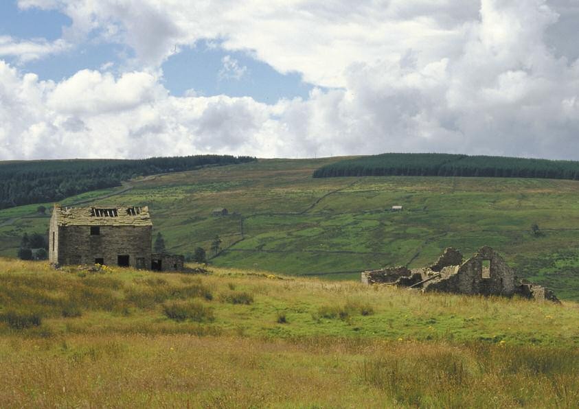
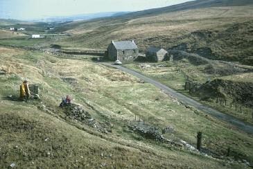
Miner-farmer landscape, upper Weardale. © Elizabeth Pickett/NPAP.
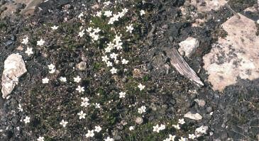
Spring Sandwort © B. Young, BGS, NERC.
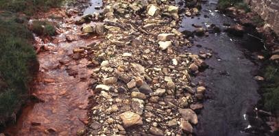
Discharge of brown iron-rich minewater entering Rookhope Burn near Ripsey Mine, 2007. © B. Young, BGS, NERC.
Lady's Rake Mine, an extremely important mineralogical site with mining history interest. © B. Young, BGS, NERC.
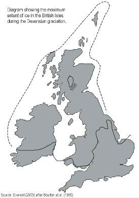
Diagram showing the maximum extent of ice in the British Isles during the Devensian glaciation.
Boulder clay in river bank, Haugh Hill, Harwood Beck,Teesdale © B.Young, BGS, NERC.

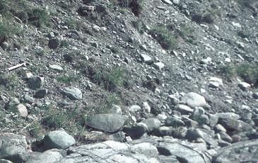
Large limestone erratic, Herdship Fell, Teesdale © B. Young, BGS, NERC.
Pre-glacial channel of the River Tees (in background) Cauldron Snout © B.Young, BGS, NERC.
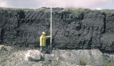
Peat overlying boulder clay, Plenmeller Opencast Coal Site © BGS, NERC.
The Great Whin Sill at High Cup Nick above Dufton on the Pennine Way © Countryside Agency.
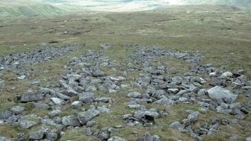
Stone Stripes, Knock Fell. © C. Vye, BGS, NERC.

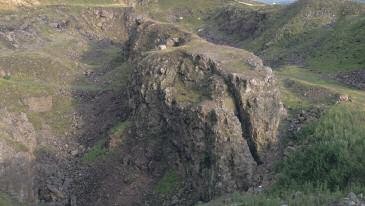
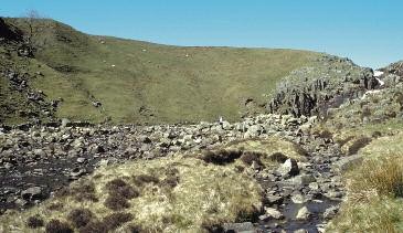
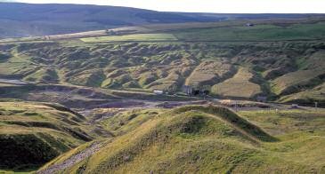
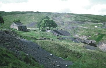
The large landslip at Mason’s Holes, Scordale. © B.Young, BGS, NERC.
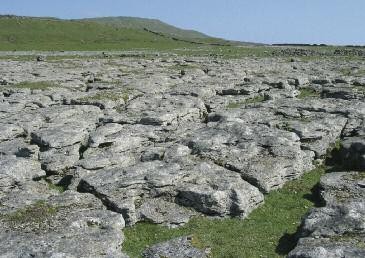
Limestone pavement, Stainmore. © Elizabeth Pickett/NPAP
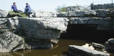
God's Bridge, a natural limestone bridge over the River Greta. © Elizabeth Pickett/NPAP.
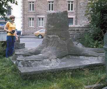
Fossilised stump of a Namurian tree, preserved in Stanhope Churchyard © B. Young, BGS, NERC.
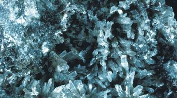
Barytocalcite crystals, Clargill Mine, Alston © BGS, NERC.

Fluorite crystals, Weardale.
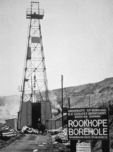
The Rookhope Borehole, 1960-61. Image courtesy of © Durham University.
Ancient Ironstone Workings, Cowshill, Weardale © B. Young, BGS, NERC.
Old Quarry in the Great Limestone, Bollihope Common – Charlie Hedley © Countryside Agency.
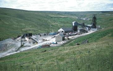
Surface plant, Groverake Mine (now disused), Rookhope © B. Young, BGS, NERC.
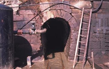
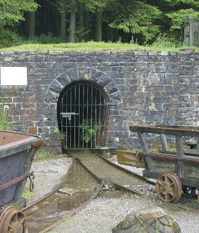
The original stone-arched entrance to Cambokeels Mine, Weardale, driven in the mid-19th Century. © B. Young, BGS, NERC.
Spoil Heaps, Coalcleugh Mine © B. Young, BGS, NERC.
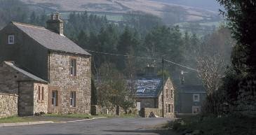
Croglin. Use of local sandstone including St. Bees sandstone from the village quarry. Charlie Hedley © Countryside Agency.
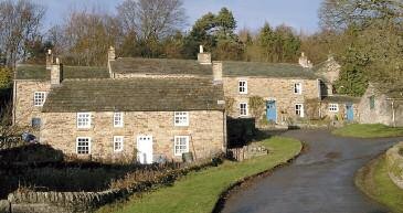
Blanchland – use of locally worked sandstones as building and roofing stone' © B. Young, BGS, NERC.
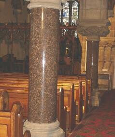
Pillars of polished Shap Granite, St Augustine’s Parish Church, Alston. © B. Young, BGS, NERC.
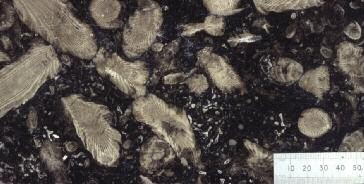
Frosterly Marble, polished surface © BGS, NERC.
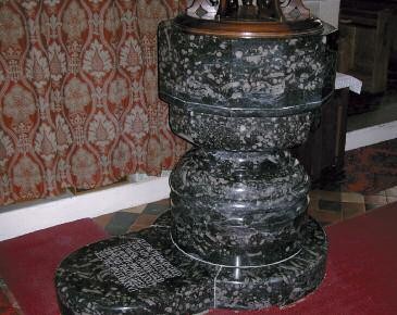
Font in Frosterly Church © B. Young, BGS, NERC.
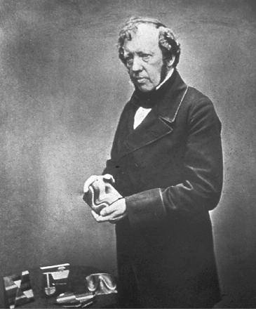
Thomas Sopwith with a selection of his wooden geological models © BGS, NERC.

British Steel's mine model for Allenheads. © Elizabeth Pickett.