Show interactive timeline
Limestone landscapes — a geodiversity audit and action plan for the Durham Magnesian Limestone Plateau — contents
Title page and preliminaries
by D J D Lawrence. Editor A H Cooper
British Geological Survey. Geology and Landscape England Programme Open Report OR/09/007
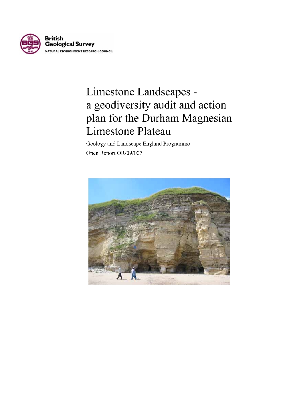
(Front cover)
Contents
Foreword
Acknowledgements
Contents
Summary
1 Introduction
1.1 Aim
1.2 Scope of the study
1.3 Area of study
2 The Magnesian Limestone
2.1 Composition
2.2 Age
2.3 Naming and Division
3 Understanding the rocks
3.1 Evolution of the rocks and landscape
3.2 Yellow Sands Formation
3.3 Marl Slate Formation
3.4 Raisby Formation (Formerly Lower Magnesian Limestone)
3.5 Ford Formation (Formerly Middle Magnesian Limestone)
3.6 Roker Dolomite Formation
3.7 Seaham Residue
3.8 Seaham Formation
3.9 Rotten Marl
3.10 Quaternary deposits
4 The geodiversity of the Limestone Landscapes area
4.1 Major features of geodiversity importance within the area
4.2 Threats to geodiversity
4.3 Enhancement of sites
5 Geodiversity Site selection
5.1 Existing designated sites
5.2 Selection of sites for Limestone Landscapes
6 Opportunities for interpretation, involvement and enhancement
6.1 Working with organisations and communities
6.2 Suggestions for major themes that could be developed and/or interpreted
7 Recommendations for geodiversity action plan
Brief descriptions of principal geodiversity sites
Fulwell & Carley Hill quarries
Tunstall Hills and Ryhope Cutting
Middridge Quarry
Claxheugh Rock
Ford Quarry
Bishop Middleham Quarry
Trimdon Grange Quarry
Wingate Quarry
Marsden Old Quarry
Hepplewhites (Cold Knuckles) Quarry
Crime Rigg Quarry
Thrislington Quarry
Trow Point to Frenchman's Bay
Frenchman's Bay
Marsden Bay
Lizard Point and Marsden Limekiln
Seaham Harbour
Blackhall Rocks
Appendix 1 Major sources of information consulted
Appendix 2 GCR, SSSI and County Geology Sites within the area
Appendix 3 Working quarries
References
Figures, plates and tables