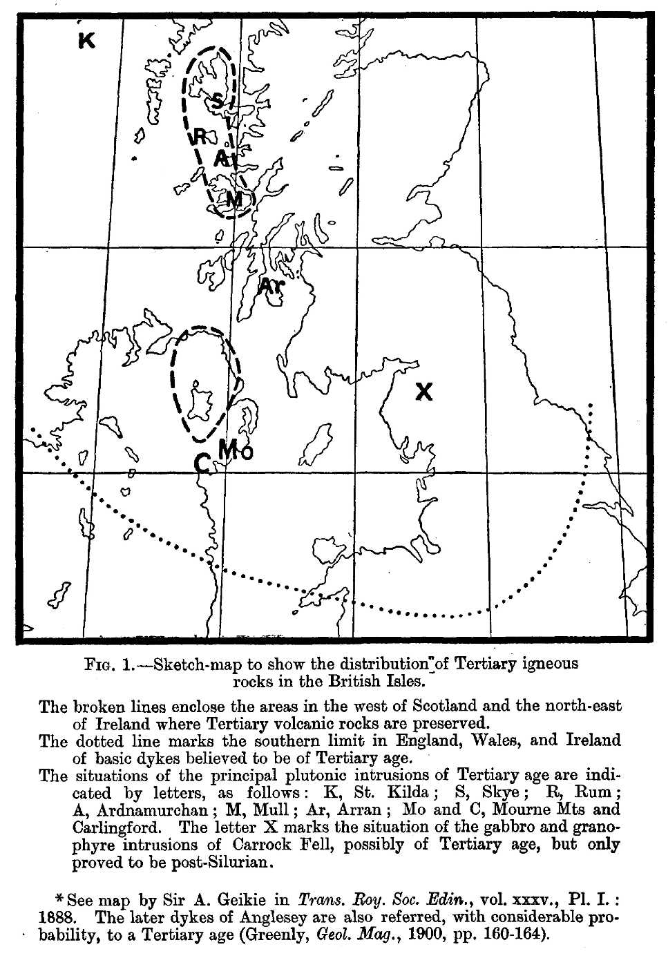
The Tertiary igneous rocks of Skye
By Alfred Harker, M.A.., F.R.S., With Notes By C. T. Clough, M.A., F.G.S.
Memoirs of the Geological Survey of the United Kingdom.
Published By Order Of The Lords Commissioners Of His Majesty's Treasury.
Glasgow: Printed For His Majesty's Stationery Office By James Hedderwick & Sons At "The Citizen" Press, St. Vincent Place.
And To Be Purchased, Either Directly Or Through Any Bookseller, From John Menzies & Co., Rose Street, Edinburgh, And 90 West Nile Street, Glasgow; Or Edward Stanford, 12, 13, And 14 Long Acre, London, W.C.; And Hodges, Figgis & Co., Ltd., 104 Grafton Street, Dublin.
1904.
Price, Nine shillings
Preface
The Tertiary Volcanic region of the West of Scotland is well known to be of exceptional interest from many points of view, and on this account my predecessor, Sir A. Geikie, determined that a typical portion of the region should be mapped and described in great detail. The district comprising the central mountain group of Skye was selected by him, and the services of Mr. Harker were secured in order that the actual survey and the petrographical work might be carried out by the same officer. The present memoir is, therefore, the result of work which was planned and in great part executed under the direction of Sir A. Geikie, who has himself contributed very largely to our knowledge of the selected area, and who has taken from first to last special interest in Mr. Harker's researches.
The district is one which has attracted the attention of many distinguished geologists from the days of Macculloch down to recent years. The main outlines of the geology are, therefore, familiar to students of the science, but in view of the publication of this volume some of the salient features of the development of research may here be referred to. Macculloch's classic work showed that the basalts of the plateaux and the eruptive masses pierce and overlie the Oolitic strata, and are therefore younger than the Jurassic rocks. The discovery of plant remains at Ardtun, in Mull, announced by the Duke of Argyll in 1851, marked an important advance, for they were regarded by Professor E. Forbes as proving the Tertiary age of the basalts with which they are associated. At the same time Forbes was led to the conclusion, from the evidence at Loch Staffin, in Skye, that the basaltic lavas are there contemporaneous with the Oolitic strata. Following the opinion of Professor Forbes, in his earliest investigations Sir A. Geikie inferred that the basaltic lavas of Skye are not younger than some late part of the Jurassic period, and he further contended that the gabbros of that island are of Archaean age from the striking resemblance of the banded types to some of the ancient gneisses of the North-West Highlands. In 1871 appeared Zirkel's valuable description of the petrology of the igneous rocks of Skye. In 1874 Professor Judd published his well known paper, in which he maintained that in the West Highlands there are relics of five great extinct Tertiary volcanoes indicating three periods of igneous activity — the first marked by the extrusion of acid lavas and tuffs connected with plutonic masses of granite, the second by basaltic lavas related to deep-seated masses of gabbro, and the third by minor outflows of lava from sporadic cones. In 1888 Sir A. Geikie embodied the results of his prolonged study of the Tertiary Igneous Rocks of the West Highlands in his monograph, communicated to the Royal Society of Edinburgh, on "The History of Volcanic Action during the Tertiary Period in the British Isles" He therein maintains that the basaltic plateaux are probably due to fissure eruptions; that the basaltic lavas were subsequently pierced by laccolitic masses of gabbro, which produced a certain amount of contact alteration on the previously-erupted lavas; and, finally, that the basic rocks were disrupted by the protrusion of masses of granophyre. These conclusions have been confirmed by Mr. Harker.
In the following pages the rocks are described with reference to their field relations and petrographical characters, due regard being paid throughout to the fact that they form a connected series of igneous products. The area referred to is represented by Sheets 70 and 71 of the one-inch maps, together with parts of Sheets 80 and 81. Sheet 81 has been published, and Sheets 70 and 71 are now being prepared for publication. In view of the complexity of the district and the impossibility of adequately representing the geological features on the one-inch maps, it is proposed to publish four six-inch Sheets (Skye 38, 39, 44, and 45), embracing the most interesting portion of the area.
This memoir has been written by Mr. Harker, and is based principally on the area surveyed by him. During the years 1895–1901 he mapped in detail the central mountain group, a broad belt of the surrounding country, the basaltic plateaux to the west and north-west of the mountainous region, the large island of Scalpay and some of the smaller islands off the East Coast. Mr. Clough has surveyed the south-eastern part of Skye and the island of Soay, a region consisting of older stratified rocks which have been invaded by numerous minor intrusions belonging to the Tertiary series. Messrs. Woodward, Barrow, and Wedd have mapped other portions of Skye, especially those in which Jurassic rocks occur, but where Tertiary igneous rocks are also found. In the following pages Mr. Harker has freely availed himself of the information supplied by his colleagues as to the Tertiary igneous rocks of the areas surveyed by them, and has visited localities of interest which lie outside his own special district.
The petrographical descriptions are based on a large series of specimens, of which more than a thousand have been sliced for microscopical examination. Most of these specimens have been collected by Mr. Harker, but a considerable number have been supplied by Mr. Clough and a few by Mr. Woodward. They include also a number of specimens collected by Sir A. Geikie prior to the detailed survey. Dr. Pollard has made twelve complete and four partial analyses for the purpose of this memoir.
During the progress of the survey Professor Lebour generously placed at our disposal his own manuscript maps of the Broadford and Kyleakin districts, together with five analyses of rocks which had been made for him by Mr. T. Baker, of the Durham College of Science. We are also indebted to Mr. Archibald Livingstone, of the Antrim Iron Ore Company, for the results of the chemical examination of some of the clays in the basaltic series; to Mr. J. H. Player for the partial analysis of another clay; to Professor Sollas for isolating and examining the constituents of some of the rocks; and to Sir J. Norman Lockyer, K.C.B., for photographs of the spectra of certain rocks.
The photographic views given as plates were taken by Mr. R. Lunn, save the frontispiece, which is reproduced by the kind permission of Messrs. Wilson & Co., Photographers, Aberdeen. One sketch was very kindly made for us by Mr. Colin B. Phillip. The other illustrations, including the micro-sections, are by the author; but many of the text figures have been re-drawn by J. D. Bowie, who has also prepared the sketch map prefixed to this volume.
Our thanks are due to the proprietors of estates in Skye, more particularly to Macleod of Macleod and Mr. R. L. Thomson of Strathaird, who have afforded every facility for the survey, and also to numerous residents of humbler station who have given kindly and intelligent help. To Mr. T. A. Falcon, as a frequent companion in camping and climbing in the Cuillins, the author desires to express his indebtedness in many ways. Mr. Falcon's photographs of the mountains have proved of value in deciphering their structure.
J. J. H. Teall, Director. Geological Survey Office, 28 Jermyn Street, London, 12th April 1904.
Contents
Chapter 1 Introduction, and General Relations of the Volcanic Series
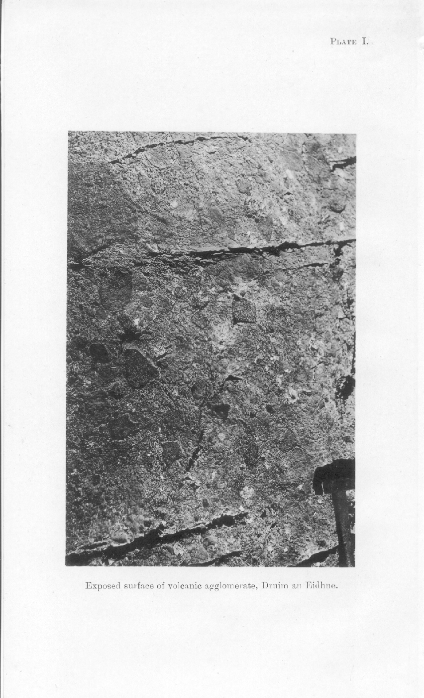
Chapter 2 Volcanic Agglomerates, Tuffs, and Conglomerates
Chapter 3 Basic Lavas: General Petrography
Chapter 4 Basic Lavas: Alterations and Metamorphism
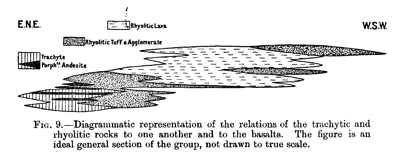
Chapter 5 Rhyolitic and Trachytic Lavas and Tuffs
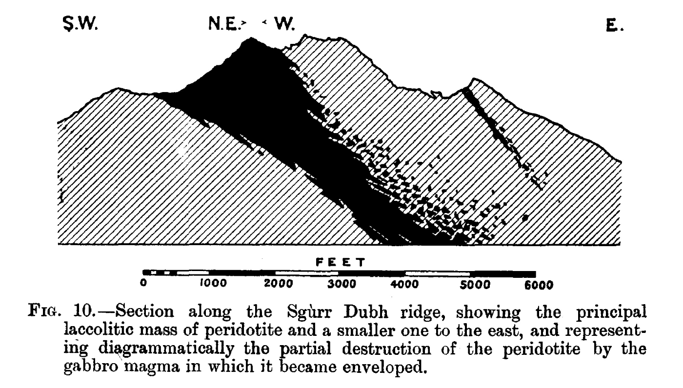
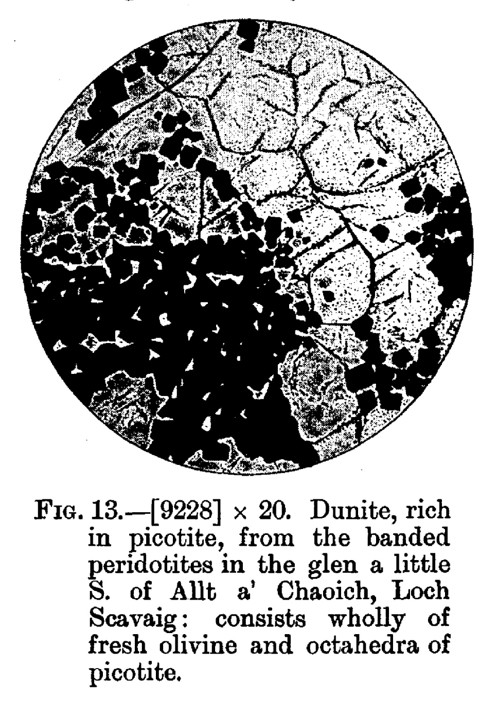
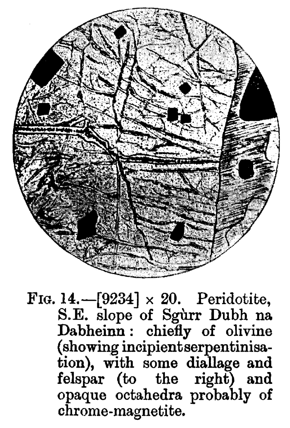
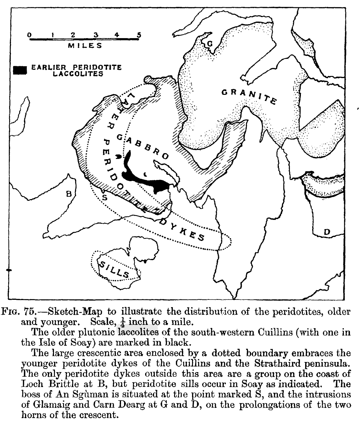
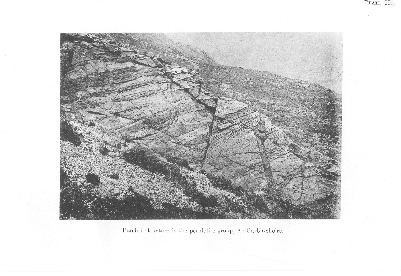
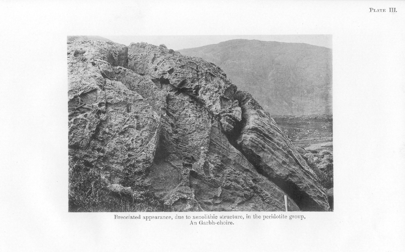
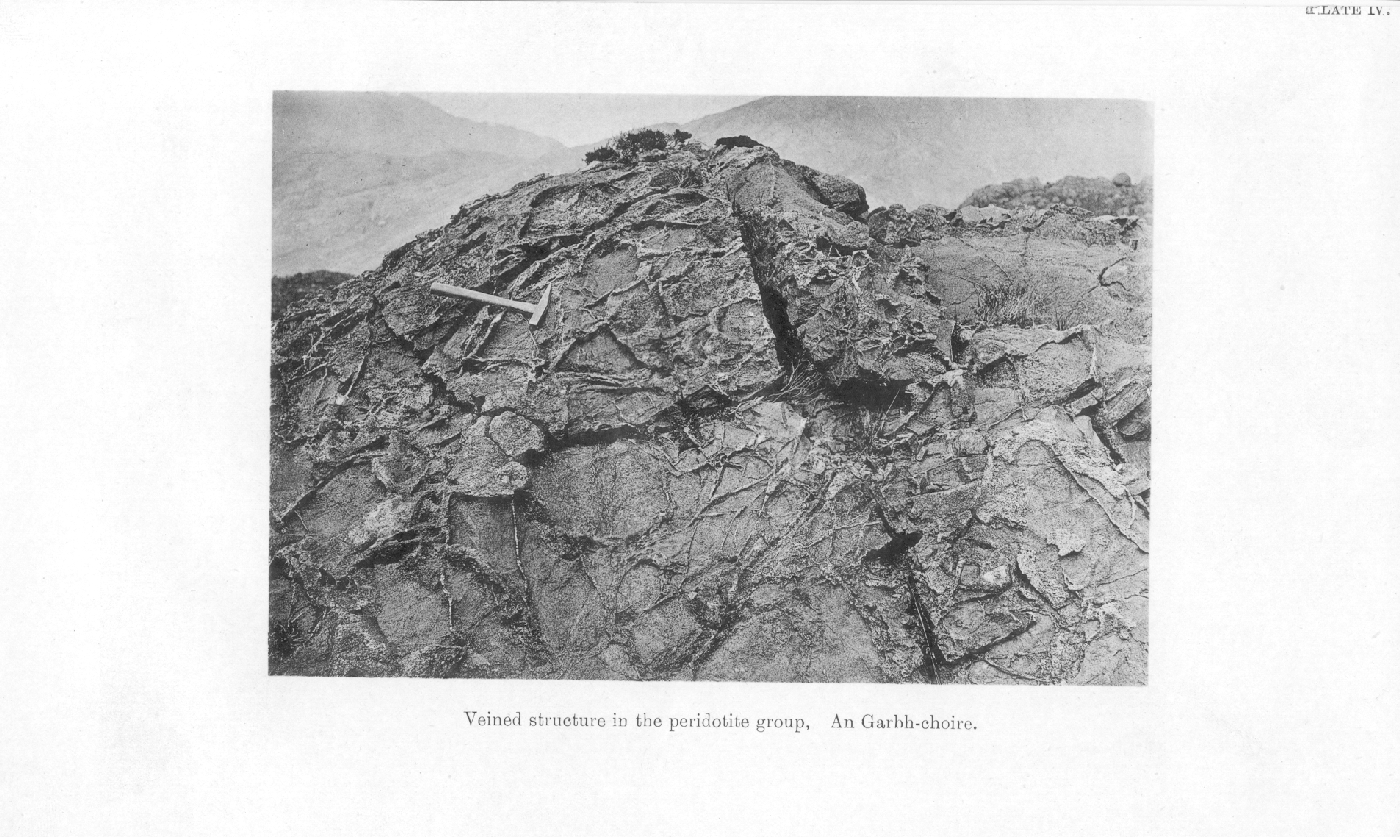
Chapter 6 Peridotites (Earlier Group)
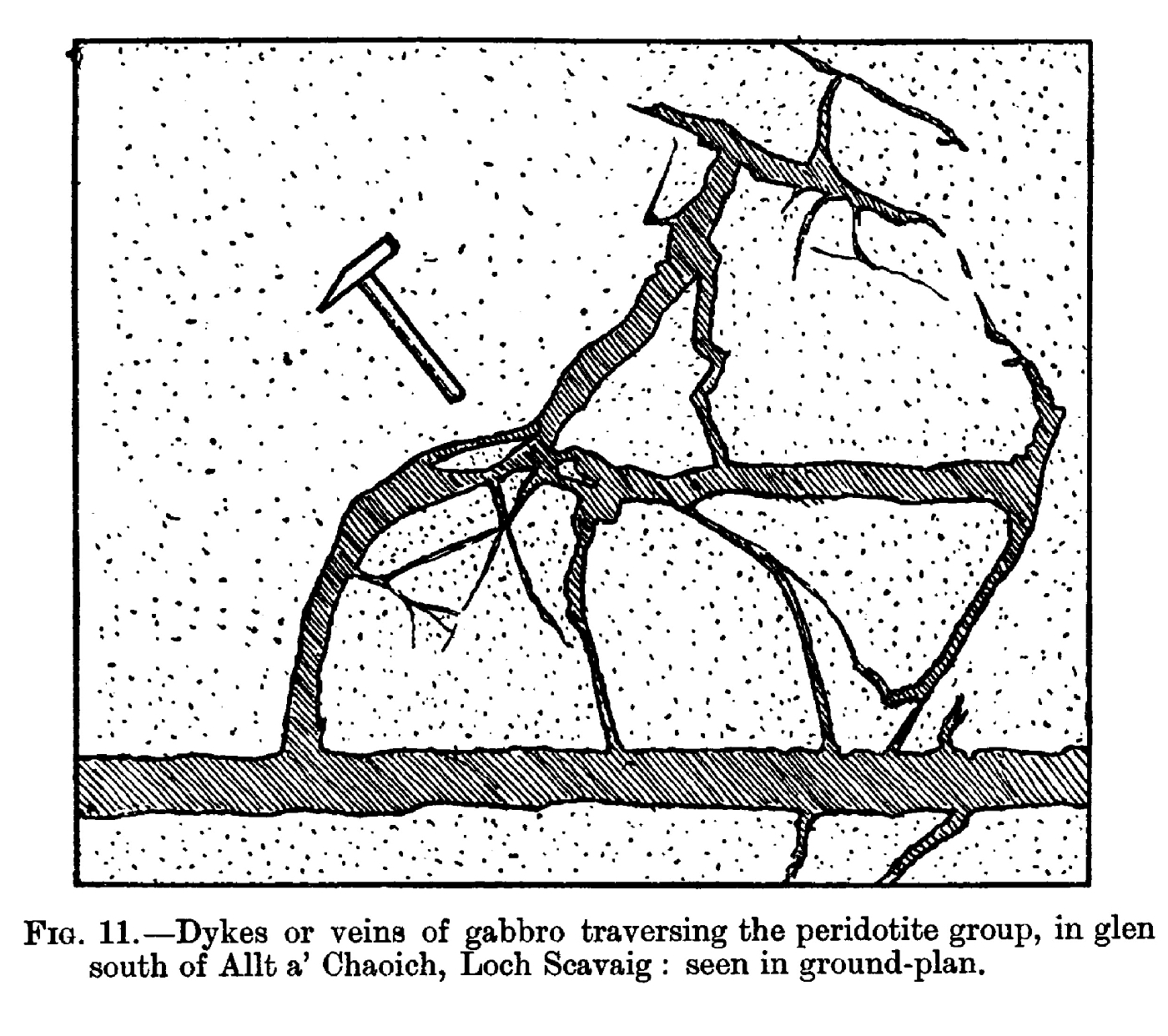
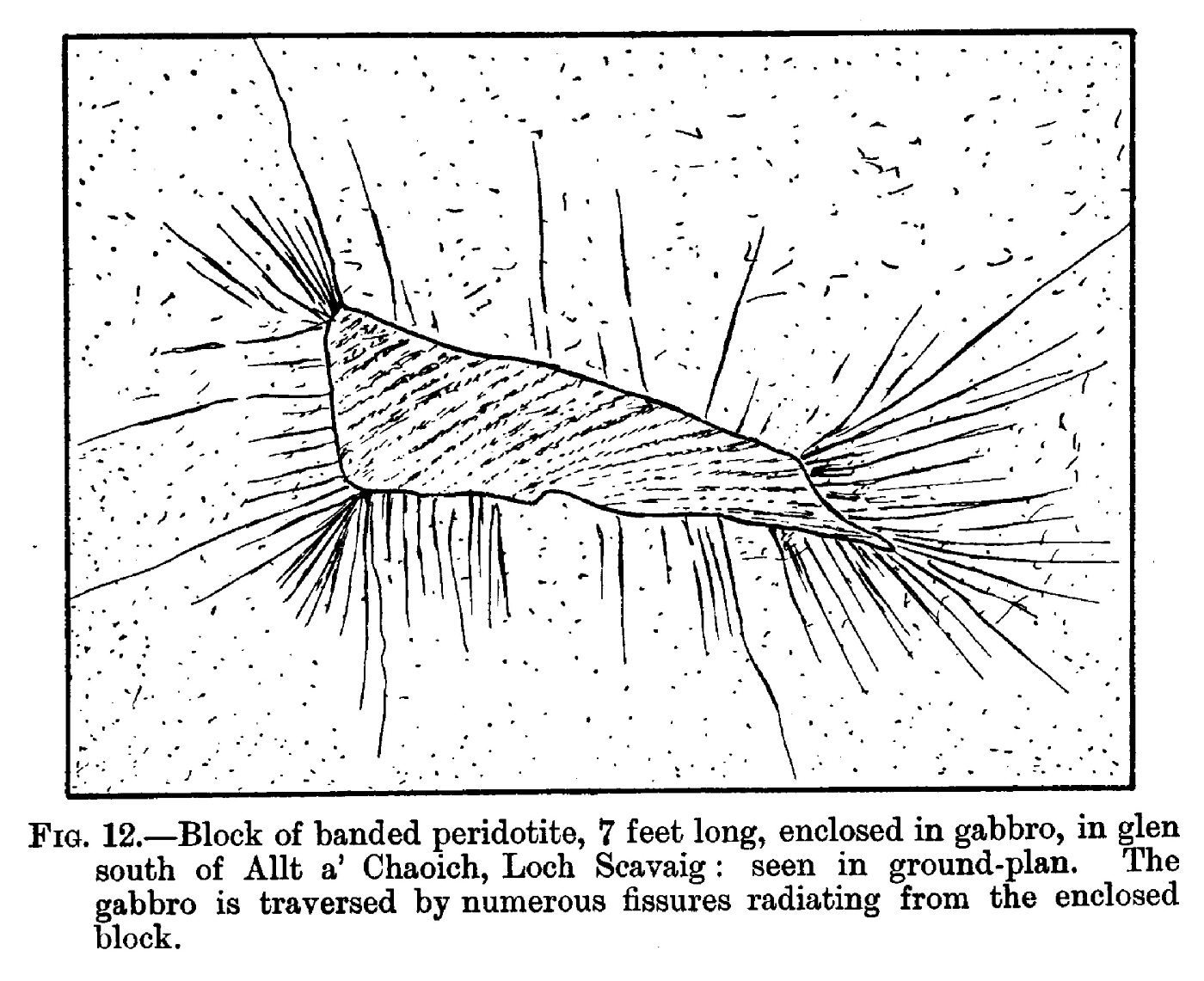
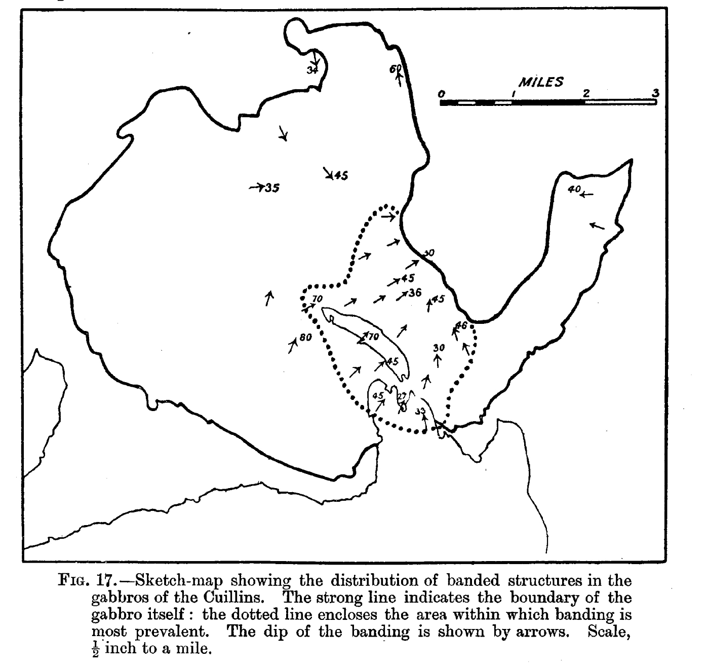
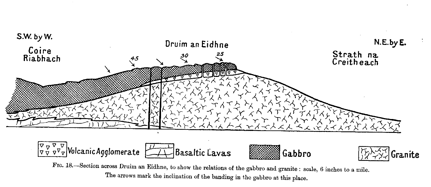
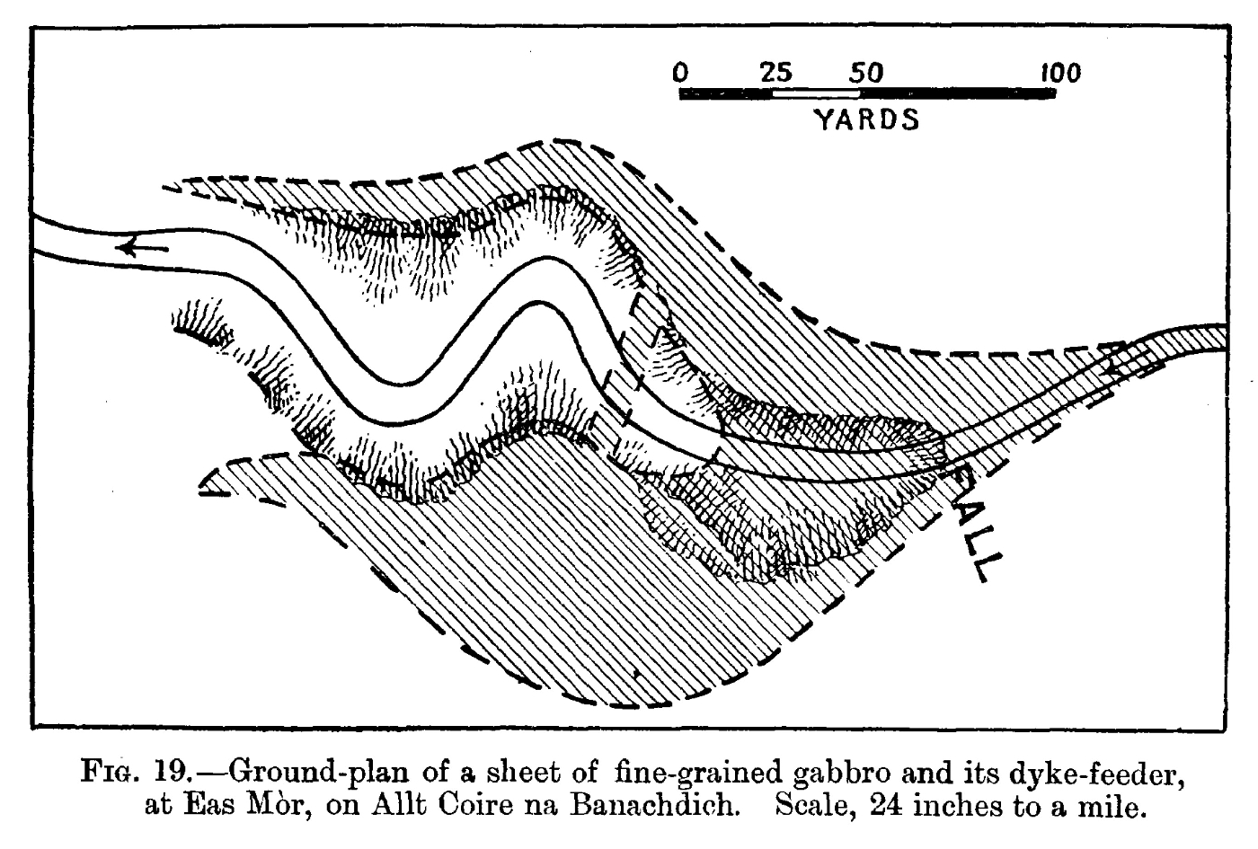
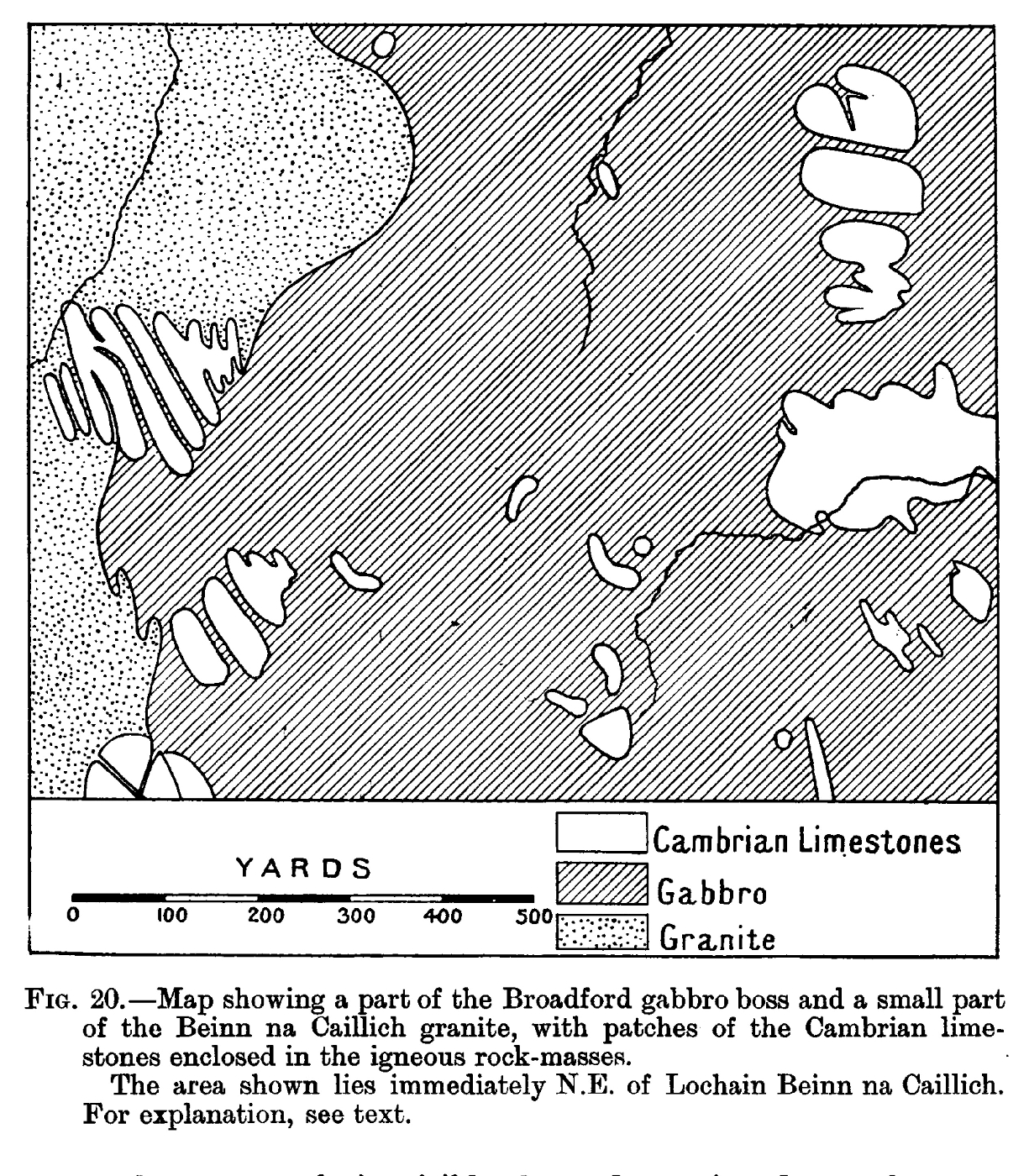
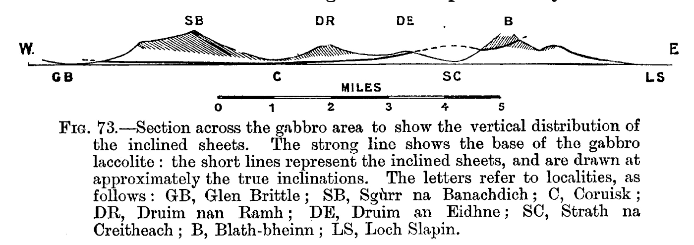
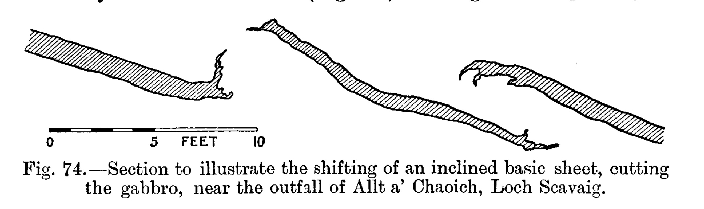
Chapter 7 Gabbros: Field-Relations
Chapter 8 Gabbros: Petrography
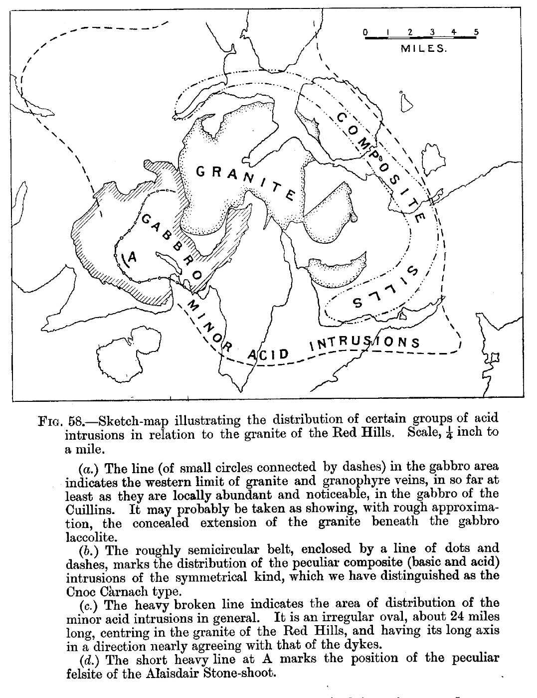
Chapter 9 Granites and Granophyres: Field-Relations
Chapter 10 Granites and Granophyres: Petrography
Chapter 11 Invasion of Basic Rocks by the Granite-Magma
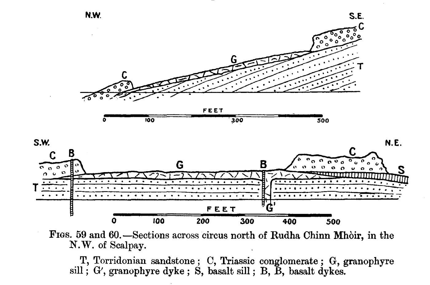
Chapter 12 Composite Sills and Dykes: General Features
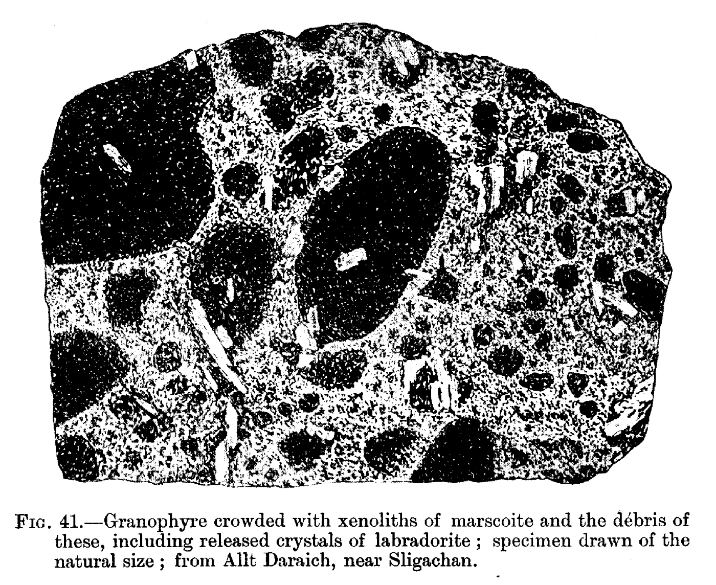
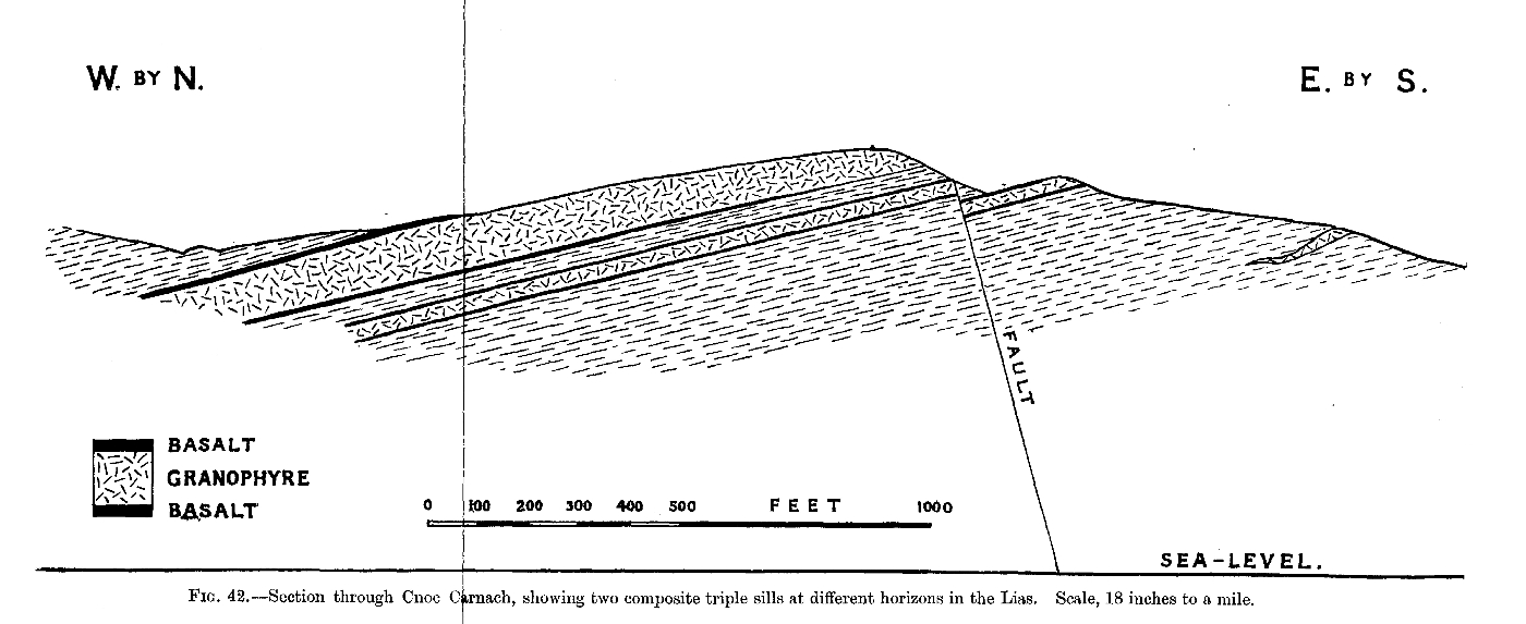
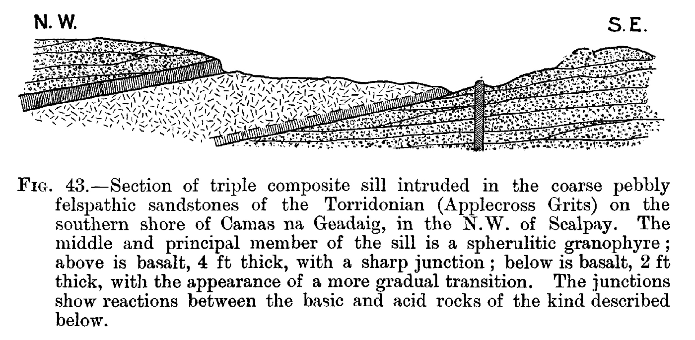
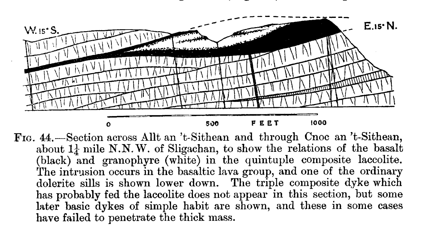
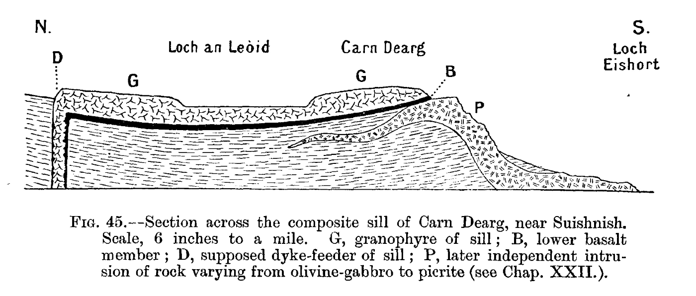
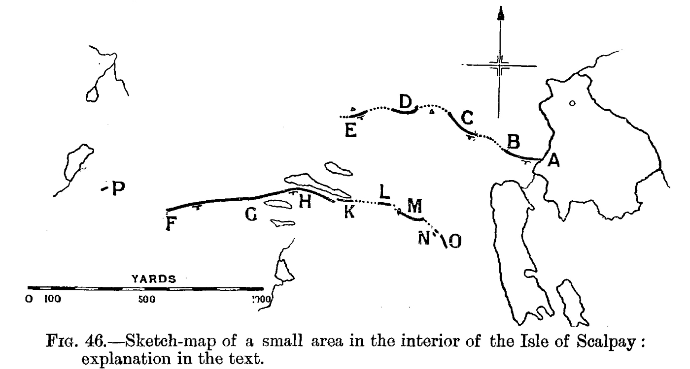
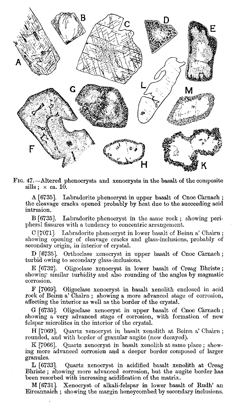
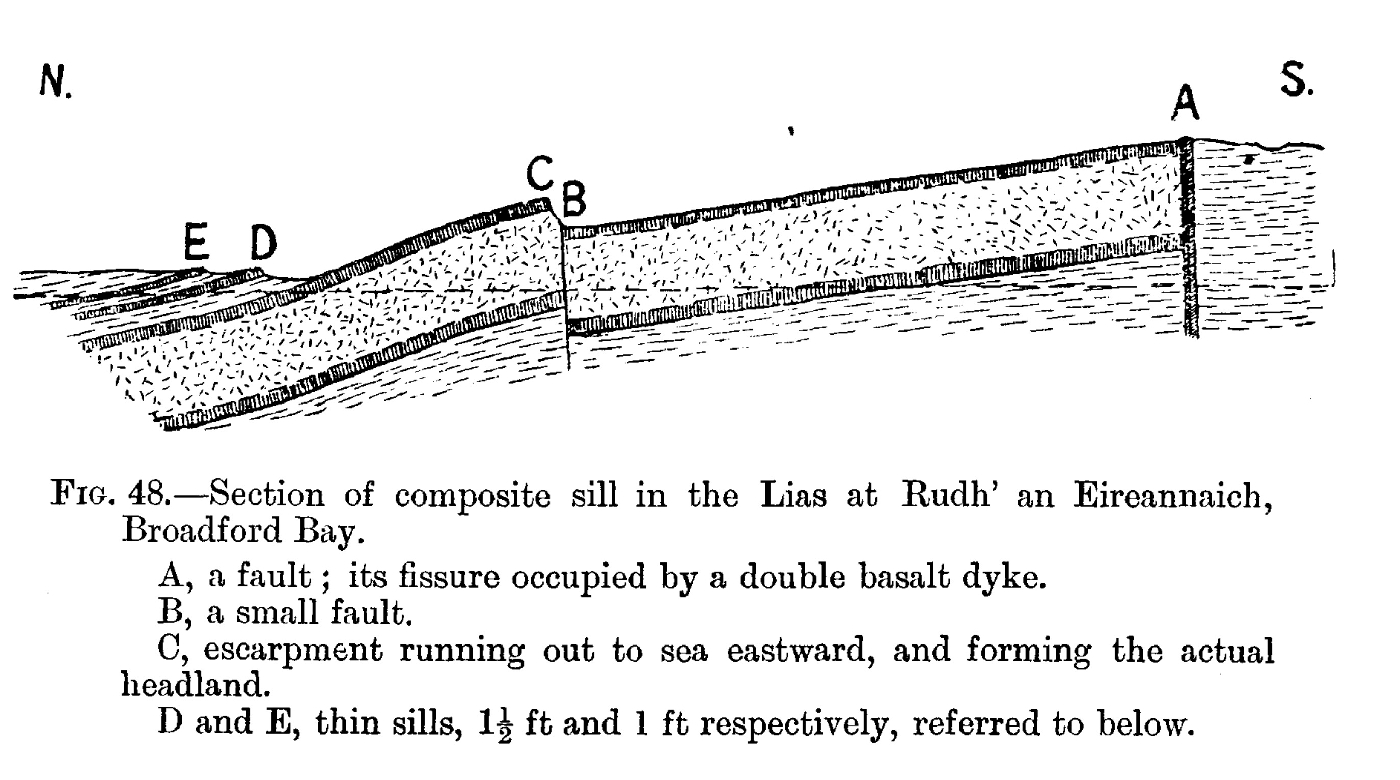
Chapter 13 Composite Sills and Dykes: Detailed Description
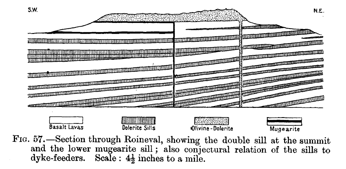
Chapter 14 Basic Sills: the Great Group
Chapter 15 Basic Sills: Minor Groups
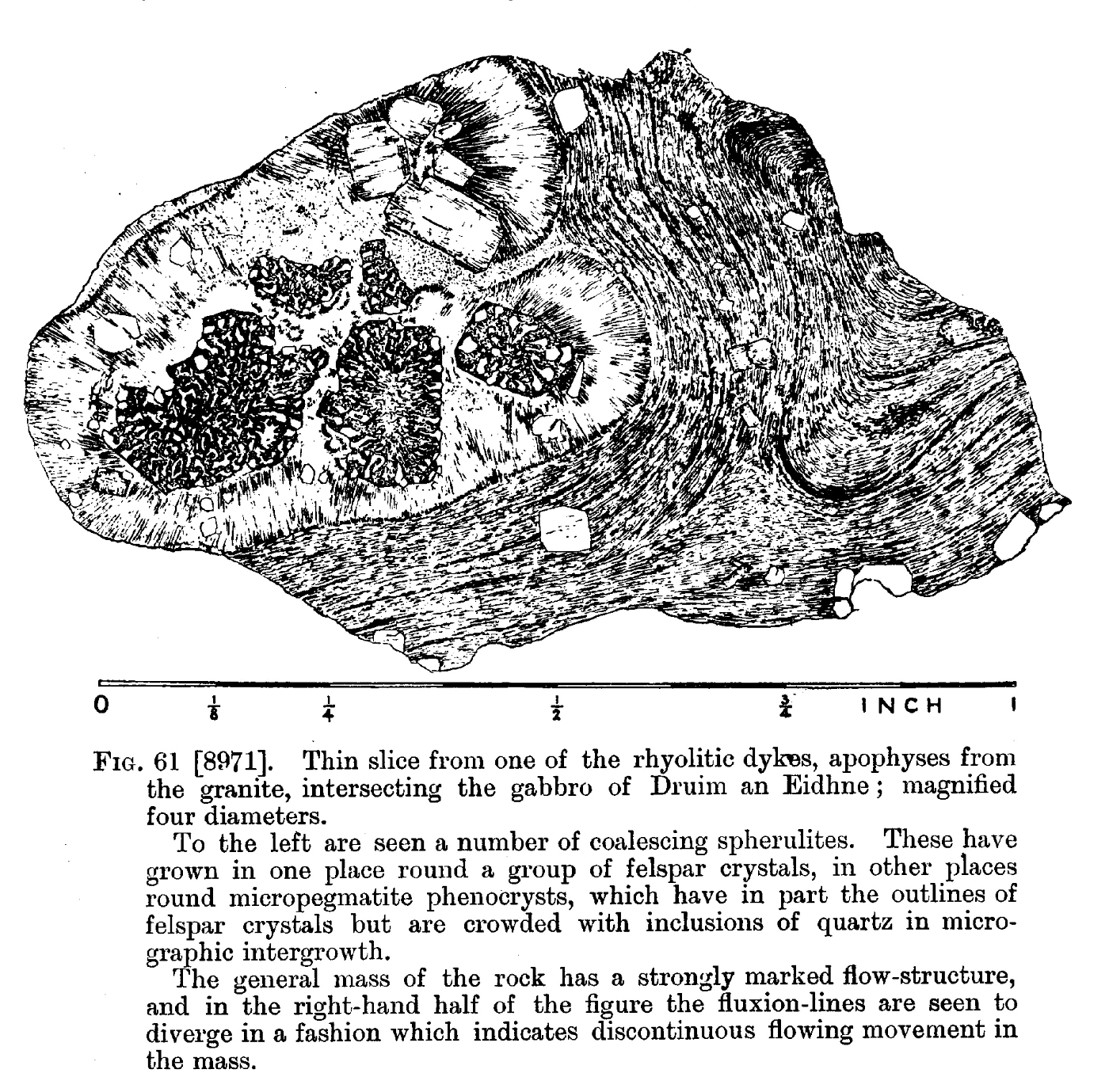
Chapter 16 Minor Acid Intrusions
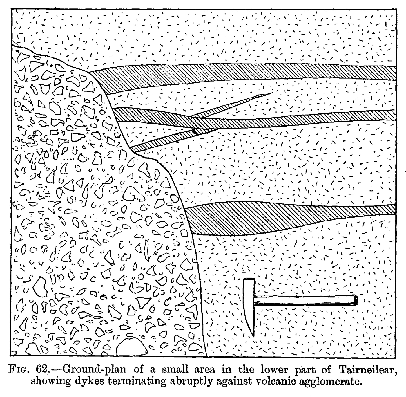
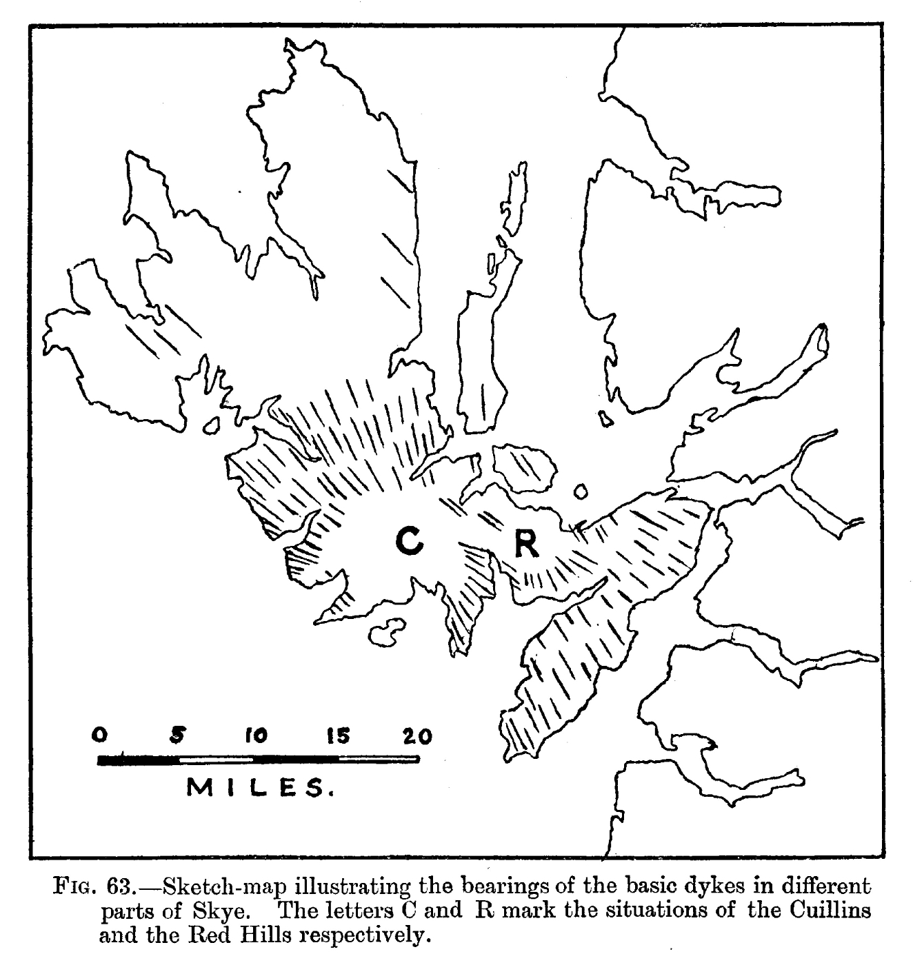
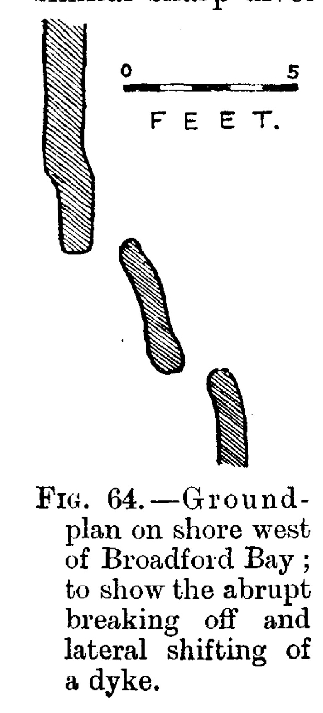
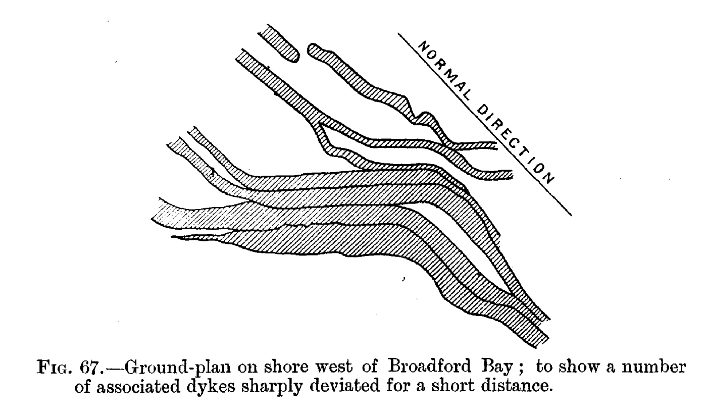
Chapter 17 Basic Dykes: Field-Relations
Chapter 18. Basic Dykes: General Petrography
Chapter 19. Basic Dykes: Tachylytic Selvages
Chapter 20. Basic Dykes: Xenoliths
Chapter 21. Basic Dykes and Sheets of the Cuillins
Chapter 22. Later Peridotites
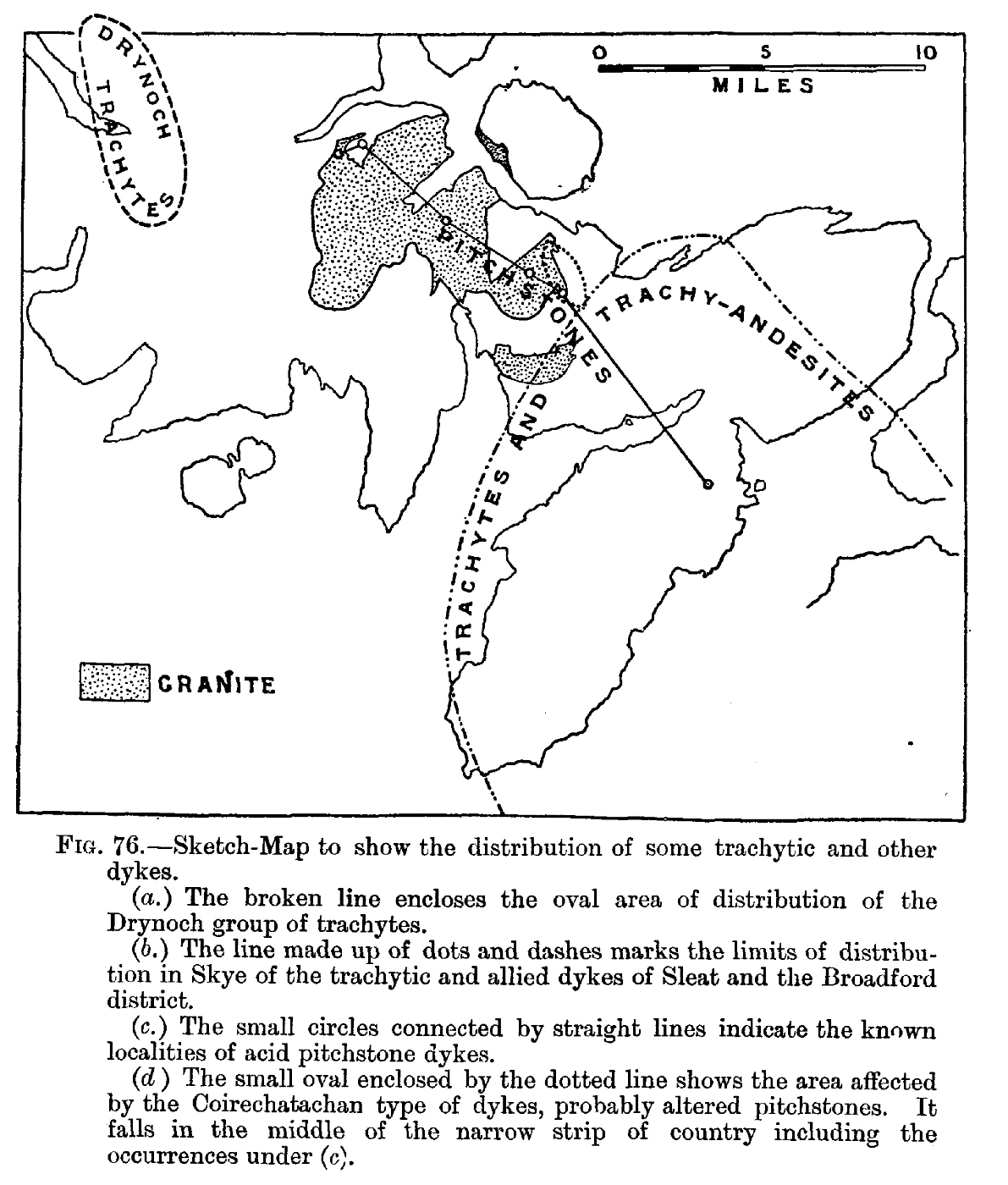
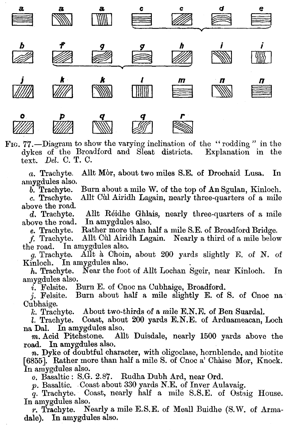
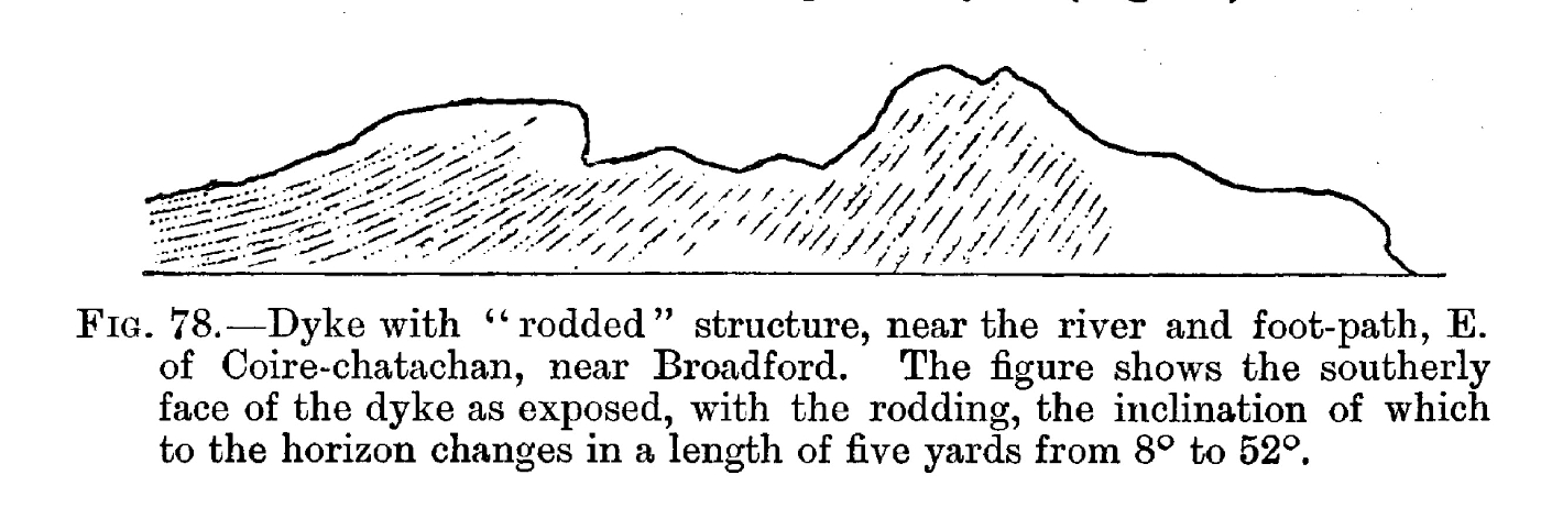
Chapter 23. Trachyte and Trachy-Andesite Dykes
Chapter 24. Augite-Andesite and Pitchstone Dykes
Chapter 25. General Review of Tertiary Igneous Activity in Skye
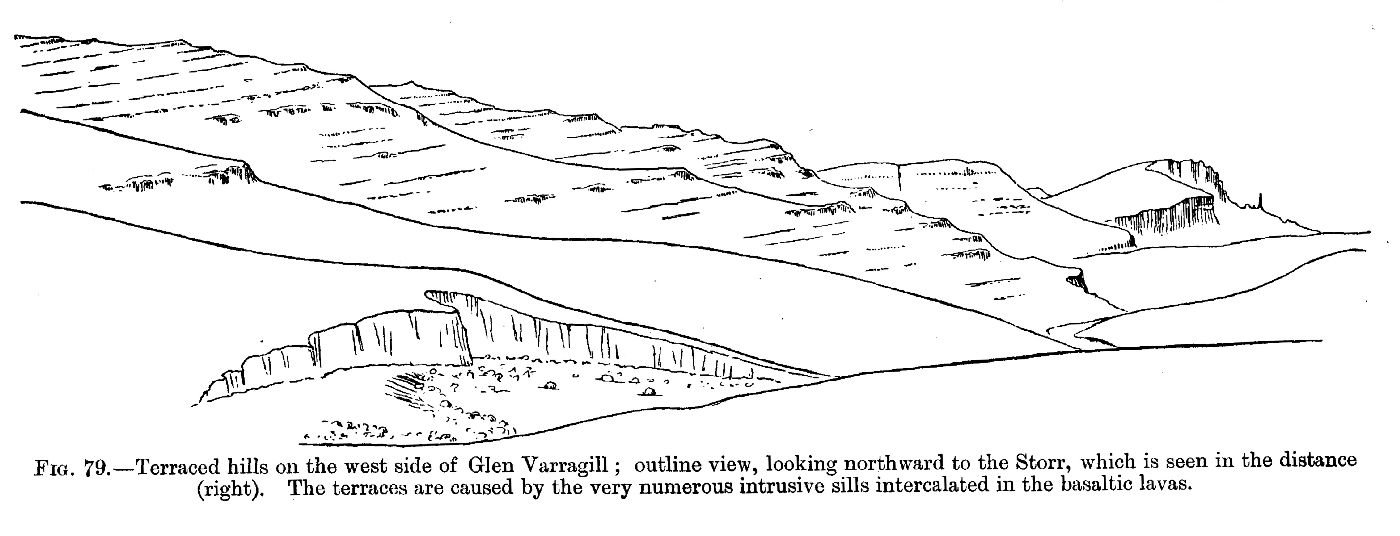
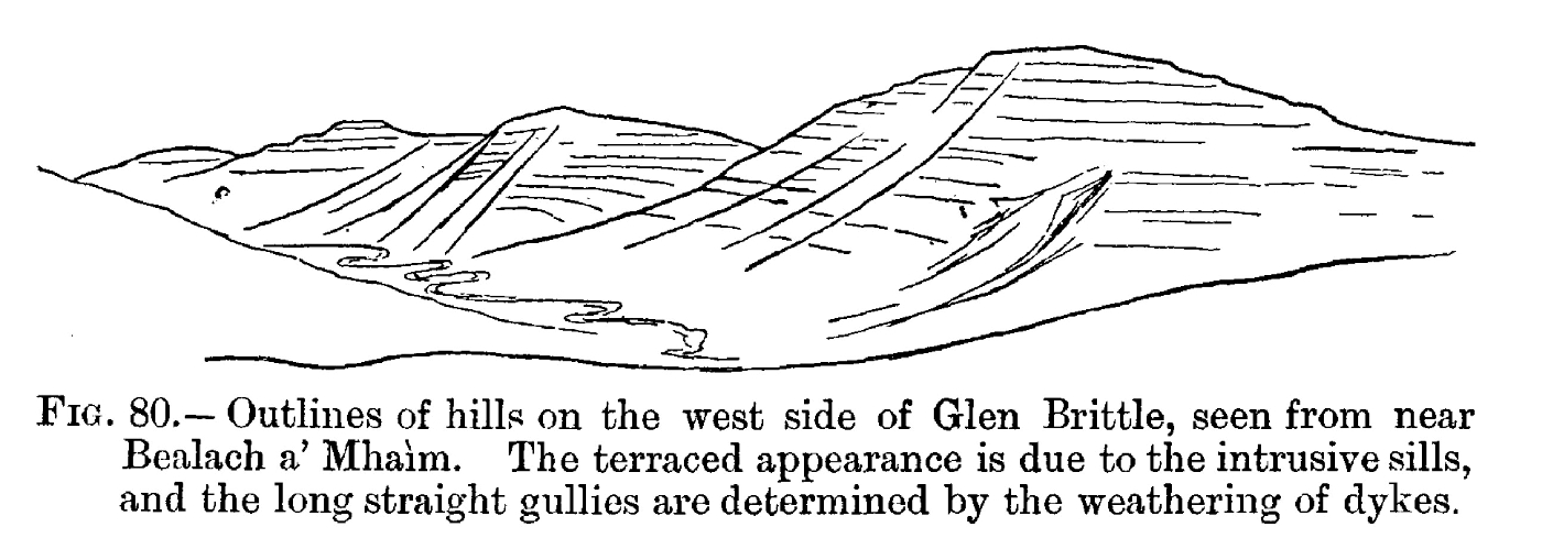
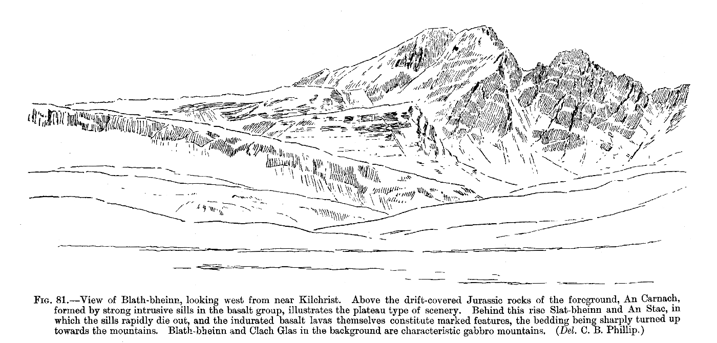
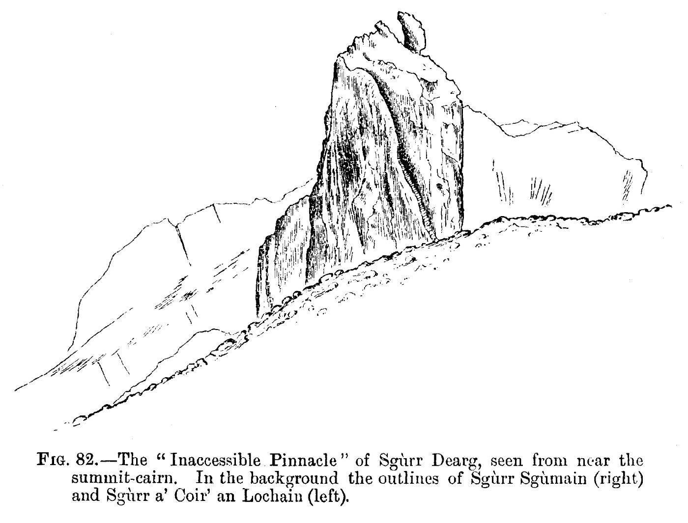
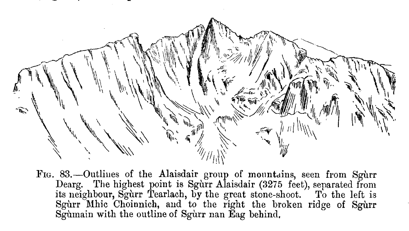
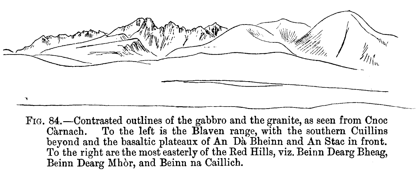
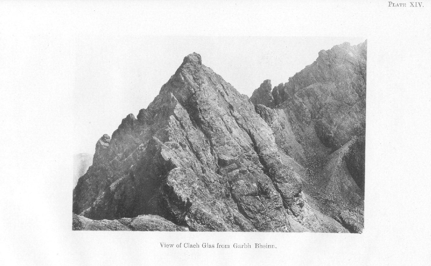
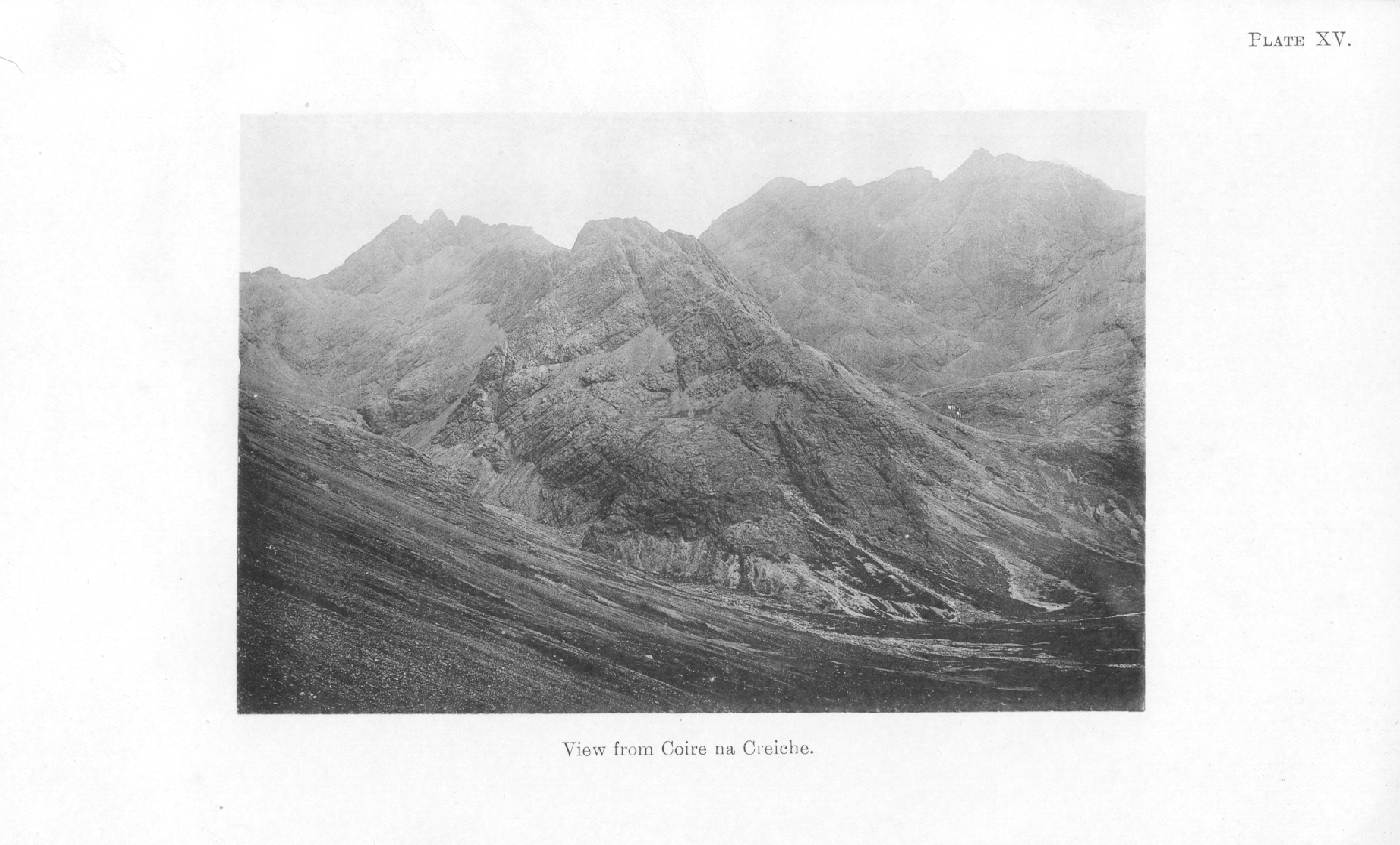
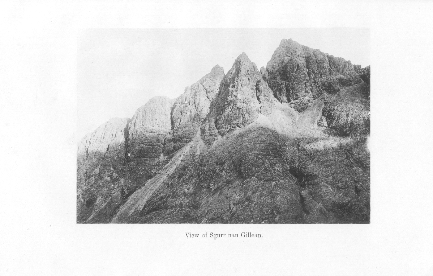
Chapter 26 Physical Features and Scenery
Appendix. Bibliography of the Tertiary Igneous Rocks of Skye
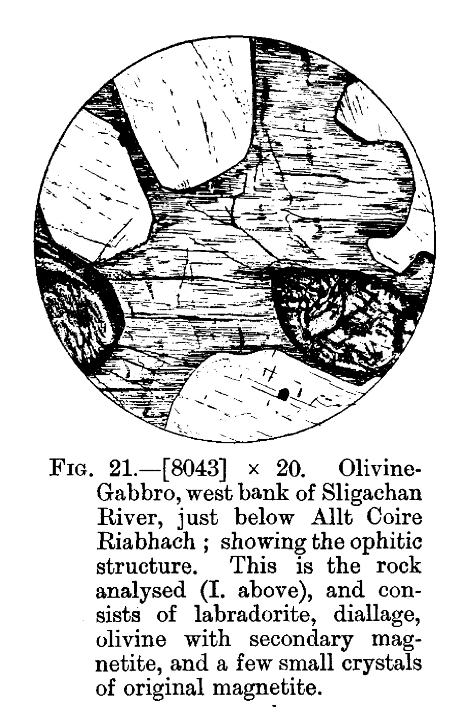
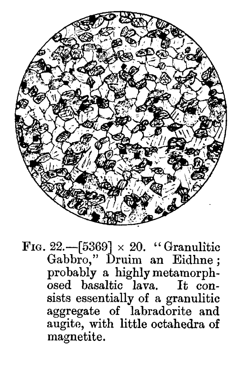
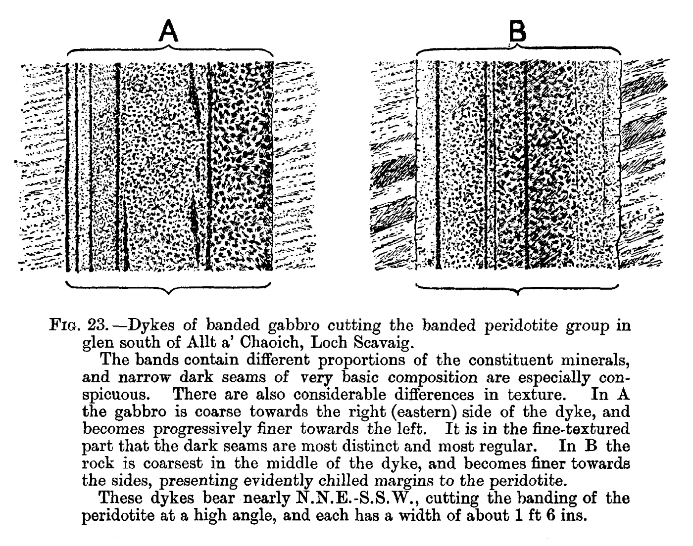
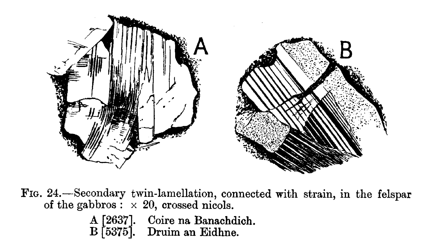
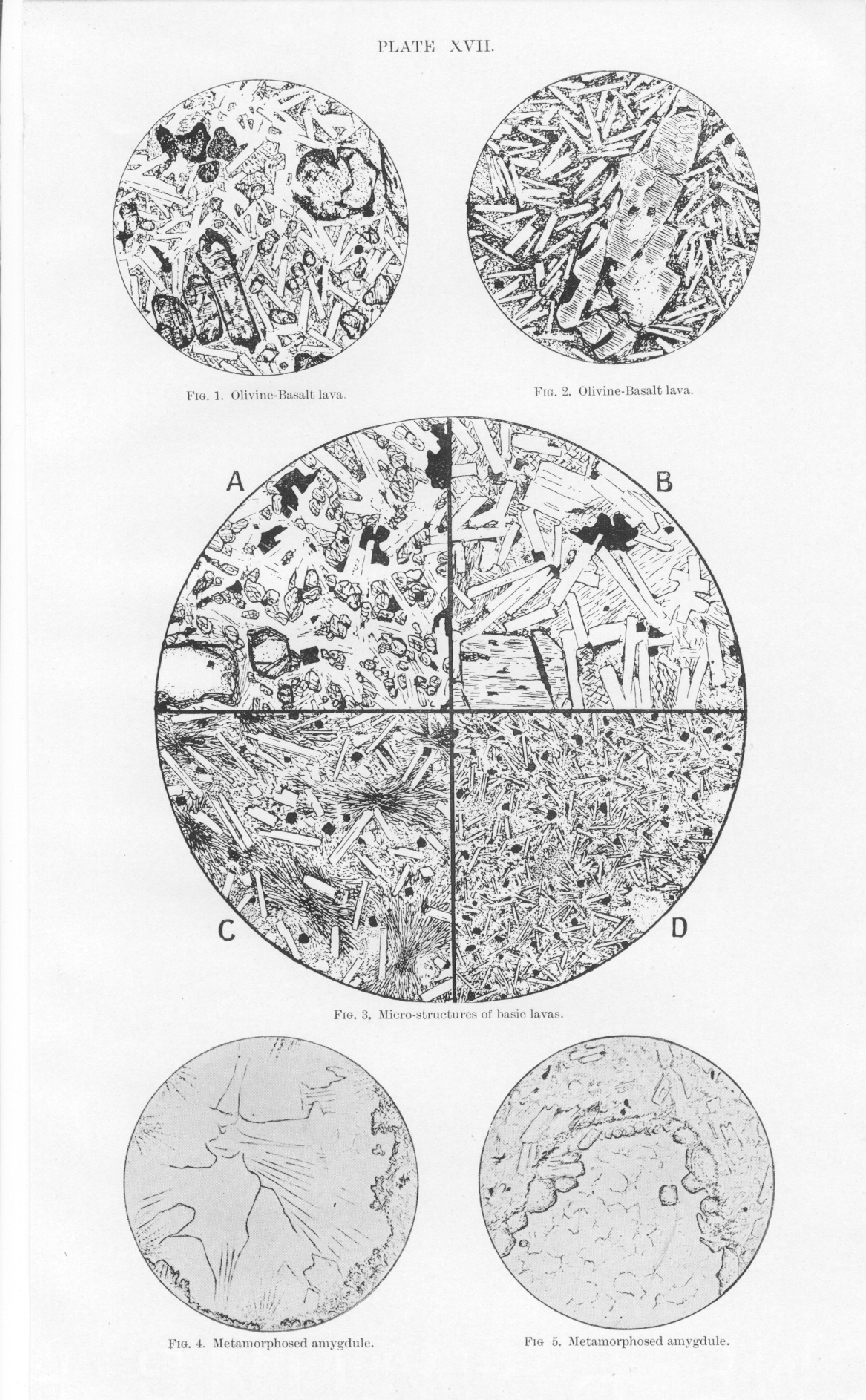
Explanation of plates of micro-sections
Index