Carboniferous rocks
Carboniferous rocks formed approximately 354 to 290 million years ago. The term ‘Carboniferous’, which is derived from the abundance of carbon-bearing coal seams within rocks of this age, was first applied to rocks in Britain and is now used internationally.
Carboniferous rocks in Great Britain
Sedimentary rocks, sandstones and mudstones (also known as shales) with numerous limestones and seams of coal, make up the greater part of the Carboniferous succession, though igneous rocks are also present. By area, Carboniferous rocks form one of the most extensive geological units in Britain. Carboniferous rocks have attracted the interest of naturalists from the earliest days of scientific enquiry and many of the basic principles of stratigraphical division and geological structure were established within them. As long ago as the late 18th century a threefold division of the Carboniferous rocks was recognised in northern England, based on lithological characteristics that are particularly well marked in Lancashire and the southern Pennines: the Carboniferous, or ‘Mountain’ Limestone at the base; the Millstone Grit; and the Coal Measures at the top. These lithostratigraphical (rock) divisions subsequently became broadly equated with the chronostratigraphical (time) divisions: Dinantian, Namurian and Westphalian, repectively:
- Dinantian (354 to 327 million years ago) is taken from the Belgian town of Dinant, where there are good sections of rocks of this age, mainly limestones, in the cliffs of the River Meuse. The term Dinantian has been superseded for formal use worldwide, but reference is made to it in this publication as it is essential for understanding existing descriptions of British Carboniferous rocks.
- Namurian (327 to 316 million years ago) is derived from the province of Namur in Belgium.
- Westphalian (about 316 to 306 million years ago) comes from Westphalia in north Germany.
The block and basin topography formed in early Carboniferous time persisted until the early Namurian (p. 21). Much greater thicknesses of sediment accumulated within the basinal areas than on the intervening blocks; widespread marine limestones enable correlation between basins and blocks. The youngest Carboniferous rocks in Britain occur in the English Midlands and parts of northernmost England and southernmost Scotland, where a succession of reddened rocks (red- beds), in topmost Westphalian and overlying strata, represent the period from 306 to 290 million years ago.
The succession of Carboniferous rocks over much of Britain records the transition from the predominantly marine conditions in the Dinantian to the almost exclusively freshwater deltaic environments of the Westphalian. The rocks contain abundant fossils which enable correlation of British strata with Europe and beyond. Britain has some of the best-exposed sequences of non-marine, upper Carboniferous strata anywhere in Europe.
Carboniferous rocks in the district
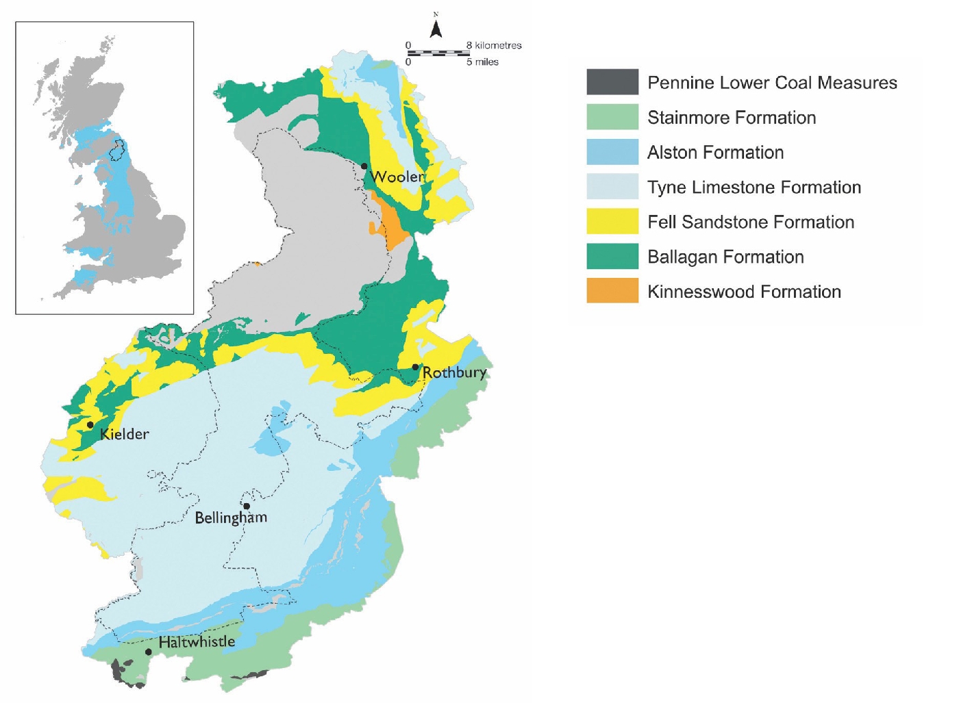
In Carboniferous times the district lay in the Northumberland Trough, bounded by two fault systems which influenced sedimentation: the North Solway Fault to the north and the Stublick–Ninety Fathom Fault to the south.
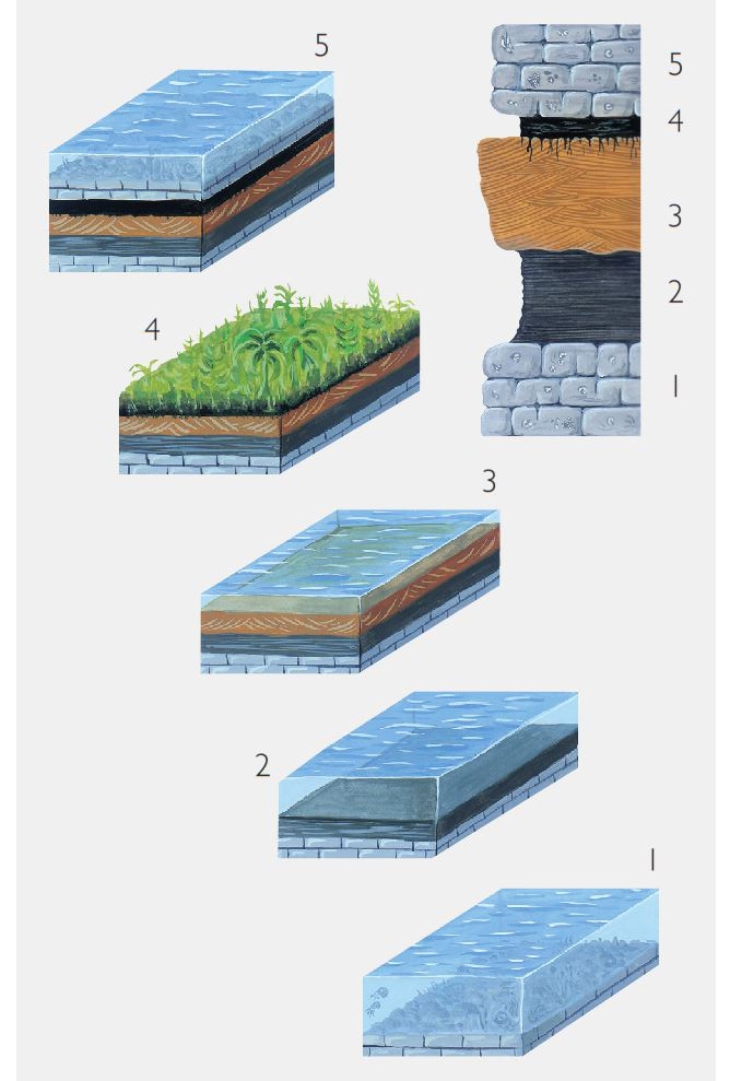
During Dinantian and early Namurian times over 2500 metres of shallow marine and deltaic deposits, derived from the north and east, were laid down in the Northumberland Trough. This is in stark contrast to the much thinner succession laid down south of the Stublick Fault, on the more buoyant ‘Alston Block’ (p. 21). The Namurian rocks typically comprise thick successions of shales, siltstones and sandstones with some, generally thin, beds of limestone and coals. During Westphalian times equatorial forests of huge primitive trees, ferns and other vegetation flourished on swampy delta slopes and thick deposits of peat derived from the partial decay of this vegetation accumulated from time to time on this surface forming the material that was eventually preserved as coal. The great diversity of form and chemical composition amongst coal ‘types’ is due, in part, to essential differences in the plant material from which they have evolved, as well as to geological processes which progressively altered the nature and maturity of coals.
It is likely that rocks of later Namurian and Westphalian age once covered the whole of the district but were later removed. Much of this erosion probably took place in the late Carboniferous and early Permian periods.
Dividing and classifying the Carboniferous succession
Rock successions can be divided and categorised in a number of different ways, including subdivision according to the characteristics of the rocks themselves, zonation by the nature of fossils contained in the rocks, or correlation utilising a combination of both methods. Lateral variation in the nature of the Carboniferous rocks across Northumberland has long presented geologists with problems in attempting to correlate them across the county. In 1863, on the basis of the sequence in north Northumberland, particularly in the River Tweed, George Tate of Alnwick, proposed a simple fourfold division of the Carboniferous of northernmost England. Numerous subsequent surveys and publications have added to the complexity of the nomenclature and have, to an extent, tended to confuse matters rather than clarify them. Such a situation is not confined to Northumberland and, in order to clarify regional understanding, a lithostratigraphical scheme encompassing the Carboniferous rocks of the entire onshore of Great Britain has recently been adopted. Although not yet used widely on BGS maps these regional group names will be implemented in future publications. Accordingly, the description of Carboniferous rocks in the district follows these new divisions, listed below with the youngest at the top:
The rocks of these groups are described below, starting with the oldest.
Inverclyde Group
The early Carboniferous succession of the Northumberland Trough, deposited along the southern margin of the Southern Uplands, is distinct from that being deposited in the remainder of England at the time, but very similar to that being deposited in the Midland Valley of Scotland. In recognition of this similarity, recent work has extended the
Kinnesswood Formation
At the base of the Carboniferous succession in the
These include the Roddam Dene, Ramshope Burn and Windy Gyle conglomerates. Although initially thought to be part of the Old Red Sandstone, they are now generally accepted to be of basal Carboniferous age, despite the absence of diagnostic fossils. The best exposed of these, at Roddam Dene, comprises a mix of beds of conglomerate, sandstone, shale, mudstone and marl of various colours, but is dominated by massive reddish coloured conglomerates of subangular to subrounded, pebble-to-boulder sized clasts of Cheviot andesite with minor amounts of Palaeozoic sediments and rare Cheviot Granite set in a clay-rich sandstone matrix. It is interpreted as the product of ephemeral streams that drained the deeply eroded margins of a Cheviot landmass that was exposed to semi-arid weathering conditions in early Carboniferous times.
The
In Northumberland, such sandstones containing cornstones, for example those underlying the
Ballagan Formation (part of the former Cementstone Group)
The formation is named from Ballagan Glen in the Campsie Fells, north of Glasgow. Used throughout Central Scotland for the mudstone, siltstone and cementstone sequence towards the base of the Carboniferous, the name is now also used in northern England to describe the continuation of that succession into the Northumberland Trough.
Ballagan Formation sites
Geological SSSIs
Dinantian of northern England and North Wales
Glebe Quarry
Roddam Dene
Geological SNCIs
Akenshaw Burn
Barrow Scar
Caistron Ponds
Canker Cleugh
Catcleugh Burn
Crawley Dene
Dovecrag Burn
Fredden
Preston
Yeavering Bell
Glanton Pike Quarry
Horsdon Channel
Lumsdon Law
Thrum Mill Gorge
The
It is a sequence of interbedded cementstone, mudstone, limestone and sandstone that is of lagoonal and estuarine origin in the north, but becomes more marine when traced westwards towards Bewcastle. The relative proportion of the different rock types varies across the district and vertically within the formation, which has its maximum estimated thickness of over 600 metres to the south of the River Tweed. The beds range in colour from grey and blue-grey, through green and yellow to brown and pinkish red. The basal cementstones are interpreted as having been deposited in a lagoonal, coastal-flat environment under conditions of high salinity and periodic desiccation.
The cementstones of the district are broadly of two types. Layered cementstones have a sharply defined top and base and some may show signs of internal stratification. They may also have sedimentary features and desiccation cracks. Nodular cementstones show a transition into calcareous mudstones above and below and they form a more or less persistent layer or a row of nodules. The layered cementstones are thought to be primary in origin and the nodular cementstones of secondary origin. The beds are generally less than 0.3 metres thick. The mudstones interbedded with the cementstones are calcareous, silty, poorly bedded and range in thickness from a few millimetres to several metres. Sandstones and siltstone also occur in the sequence and are very variable. Two exceptional limestone developments within the formation are worthy of note. Just south-west of Coldstream the Carham Limestone is a thick-bedded magnesian limestone up to 8 metres thick with a brecciated appearance. 1 kilometre south-west of Rothbury the disused, Glebe Quarry
Influence on the landscape
The rocks of the
Hence, much of the area they underlie forms low-lying ground and is now covered with Quaternary deposits. Consequently the landscape tends to reflect the nature of the overlying Quaternary deposits rather than that of the bedrock. In a few places, river erosion has exposed fine sections, such as the river cliff of the Coquet at Barrow Scar.
In the Kielder area, the
Influence on biodiversity
The influence on biodiversity is varied and like the landscape linked more to the Quaternary deposits overlying the rocks. A lot of the outcrop of the
Economic use
Many of the thicker limestone units have been quarried at least on a small scale, and burnt to provide local supplies of quicklime and slaked lime for use as a soil improver. Remnants of the former small quarries and limekilns can still be seen marking the outcrop of the limestones. None of the limestones are worked today.
Many of the thicker and more robust sandstones have also been quarried throughout the district for building stones, but are no longer worked. Although these have been dominantly for local use, some quarries such as those at Greenlaw and Glanton Pike are known to have exported stone as far as Carlisle, Glasgow and Edinburgh.
Under present, or currently foreseeable, economic conditions it is unlikely that these rocks will attract significant commercial interest. Small scale reworking of some historic quarries may occur for matching stone in old buildings.
Wider significance
The Roddam Dene Conglomerate, arguably the finest of its kind in the British Dinantian succession, is critical to our understanding both of the early Carboniferous palaeogeography of the area and the development of the Northumberland Trough.
Border Group
The
Geological SSSI
Dinantian of northern England and North Wales
Colour Heugh and Bowden Doors
Geological SNCIs
Akenshaw Burn
Bowden Doors
Callaly Crags
Catcleugh Burn
Coldmartin Loughs
Dovecrag Burn
Kyloe Hills
Shiellow Crags
Thrum Mill Gorge
NWT reserves
Harbottle Crags
Lyne Formation
Fell Sandstone Formation
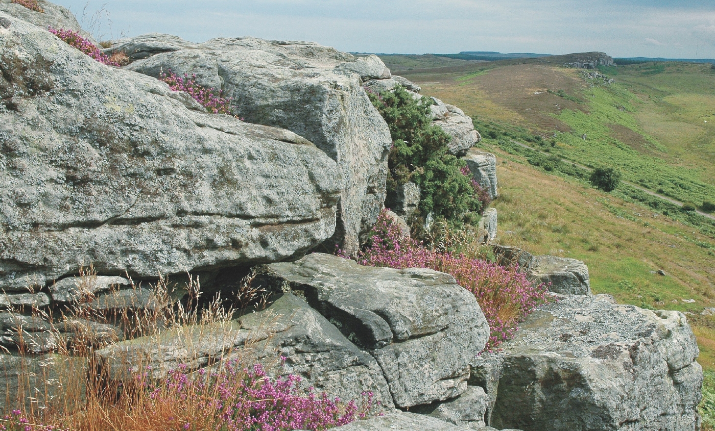
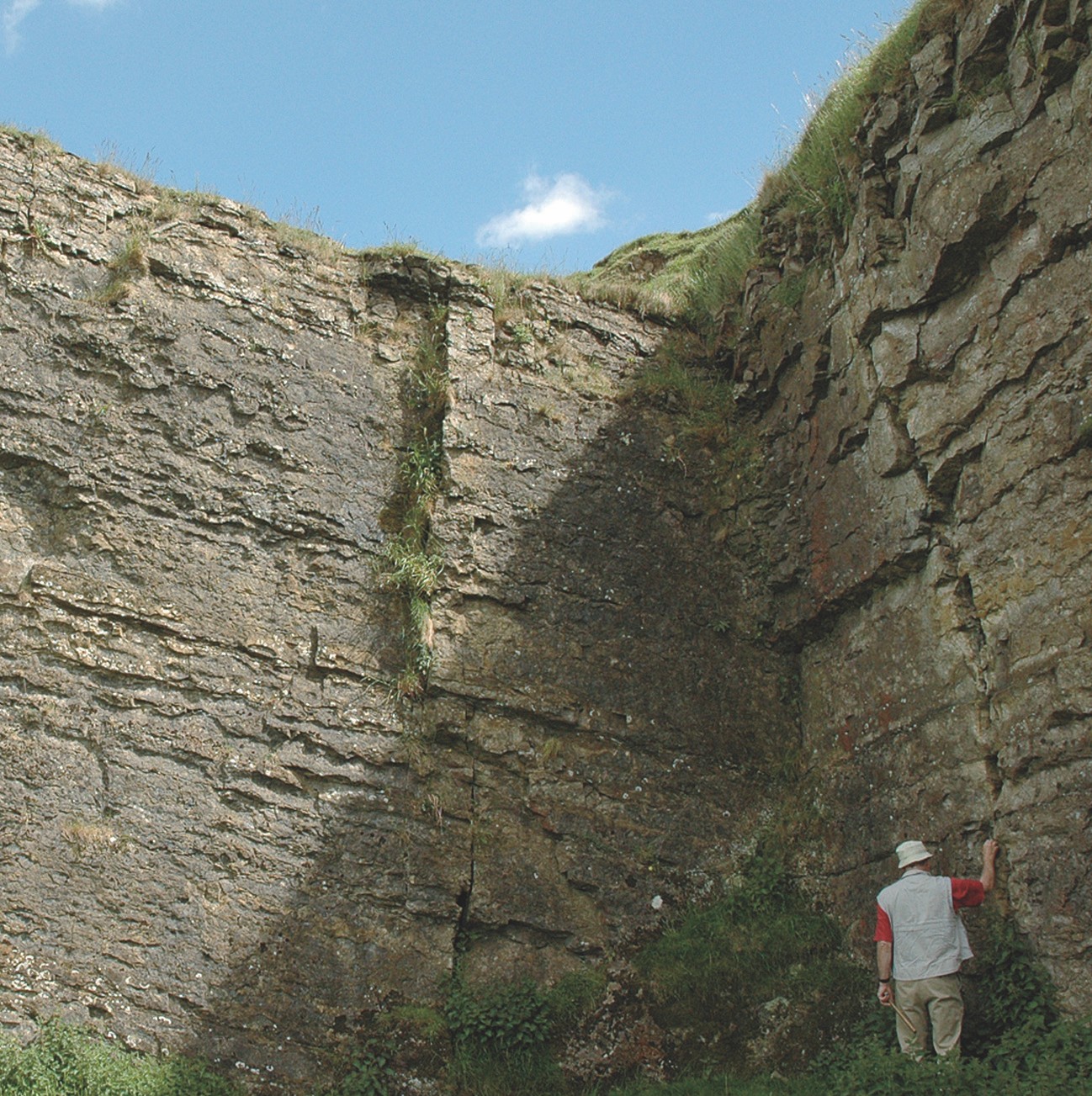
The name Fell Sandstone was introduced in the late nineteenth century to describe the characteristic sandstone-rich sequence of rocks exposed on the hills (or fells) of Northumberland. At outcrop it can be traced as a number of prominent sandstone crags and scarp faces, which run in an arcuate pattern from Berwick to Rothbury, thence westwards to Carter Fell, and finally southwards to the Gilsland area. The beds in general have a gentle dip of 5 to 10 degrees away from the Cheviot ‘dome’, but in the Holburn Anticline near- vertical dips occur (p. 81). Examination of the outcrops led many early workers to believe that the sequence consisted almost entirely of sandstone. This is indeed the case in parts of mid-Northumberland, notably around Rothbury and Harbottle, where the formation attains its maximum thickness of about 350 metres. However, the proportion of sandstone to shale varies considerably within the Northumberland Trough and boreholes show that in places the Fell Sandstone may contain up to 40% of finer grained lithologies.
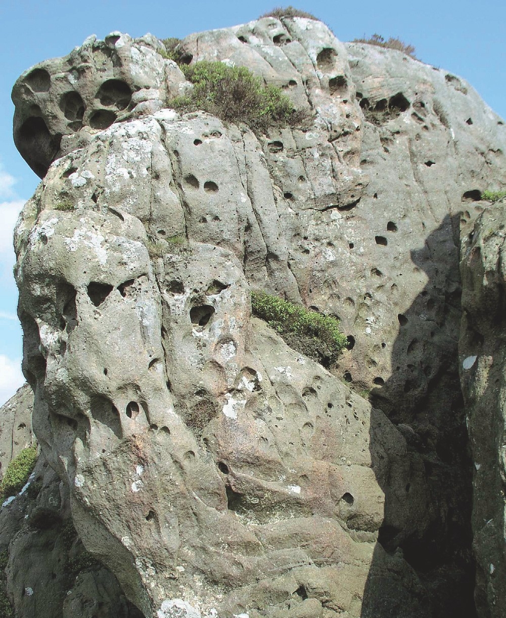
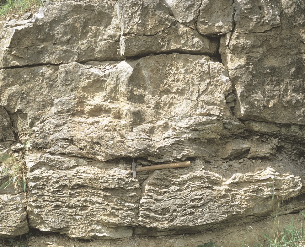
Within the district the rocks are, in the main, very thick hard grits and moderately- to poorly-sorted, generally medium- to coarse-grained, but locally fine-grained, sandstones. In places sandstones overlie one another to form multistorey units up to 90 metres thick. They contain subangular to subrounded fragments of mudstone and a few pebble layers. The excellent sedimentary structures preserved include a variety of forms of cross-stratification, examples of steep-sided channels and thick structureless units. The succession is largely unfossiliferous, although ostracods and the large bivalve Archanodon jukesi (Bailey) have been recorded together with some plant fossils.
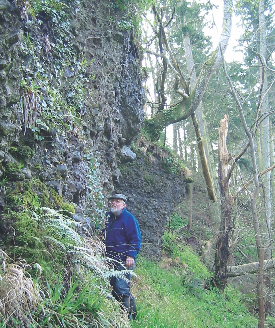
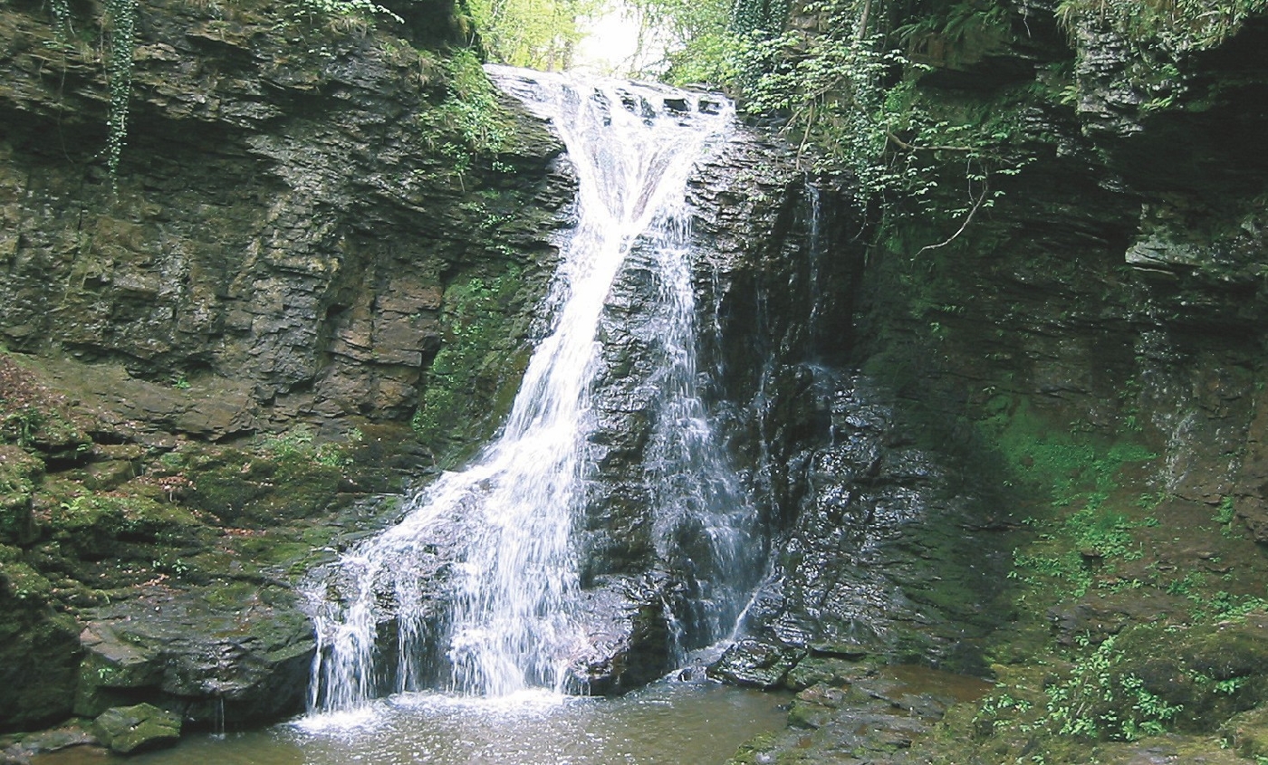
Influence on the landscape The very thick hard grits and sandstones form the long tiers of crags and bold escarpments that are so conspicuous in north Northumberland. They are distinctive skyline features characterised by generally level tops, scarp slopes, and craggy outcrops. The crags usually carry screes, and a hillwash of white sand is commonly conspicuous amongst the heather and wasting peat. In the north, the Fell Sandstone encircles the Cheviots in a belt which has a curious tendency to be duplicated by faulting. The outer ring is the more prominent. The outcrop culminates in the Simonside Hills, reaching 440 metres south-west of Rothbury. In spite of its modest elevation, this group of moors forms perhaps the most imposing feature in the county. In Upper Redesdale and Upper North Tynedale, the much afforested Fell Sandstone hills of Carter Fell, Peel Fell, Deadwater Fell and Glendhu Hill are bulkier and, rather than making cuesta, are tabular in form. In the Border country, between Carter and Peel Fells, the presence of a thick bed of soft water-logged marls has involved the overlying crags of grit in numerous vast landslides, the so-called ‘stony holes’ of that area. A number of caves are developed along the outcrop of the Fell Sandstone. The longest being Roughting Linn Cave
Influence on biodiversity
The silica-rich sandstone bedrock slowly weathers to form thin, acidic, nutrient-poor sandy soils which support heather moorland, particularly above 250 meters. Heather, mainly ling, grows in extensive patches on much of the upper slopes and crags of the hills. Other associated dry heath species include bilberry, cowberry, crowberry, and bell heather (particularly on rocky outcrops). Species found on wet heath include cross- leaved heath, deer grass and hare’s tail cottongrass.
This moorland is managed both for grouse, and as rough grazing for sheep where it often forms an acid grassland/heather mosaic. Both the Simonside Hills and Harbottle Moors SACs, support excellent examples of both wet and dry heathland vegetation which occur in mosaic with blanket bog and raised mires and shallow loughs. Bog myrtle is found in wetter areas and some uncommon species such as dwarf cornel occur on ungrazed ledges. Breeding waders such as golden plover, curlew and dunlin are found together with crag nesting birds such as kestrel, raven and peregrine. The Grasslees Burn valley, which lies between the Harbottle Hills and the Simonside ridge supports remnant alder woodland and areas of semi-natural upland oak and birch woodland together with small areas of juniper scrub. The sandstone crags, such as Great Dour and Echo Crags, often have curtains of pendulous lichens hanging from vertical faces, including several species of Usnea and Bryoria, and most of the English population of Alectoria sarmentosa. Dry underhangs have pink patches of Arthonia arthonioides.
Economic use
Throughout much of its outcrop the Fell Sandstone has proved suitable for use as a building stone, although in some places the rock is too soft for use as a freestone. Sandstone quarrying continues today. Pebbly sandstones are sometimes gritty enough for millstones. Suitable ‘grits’ contain a proportion of comparatively softer grains, which ensures that the rock maintains a rough surface when exposed to wear and keeps its abrasive nature. Evidence of the quarrying and remains of partially- completed millstones can be seen near Harbottle Crags and on Beanley Moor. The digging of millstones on Harbottle Crag is mentioned as early as 1604 and continued until the 19th century.
The thickness, geometry and lateral persistence of the Fell Sandstone make it one of the few potential hydrocarbon reservoirs in the Northumberland Trough.
It is also a good aquifer because of continuity, thickness, high porosity through fractures, and low cementation.
Conservation
Fell Sandstone crags, including Simonside and Bowden Doors are popular for climbing. Climbers, in general, are well aware of the need to respect the rock faces and the British Mountaineering Council issues a code of good practice. There are opportunities to continue to work with groups to monitor and protect sites.
Wider significance
The Fell Sandstone is one of the most prominent and best-exposed rock units in the Carboniferous succession of the Northumberland Trough. Sedimentary features typical of fluviodeltaic alluvial plain sediments, with braided and meandering river bedforms are outstandingly displayed in the crags. The river system, flowing some 340 to 330 million years ago, may have been comparable in extent to the braided stretches of the modern Brahmaputra River in Bangladesh. The high quality of the sections has continued to invite a number of modern detailed interpretations of such depositional environments and sedimentology.
The Fell Sandstone is associated with a variety of prehistoric sites, which together form some of the most interesting archaeological landscapes in England. These include ‘cup and ring’ marked rocks, Bronze Age burial cists, earthwork remains of later Iron Age hill fort systems, standing stones, enclosures, and cairns.
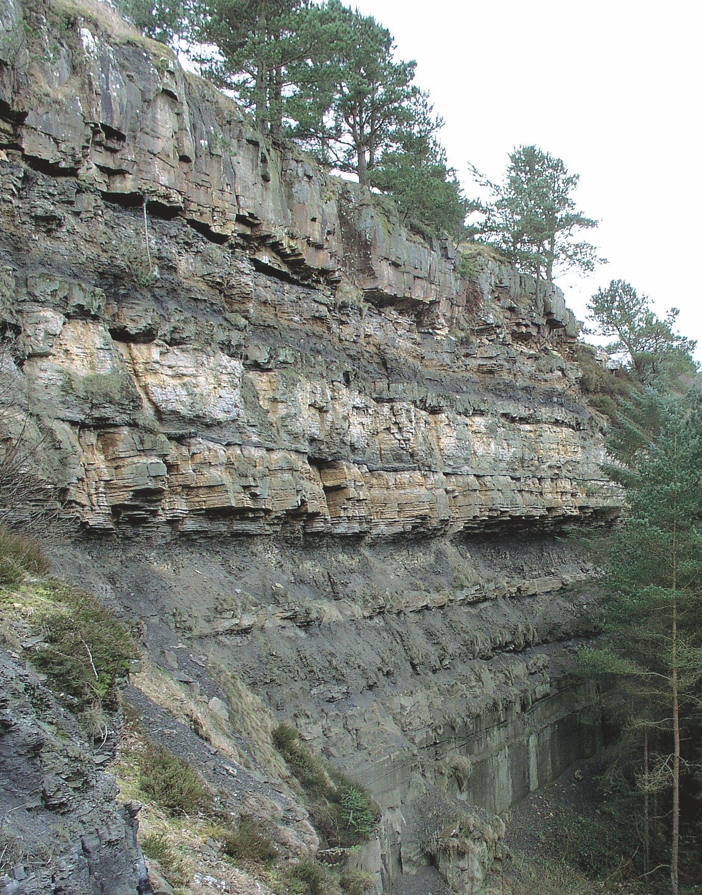
Yoredale Group
The
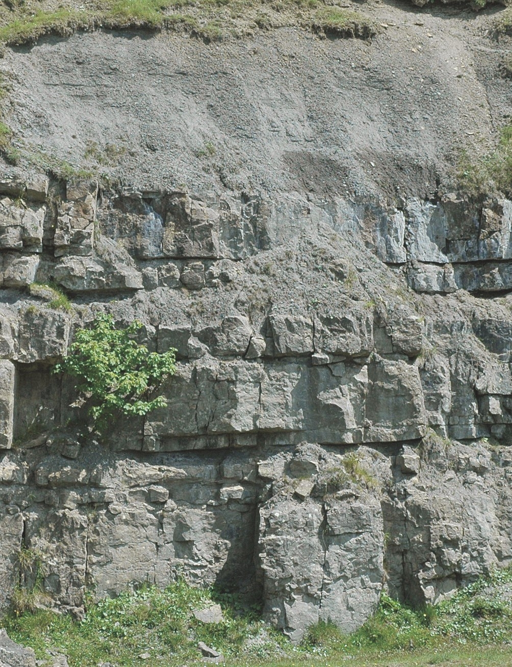
Whereas many cyclothems include representatives of each rock type, others are incomplete with one or more of the characteristic rock units absent. Most commonly absent is the coal horizon. Limestones are the most persistent, and generally the most easily recognised, of the component rocks, although they commonly comprise only a comparatively small proportion of the total thickness of rocks within the succession.
The limestones are generally rather impure and contain significant amounts of clay and bituminous impurities, giving them a rather dark grey colour. Most contain an abundance of, mainly fragmentary, fossils. Although certain beds are characterised by rich faunas of fossils such as corals and sponges, it can be extremely difficult or impossible to tell the limestones apart. By convention, each cyclothem is named after the limestone at its base.
Many individual rock units have long had local names, several of which can be recognised and correlated over wide areas. Many of these names recall the locality at which the rock unit is best developed, at which it was first distinguished, or reflect a variety of intrinsic characteristics such as thickness.
The
Limestones generally increase in importance and thickness as the sequence is traced up towards the top of the
Yoredale Group sites
Geological SSSIs
Dinantian of northern England and North Wales
Redesdale Ironstone Quarries
Tipalt Burn
Namurian of England and Wales
Brunton Bank Quarry
Greenleighton Quarry
Geological SNCIs
Akenshaw Burn
Bowden Doors
Chirdon Burn
Colster Cleugh
Conshield Back Wood
Forest Burn
Hawkside South
Hawthorne Moss
Kyloe Hills
Linkleylaw Quarry
Mill Burn
Ridsdale Quarries
Shiellow Crags
Swallow Crags
The Wanneys
Warks Burn
Barmoorhill Quarry
Barras Quarry
Toddle
Reaver
Cawfield Crags
Divethill and Claywalls
Forest Burn
Fourstones
Haltwhistle Burn
Milestone House Quarry
Walltown Quarry
Haltwhistle Burn
Milestone House Quarry
Fourstones
NWT Reserve
Crindledykes
Examples of rock units in the Yoredale Group
Tyne Limestone Formation
The Thirwall (Furnace) Coal and Bellingham (Plashetts or Carriteth) Coal, slightly lower in the succession, have been worked in many parts of the district. The Bellingham Coal forms a useful stratigraphical marker because numerous old adits, bell-pits and spoil heaps attest to its presence.
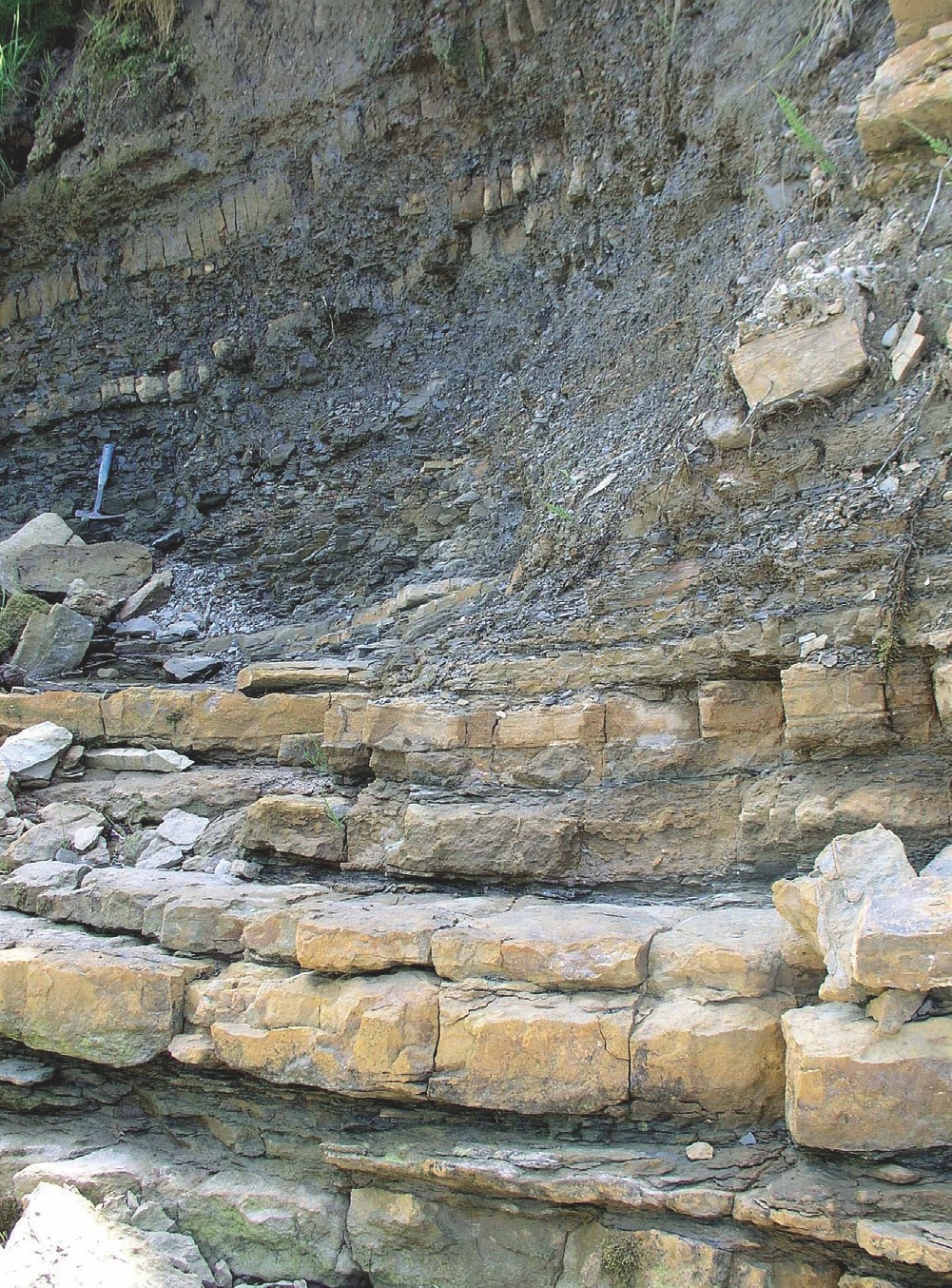
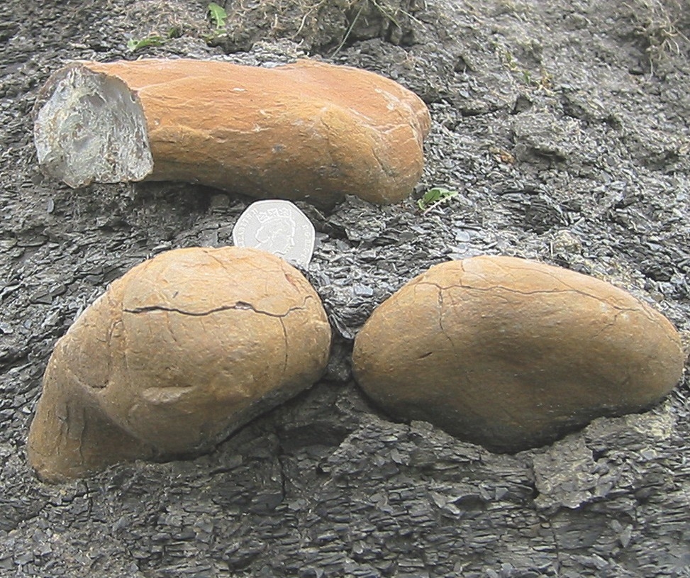
The Redesdale Ironstone Shale is well known in the geological literature for its profusion of well-preserved fossils, particularly bryozoans, brachiopods, bivalves and crinoids. The fossils are concentrated into layers sometimes preserved in ironstone. The ‘shales’ are some 9 metres thick, with subsidiary concretionary siderite nodules forming up to 10 per cent of the total sequence. These nodules, varying in size up to 35 cm, occur as scattered discontinuous concretions, locally coalescing to form irregular bands. They were formerly worked on a substantial scale as iron ores. Both the overlying limestone and the shale are now poorly exposed, one of the best localities being the Hareshaw Burn
The
The
The Fourlaws Coal, one of the few economically important seams of the Dinantian, has been worked north of Barrasford at Hareshaw Head
Alston Formation
The Oxford Limestone, 5 to 6 metres thick, is seen in many natural and quarry exposures and is particularly rich in corals and brachipods. It is a grey to dark grey limestone with numerous red weathering Osagia (‘Girvanella’) haloes and although Osagia occur in other limestones, they are rarely so obvious or in such rich abundance. In Barrasford Quarry the limestone is partly metamorphosed to marble adjacent to the Whin Sill.
The
The Eelwell Limestone is a massive grey bioclastic limestone devoid of mudstone partings. It has been extensively quarried and is locally well exposed.
The Three Yard limestone is commonly crinoidal and with numerous mudstone partings. Clay ironstone nodules, an impure form of siderite, are locally common in the shales above the Three
The Four Fathom Limestone, a grey wavy-bedded and locally cherty limestone commonly forms a pronounced feature and is locally well exposed. Also known as the ‘Eight Yard’ throughout much of northern and central Northumberland, its name reflects its thickness of 24 feet (7.3 metres).
The Great Limestone (Catsbit Limestone, Dryburn Limestone) is one of the most extensive limestones within north-east England. The name, given to it by early lead miners and quarrymen, reflects both its thickness and economic importance. It is by far the thickest (up to 15 metres) and purest limestone within the district and has been extensively quarried along the length of its outcrop. Like the majority of the underlying limestones, the Great typically comprises a medium-grey, slightly bituminous limestone, in which small fragments of the marine animals crinoids are usually abundant. Complete or fragmentary shells of brachiopods and some bivalves are locally conspicuous and in places both solitary and colonial corals are common. The limestone typically occurs as thick beds, known to local quarrymen and miners as ‘posts’, which vary from a few centimetres up to almost 2 metres thick. Some individual beds of limestone can be traced for several kilometres. Three major divisions of the limestone have been recognized throughout the district.
The lowest few metres are commonly dolomitic and include the distinctive Chaetetes Band (p. 85). The middle division, 5 to 6 metres thick, sometimes called the‘Main Posts’ is composed of grey, wavy-bedded, fine-grained limestone with few large (macro) fossils.
It contains the Brunton Band. The topmost division, up to 7 metres thick, comprises well-marked posts of limestone separated by beds of dark grey shale up to 0. 6 metres thick. The term ‘Tumbler Beds’ is applied collectively to these upper beds, from their troublesome instability during mining or quarrying.
Stainmore Formation
The
The
Tyne Limestone Formation
All but the thinnest and most impersistent limestones in the formation are named and comprise useful correlative horizons. Between the limestones the succession, mainly comprising mudstones and sandstones, is much more varied in character and thickness from place to place. Immediately above the limestones, the mudstones are commonly fossiliferous and calcareous and pass upwards into dark grey or black rocks, in places with clay ironstone nodules. Although several of the more prominent sandstones can be traced over large areas, their thickness may vary markedly, and in places the sandstone may be absent. The sandstones are mainly fine grained; coarse pebbly sandstones are relatively uncommon. North and east of Bellingham the lowest part of the formation, formerly known by the now obsolete name ‘Scremerston Coal Group’, contains a number of workable coals. Elsewhere, coal, if present, is rarely more than a few centimetres thick.
Alston Formation
Thick, commonly bioclastic, limestones are the most persistent and laterally extensive rock types within the formation. The Great Limestone at the top is up to 15 metres thick, other limestones rarely exceed 6 metres in thickness.
Stainmore Formation
A rhythmic succession dominated by shales and sandstones with a small number of interbedded thin limestones and coals dominates the
Influence on the landscape
Because of their extensive outcrop the rocks of the
Mining and quarrying have left their mark on the landscape. The large scale working of sandstone for building stone has left substantial quarries on the hillsides around West Woodburn, and Otterburn. Relatively large quarries in the Great Limestone can be seen in the south of the district. Large scale extraction of iron ores around Ridsdale and Bellingham has left a conspicuous legacy of abandoned quarries and spoil heaps; adit mouths are still visible near Ridsdale
Remains of coal mining are on a modest scale. Small but obvious grey spoil heaps remain to mark the site of several mines in the Bellingham, Rochester and Longframlington areas. Extensive areas of outcrop workings and shallow bell pits can still be traced on the Fourlaws Coal in Redesdale, particulary around and across the Otterburn Ranges.
Influence on biodiversity
Outcrops of shales or sandstones, especially in the
Although limestones comprise only a comparatively small proportion of the district’s geological succession, their outcrops may be distinctive. Outcrops of limestone, where free, or substantially free, of superficial cover, typically support areas of species-rich limestone grassland. The brighter green vegetation on the limestone, stands out from the whiter vegetation of the more acidic soils developed on the intervening mudstones and sandstones, and may be a useful clue to identifying limestone outcrops. Typical species include eyebrights, salad burnet, thyme, rock rose and fine grasses such as quaking grass and bents and a variety of small sedges. Quarrying, especially of the Great Limestone has left a legacy of abandoned quarries which exhibit varying degrees of degradation and regeneration and are commonly hosts to a rich limestone flora. Weathered limestone, in natural outcrops and abandoned quarries, provides extremely important habitats for a number of specialised plant communities, including as a substrate for ferns, lichens and other lower plants. Where limestone dissolution has taken place by natural groundwaters, emergent springs may carry a substantial amount of calcium in solution. Such springs may be associated with the development of tufa mounds and terraces in which calcite deposition may in part be facilitated by the influence of bacteria or algae. At least one calcareous spring near Kielder is associated with the development of flattened ovoid oncolites of algal origin.
Calcareous springs may also raise the pH of stream or pond water and the surrounding wet grassland supports species such as devil’s bit scabious, grass of Parnassus, butterwort and fragrant orchid.
Both limestones and sandstones locally form areas of small bare crags and may provide important habitats for a variety of plants. Natural crags, cliffs and quarry faces may offer important nesting and roosting sites for birds and possibly bats.
The bulk of the
Economic use
Rocks of the
Most of the limestones have been quarried, at least on a small scale, and burnt to provide local supplies of quicklime and slaked lime for use as a soil improver. Large scale extraction of limestone within the district has been confined to the Great Limestone. Significant quarries were worked at Fourstones, Brunton, Ryal and Greenleighton. The Great Limestone is today worked on a large scale at Mootlaw Quarry; mainly as a source of crushed rock aggregate and as armour stone for coastal defence work. Metamorphosed Oxford Limestone is worked alongside Whin Sill dolerite at Barrasford Quarry and combined with the dolerite in certain aggregate mixes.
The coal seams of the Alston and Tyne Limestone formations are generally thinner and less laterally extensive than those of the
Although many mudstones in the
Ridsdale and Bellingham were thriving centres of mining in the 19th century obtaining ironstone from the Redesdale Shales, the largest nodule recovered was reported to weigh 23 kg. Clay ironstone nodules in the shales above the Three
Many of the sandstones have been exploited as building stones from an early date, current working quarries include Cop Crag, within the National Park (p. 95).
The mudstone and seatearth associated with some coals were worked as brick and pottery clays including at Haltwhistle, Bardon Mill and Langley in the south and Plashetts in the north.
Gilsland, in the extreme west of the district was, during the 18th and 19th centuries, a watering place and spa resort, based around the sulphurous and chalybeate (iron-rich) springs, which arise from pyritous shales in the
Extraction of the Great Limestone at Mootlaw Quarry is likely to continue. Future interest in iron ore working is extremely unlikely. Although there are reserves of coal probably suitable for further small-scale workings by both deep mining as well as by opencast methods, the thinness, variability and generally poor quality of the seams make it unlikely that any large scale working of these coals can be envisaged in the foreseeable future. The extraction of good quality building stone may be expected to continue from existing working quarries. Increased demand for, and popularity of, natural stone as a construction material and for repairs to existing stone structures may lead to interest in further working of previous deposits, or the search for new quarry sites.
Environmental and conservation issues
Most of the exposures of, and features associated with, these rocks are robust elements in the landscape. However, the cuesta landscape in the Hadrian’s Wall area is especially noteworthy and suitable vigilance should be exercised to ensure that no operations or activities pose threats to it.
The progressive deterioration of long-abandoned quarry faces and the risk of quarries being filled and obliterated pose some long-term threats. A number of important sections through parts of the succession, including the type localities at which geological units were first named, are still exposed in abandoned quarries and might provide opportunities for interpretation or enhancement. Although some of these are scheduled as SNCIs, most are not currently managed and the local RIGS group could consider the possibility of taking responsibility for ensuring their continuity. Appropriate sections could be made accessible to educational groups or the public.
These early mining landscapes, together with the fragments of more developed later ventures, serve to remind us of the smaller scale coal workings landscapes of the Great Northern Coalfield which have been largely destroyed through land reclamation. This rarity significantly enhances the importance of the remains within the district.
Whereas many of the former underground coal workings are almost certainly flooded, discharges of contaminated mine water are not thought to present a widespread environmental problem. Small surface discharges of iron- and aluminium- rich water are present locally, for example in parts of Haltwhistle Burn and in the Crindledykes area. Although no instances of surface discharges of mine gases are known within the district, vigilance should be maintained for these close to buildings or centres of population. Few examples of ground stability problems over underground coal workings are known in the district. However, as many of these workings employed pillar and stall extraction methods, vigilance should be maintained for evidence of pillar failure and related stability problems.
Wider significance
These rocks provide a wealth of evidence of the geological environments and processes involved in their deposition during Carboniferous times. They provide excellent illustrations of the effects of blocks and basins, and the structural factors which controlled their formation and evolution, on sedimentary facies and the thickness of sediments deposited. Comparison of this district with adjacent sedimentary basins, such as the Midland Valley and Craven basins, allows correlation of rock units to further understanding of the UK’s evolution during Carboniferous times.
The Great Limestone, marks the last significant episode of limestone formation in the Carboniferous succession. Like all of the marine limestones, it contains abundant evidence of the contemporary marine fauna and flora, and in places, e.g. the Chaetetes Band, exhibits striking examples of complete marine ecosystems fossilised in situ.
Pennine Coal Measures Group
A string of Coal Measures outliers extends westwards from the main Northumberland and Durham Coalfield along the south side of the Tyne valley. These areas provide a link between the major coalfields of Northumberland and Durham in the east and Cumbria in the west. These outliers are mostly elongated east- west and are preserved on the northern and downthrown side of a series of en-echelon faults that form part of the Stublick–Ninety Fathom Fault System (p. 80). The Midgeholme coalfield, with an area of six square miles, is the largest and the most westerly of the outliers. Only the easternmost part of this coalfield and small portions of the Plenmeller and Stublick coalfields are exposed at the very southern margin of the district.
Coal was being raised from Midgeholme
Impact on the landscape
No mining in Westphalian rocks is now taking place in the district, but evidence of previous mining activity is seen in collapsed land, local concentrations of old bell pits, abandoned shafts and adits and spoil heaps.
Impact on biodiversity
An extensive mantle of Quaternary deposits, mainly glacial till, conceals substantial parts of the Coal Measures outcrop. In such areas the biodiversity typically reflects the nature of these superficial deposits rather than the underlying Coal Measures rocks. Only a limited amount of opencasting has taken place in the district and special measures were taken at Plenmeller to minimise disruption to wildlife and habitats and to preserve peat deposits.
Economic use
In addition to deep mining in the small coalfields, opencast extraction took place at Plenmeller
Wider importance
Exposures within the district are insignificant by comparison with the extensive coastal sections of Northumberland. However, the Westphalian outliers are important as examples of fault-bounded coalfields and help to define and demonstrate the geological structure of northern England. In addition, the sequence of Westphalian rocks present in these outliers provides important evidence linking the Cumbrian, Northumberland and Durham coalfields. The Stublick–Ninety Fathom Fault System was exposed and recorded during the excavation of the Plenmeller Opencast Coal site