3 Understanding the rocks
3.1 Evolution of the rocks and landscape
Some 280 million years ago, at the beginning of the Permian Period, Britain as we know it today did not exist. Instead the area destined to become Britain lay within a large continent known as Pangea, situated in tropical latitudes very close to the equator.
During the early Permian, northern Europe was one of the world's great deserts. Major earth movements towards the end of Carboniferous times had created mountains across what became northern England. These widespread barren uplands were gradually worn down by Permian desert erosion and up to 500 metres of Carboniferous rocks were removed. The product of this prolonged phase of erosion was a mature, gently rolling plain, probably with, in present-day north-east England, a gentle eastward slope into the subsiding North Sea Basin. This plain became the Carboniferous-Permian unconformity, a surface of generally low relief on which the Permian
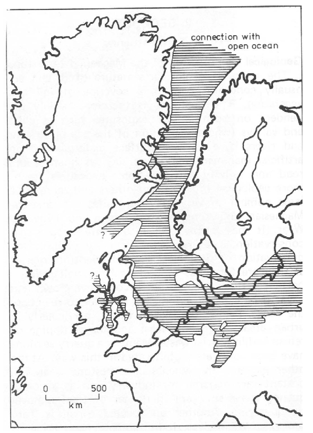
In the late Permian continental extension opened a seaway which flooded low-lying ground and formed inland drainage basins, the so-called Bakevillia and Zechstein seas, approximately in the areas now occupied by the Irish and North seas
Straddling latitude 30° north during Late Permian times, the sea was subjected to high evaporation rates. As it was connected to open ocean to the north by a narrow shallow seaway, changes in global sea-levels affected the rates at which incoming sea-water could replace that lost by evaporation. The climate was hot and dry, possibly equivalent to that around the present Persian Gulf. During episodes of high global sea-level, recharge rates through the narrow seaway were high, and so the salinity levels of the Zechstein Sea were normal and limestones were deposited in and around its margins. When global sea-levels fell, the amount of water flowing through the sea-way was significantly reduced, leading to elevated salinity levels and the formation of extensive evaporite deposits (particularly anhydrite (CaSO4) and halite (NaCl)). Repeated rise and fall of global sea-level resulted repetitive depositional cycles. For a long time, and in comparison with the German sequence, five cycles of carbonate to evaporite deposition were recognised, these are known as the Zechstein cycles. A more recent and plausible interpretation recognises seven sequence stratigraphical cycles with evaporite deposition related to low sea levels (lowstands) and carbonate deposition related to high sea levels (highstands).
No early Permian terrestrial sediments in north east England have provided evidence of contemporary life but it is hard to believe that the area was totally lifeless when other apparently equally inhospitable parts of Britain bear clear traces of a range of organisms including carnivores; an equally diverse range of specialized organisms probably inhabited the northeastern desert.
3.2 Yellow Sands Formation
The
The Permian Yellow Sands crop out intermittently along the base of the Magnesian Limestone escarpment and dip to the east beneath the limestone. At outcrop the formation is clearly discontinuous and forms ridges of various heights. When they were deposited, the sands formed hills on the land surface and the crests of such hills have been visible in a number of exposures. The ridges, which probably represent accumulations of sand dunes, are typically between one to two kilometres wide with sand thicknesses of up to almost 70 metres and are separated by belts where the sands are thin or absent. The absence of suitable sub-surface information for much of the area makes it impossible to predict accurately where they occur, although it is generally accepted that they occur in west-south-west to east-north-east trending ridges which continue beneath the limestone for some distance. The exact nature of the dunes has been the subject of much discussion and is still a topic of research
There is no independent evidence for the age of the
3.3 Marl Slate Formation
The
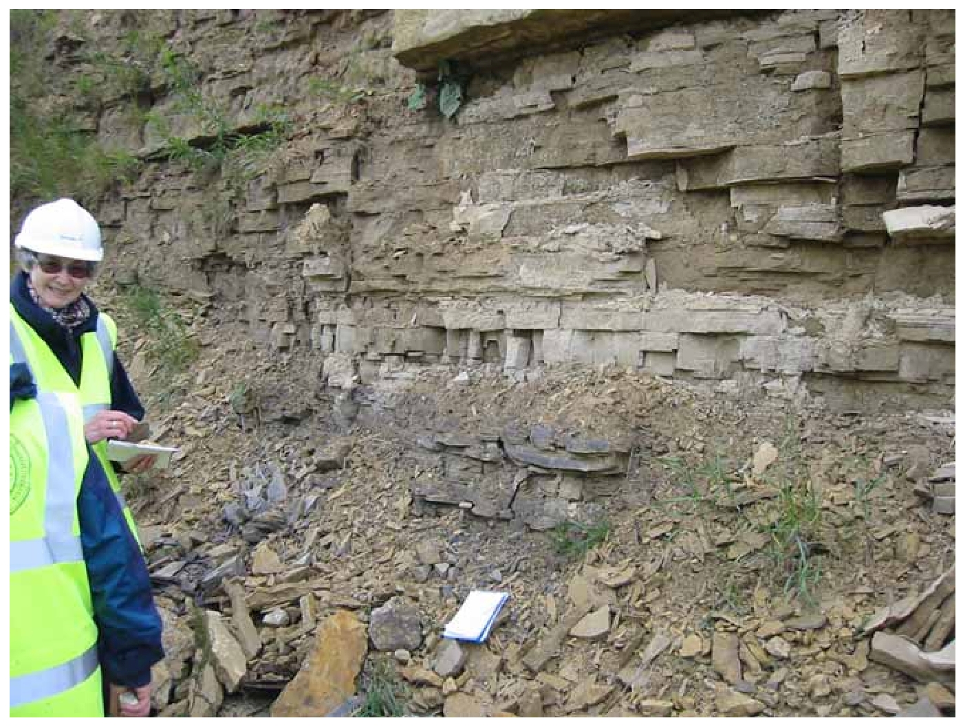
The well-established name Marl Slate was applied to the formation in the 19th century, although in strict geological terms the rock is neither a marl, nor a slate. The Marl Slate in places includes rounded sand grains and minerals such as sphalerite, galena and chalcopyrite. It has been suggested that some of the fish and other organic remains in the sequence may have been a source of the mineralisation that was taking place at the same time.
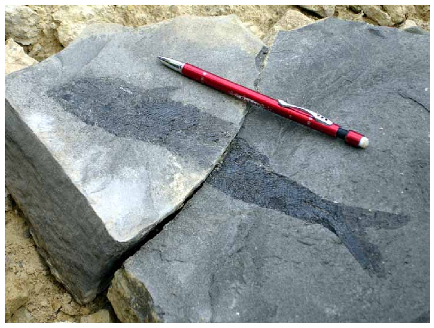
The Marl Slate is well known for its fauna of fossil fish. It has also yielded important fossil reptiles and plants. Permian fossil fish faunas are very limited in number and distribution world wide. Relatively well-preserved and locally numerous examples of fossil fish from the Kupferschiefer of Germany attracted attention early in the 19th century. Those in the Marl Slate of north-east England were discovered at about the same time and were described a little later. In the past well-preserved specimens were collected from localities such as the Ferryhill Gap and from quarries along the escarpment and there are internationally important collections of the fossils in numerous museums. The quarries south of Middridge have been the source of the best-preserved Permian plants found in England
3.4 Raisby Formation (formerly Lower Magnesian Limestone)
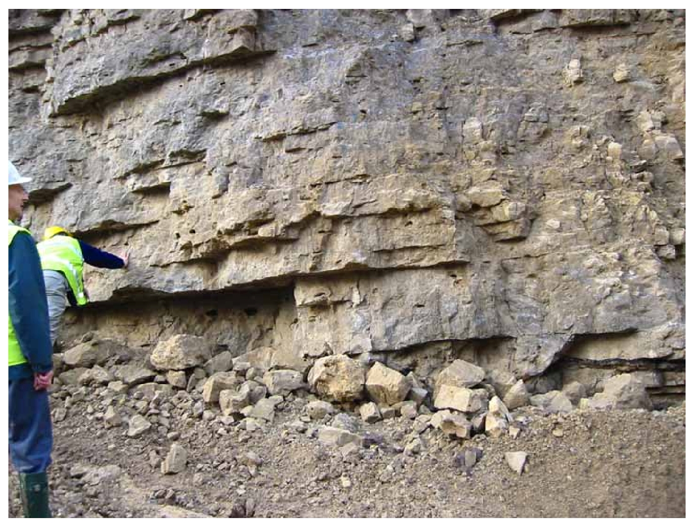
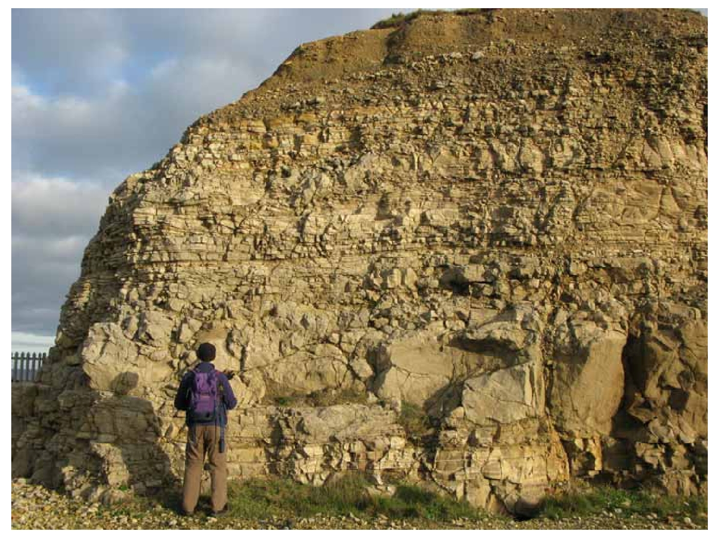
This lowest division of the Magnesian Limestone includes rocks which range in composition from yellow or cream dolomites to almost pure, grey limestones, though the latter are rare. Three main lithological units distinguished by colour, bedding thickness, texture and compositional variations can be recognized in many areas. The middle unit is the one most commonly seen; it is a sparingly fossiliferous hard rock with a characteristic mottling rarely found in other parts of the Magnesian Limestone. Lower units of the
The
The type Section is in Raisby Quarries (now known as Coxhoe Quarry) Nr. Cornforth, County Durham.
At Thickley Quarry the lowest beds of the formation, which comprise thick-bedded dolomitic limestones, are overlain by fossiliferous limestone texturally similar to those at Raisby Hill Quarry. At Raisby this unit is 30 metres thick; at Thickley it is only 1 metre thick.
3.5 Ford Formation (formerly Middle Magnesian Limestone)
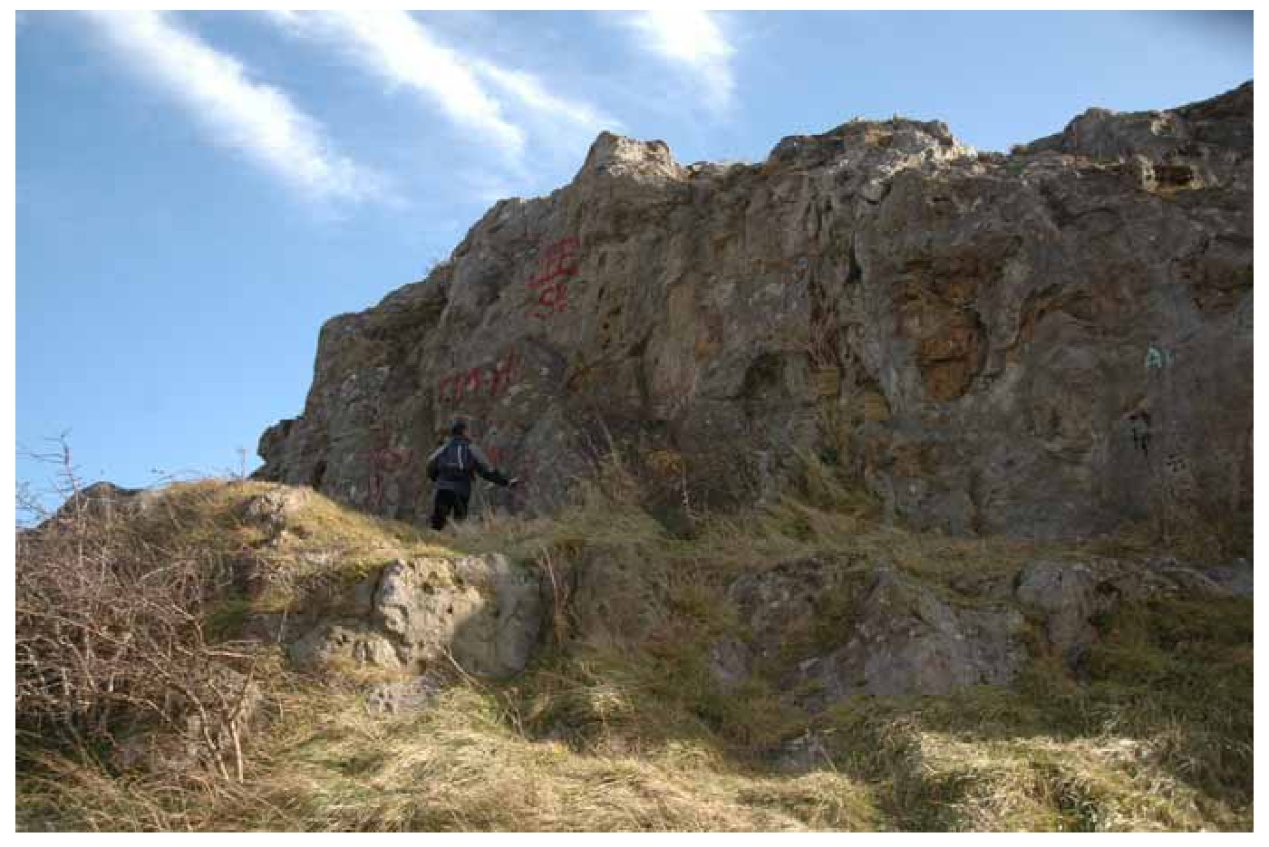
The Ford Formations displays a varied sequence of dolomites deposited in three distinct environments: shelf-edge reef that separates a broad belt of back-reef and lagoonal beds to the west from a belt of fore-reef talus aprons and off-reef beds to the east.
The barrier reef of the
It is not always easy to distinguish where the
Rocks of the lagoonal type occupy most of the
One of the largest exposures of late Permian reef-rocks in North-East England is at Hawthorn Quarry. An unusual algal-laminated dolomite, known as the Hesleden Dene Stromatolite Biostrome, overlies the top of the reef at Hawthorn Quarry. It has a boulder conglomerate at its base. The biostrome is named from its occurrence further south in Hesleden Dene and it is also very well exposed at Blackhall rocks.
3.6 Roker Dolomite Formation
The Roker Dolomite Formation includes the Concretionary Limestone, often considered as a separate unit in its own right. The two are best regarded as complementary and joint representatives of Zechstein Cycle 2 carbonates. They were formerly included as part of the Upper Magnesian Limestone along with what is now recognised as the
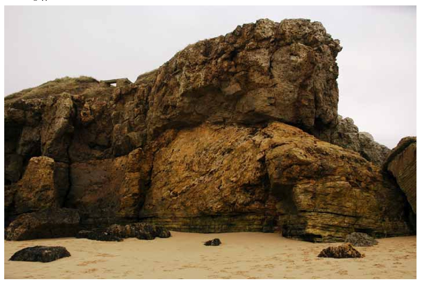
The Concretionary Limestone is about 100 m thick in the Sunderland area but thins southwards and dies out to the south of Seaham. It is by far the most varied carbonate formation of the English Zechstein sequence. Its best known feature is a range of calcite concretions which are spectacularly developed in the Sunderland area, most notably in the 'Cannon-ball Rock' and have been described as 'the most remarkable patterns in sedimentary rocks anywhere in the world'. Concretions are present at all levels but are abundant around Sunderland only at two levels, about 27 m and 55m above the base.
The lower beds are often so laterally variable that exact correlation of adjacent sections is difficult. The formation is composed mainly of thinly bedded granular dolomites of silt- to fine- sand grade, but the rock is locally recrystallised and in some places contains many concretions. When freshly broken these rocks usually smell strongly of oil. In all onshore areas the Concretionary Limestone has foundered and lower beds have suffered varying degrees of collapse brecciation due to the solution of the underlying Hartlepool Anhydrite.
Detailed correlation between exposures is difficult, the only exception being the widespread; '
Where the Concretionary Limestone is not developed, the
3.7 Seaham Residue
The
3.8 Seaham Formation
Although itself highly variable, the
The formation carries a unique and distinctive diagnostic assemblage of alga and bivalves. Small tubular, stick-like remains of the probable alga Calcinema permiana are present in great abundance. The
3.9 Rotten Marl
The Rotten Marl is a dull dark red-brown silty mudstone, which in borehole cores contains scattered halite crystals and a network of veins of fibrous halite and gypsum. It occurs in situ only south of the area and offshore. It was exposed with the filling of a breccia pipe, or fissure filling, at the top of the north wall in Seaham
3.10 Quaternary deposits
Quaternary deposits are sediments that were deposited during the Quaternary episode of earth history, between 2.5 million years ago and the present day. The Quaternary is divided into two periods: the Pleistocene Period dates from 2.5 million years ago until 10 000 years ago and the Holocene continues to the present day. For a long time these deposits were collectively referred to as 'drift', but are now more commonly referred to as 'superficial deposits' to separate them from the 'bedrock' which used to be termed 'solid'.
Global cooling caused the Quaternary Period to be a time dominated by a series of 'ice ages' when the climate oscillated between colder (glacial) and warmer (interglacial) stages. Successive glaciations advanced across the landscape, sourced from the upland areas of Scotland, Wales, northern England and Scandinavia and formed extensive ice sheets that were over 1 km thick in places. Unfortunately, the nature of glaciations is that their imprint on the landscape is largely destroyed by any subsequent glacial advance, so most evidence for glacial advance in northern Britain dates from the most recent cold period, the Late Devensian, from about 25 000 to 10 000 years ago. The effects of persistent freeze-thaw action in ground which was often very deeply frozen, and the deposition of a variety of glacial sediments further modified any pre-existing landscape. The deposits of the Holocene Period reflect erosion and deposition in a varied succession of environments during much milder climatic conditions.
Quaternary deposits and their interpretation provide a wealth of information on the environments of the recent geological past. Information from glacial landforms and the nature and morphology of glacial deposits is essential to understanding these climatic conditions and may provide valuable insights into likely future environmental changes related to global warming.
Details of the Quaternary deposits are given in the geological survey memoirs for the area (Smith, 1994; Smith and Francis, 1967) and, more recently for the south of the area by Young (2008). The Quaternary Research Association Field Guide to the 'Quaternary of North-east England' (Bridgland et al., 1999) contains a wealth of useful and up-to-date information, including illustrations of key sections.
Glacial deposits
There is very little evidence of the earlier part of the Quaternary in north-eastern England. The most probable reason for this is that the later glaciations reworked the material deposited during earlier glaciations and interglacial intervals. However, two sites on the Durham Coast provide evidence of the presence of Quaternary sediments that predate the last glaciation.
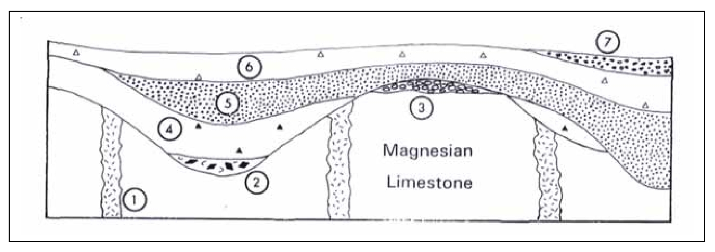
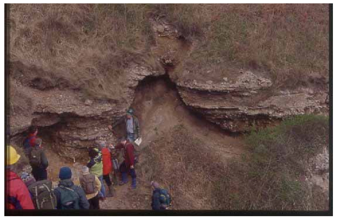
Fissure fills in the Magnesian Limestone coastal cliffs represent the oldest known Quaternary deposits in the area, likely to have formed in the Lower and Middle Quaternary. The fissures contain a variety of boulders, fragments of rock and clay that have been forced in from above by later glaciations. A pre-Devensian till containing mollusc remains and Scandinavian erratics lies unconformably over the Magnesian Limestone bedrock at Warren House Gill about 2.5 km south of Shippersea Bay. Fossil material in some of the fissure fill from Warren House Gill and nearby Blackhall Colliery includes shells, peat, tree trunks, insects, rodent teeth and the vertebra of an elephant resembling Mammuthus meridionalis. Some of the fissures contain exotic rocks similar to those within the later Scandinavian Drift.
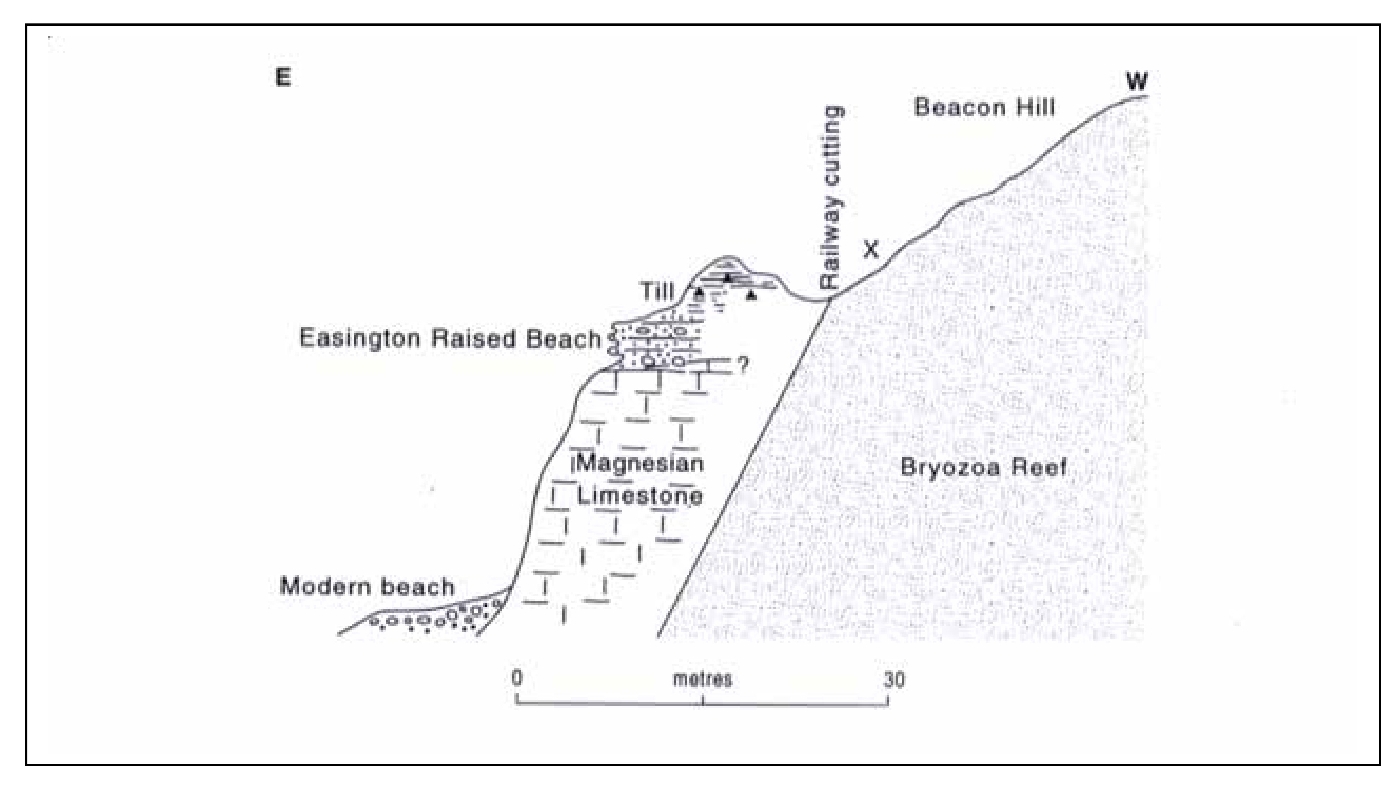
At Shippersea Bay the bevelled upper surface of the Magnesian Limestone represents the wave-cut platform on which rest the deposits of the Easington Raised Beach
The most widespread glacial deposit is
Scandinavian Drift-The Warren House
The Lower till (The Durham Lower Boulder Clay) containing North British rocks including Lake District and Scottish rocks was deposited by the British ice sheet after the Scandinavian ice sheet retreated. It is possible that there is a complete climatic cycle between the deposition of the Scandinavian and British Drift deposits. It is generally a tough, grey or brown, sandy boulder clay, or 'till', in which occur scattered pebbles cobbles and boulders of a variety of rock types that originated outside the district. These exotic rock types, known as 'glacial erratics' mainly comprise fragments of grey limestone and dolerite ('whinstone') derived from the Pennines or south Northumberland, accompanied by scarcer and smaller fragments of a variety of rock types originating from south-west Scotland, the Cheviots and the Lake District. Many of the included boulders exhibit conspicuous scratches, or striations, resulting from the grinding of boulders against one another as they were transported by the ice
The Upper till (The Durham Upper Boulder Clay) is a red-brown stony clay that overlies both the Lower
In parts of the county a tripartite division in the Devensian sediments has been recognised. This consists of the Lower and Upper tills, separated by an intervening body of sand and gravel referred to as the Middle or Ryhope Sands. These deposits may have been deposited by meltwaters from the retreat of the western ice back to the Lake District and Southern Uplands. Other bodies of sand and gravel include more recent deposits overlying the upper till and locally a group of basal sands and gravels.
Various ice-contact slopes are found in the area of the Upper
The Pelaw Clay, which was referred to in older literature as the 'Upper Wear Clay' takes its name from the disused Pelaw Brick Pits
The Durham Denes are features of the landscape in the eastern part of the county. These west–east orientated steep-sided coastal valleys are incised through the cover of Quaternary Deposits into the Magnesian Limestone. The 'denes' are in part glacial meltwater channels, cut rapidly by streams flowing to the North Sea at the end of the Devensian glaciation. The distinct morphology of these channels in this coastal area is due to the rapidity of the erosion.
Holocene deposits
Marine Beach Deposits are modern day accumulations of sand and shingle exposed between the high and low water marks. In addition to boulders and pebbles of Magnesian Limestone, a high proportion of the naturally occurring beach material appears to have been derived from the Quaternary deposits eroded from the cliffs. A variety of glacially transported rock types can be seen in most accumulations of beach shingle. Most prominent are boulders of Carboniferous limestones and sandstones, with smaller quantities of whin Sill dolerite, some Cheviot volcanic rocks and rocks derived from southern Scotland and the Lake District, including granites, volcanic rocks, slates and greywacke sandstones.
Submerged forest
Periods of reduced sea levels are recorded in the 'submerged forests' found locally around the British coastline. These typically comprise beds of peaty sediment with tree stumps in former growth position. One small example of such a submerged forest deposit is present at Whitburn. This is intermittently exposed, normally after storms have removed the overlying sand. Remains of a variety of tree species, including alder, birch, hazel and oak have been recorded, together with bones of deer and Bos primagenius (Smith, 1994). A significant exposure of peat beds with abundant wood remains is exposed in several places in the intertidal zone in Hartlepool Bay at the southern edge of the area.
By their very nature, as generally weak and unconsolidated materials, there are few permanent natural exposures of Quaternary deposits within the inland parts of the district. However, continuing marine erosion ensures that the coastal cliffs provide almost continuous, though inevitably changing, sections through parts of some of these deposits. These materials are typically found in the upper portions of the cliff sections, though their instability commonly results in parts of the Quaternary succession being partially obscured due to slipping of loose material or, in places, the development of significant vegetation cover.
In addition to numerous important exposures of Permian rocks and Quaternary deposits, the Durham coast includes a number of characteristic coastal landforms:
Sea cliffs extend almost continuously along the coastline. Typically the cliff profile reflects the geological deposits exposed. The 'solid' limestones of the Magnesian Limestone generally stand as vertical or near vertical cliffs. Overlying this, a more gently inclined profile marks the exposure of a variety of Quaternary deposits, mainly till and sands and gravels. The variable erosion of sections of the cliff has produced a series of bays and headlands
Sea stacks are residual masses of rather more resistant limestone created by the retreat of the cliff line. Good examples may be seen at Marsden Bay and Blackhall rocks.
Caves of varying sizes are present within the Magnesian Limestone at many places along the coast. They are readily developed by wave action where the limestone is highly fractured by collapse brecciation, or adjacent to joints.
Wave cut platforms are more or less flat areas of bare rock cut by marine erosion at beach level. Examples include the expanses of Magnesian Limestone exposed on the beach between Hawthorn Hive and Horden Dene.